Wednesday, March 27, 2013

John Bunker Sands Wetland Center On The Trinity River

Adult male Bald Eagle Haliaeetus leucocephalus; initiating a high speed 100+ mph hunting dive into the John Bunker Sands Wetlands
Want to see some Bald Eagles? Read on. It all began began with the premise of turning a cattle pasture into a wetland. The periodic floods of the Trinity combined with pancake flat landscape created brief wetland environments that transformed the pasture into a bird magnet overnight. Twenty years ago, a man named John Bunker Sands had a vision of turning that cattle pasture into one of the largest created wetlands in the United States.

Now it's a place where nature and state-of-the-art science collide on the Trinity River. Where the only crop grown is water. The byproduct is a unique habitat for wildlife rarely seen in North Texas. Home to eagles, bobcats, otters and hawks the spectacular vistas of the public-private partnership are a real gift to North Texans.

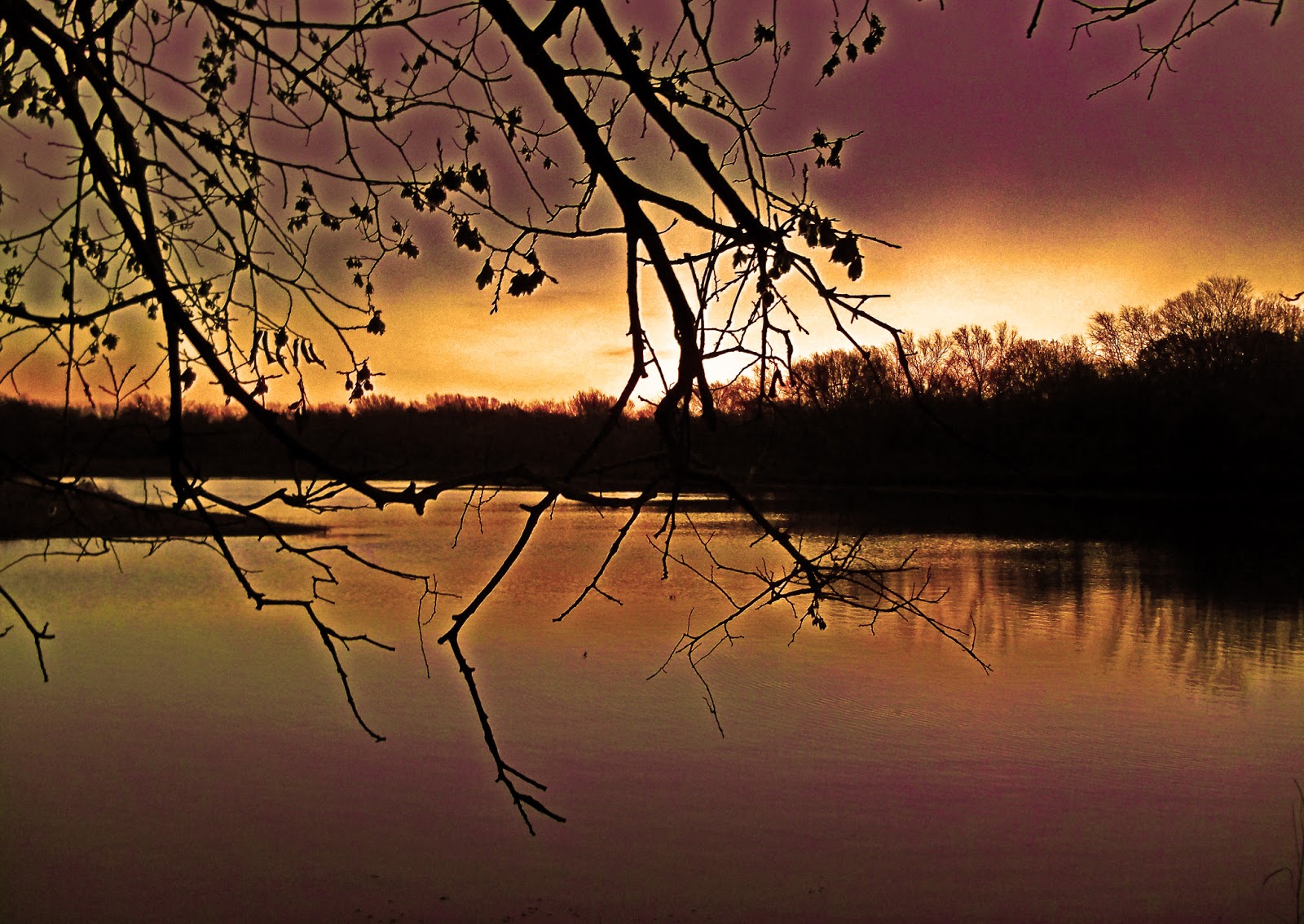
John Bunker Sands Wetlands at sunset under a rising full moon, March 2013
The late John Bunker Sands was the son of Loyd Bowmer Sands and Caroline Rose Hunt. Coming from a family of Texas outdoors enthusiasts, John Bunker Sands enjoyed spending time on the five ranches in his family's holdings. His original idea was to take waste water from surrounding municipalities and funnel it through a wetland biofilter before it entered the river. At the time it seemed pretty far fetched but quickly gained traction. The North Texas Municipal Water District jumped onboard and the resulting public/private partnership formed the John Bunker Sands Wetlands we see today.

Catwalk above the Wetland Cells
JBS Bald Eagle
Directions: US 175 south to FM 1389, head south two miles to Martin Lane, entrance is on left off 1389
John Bunker Sands Website: www.wetlandcenter.com
East Fork Raw Water Project: http://www.ntmwd.com/re-use_info.html

Open first and third saturdays of the month, $5 admission 9am-4pm, open other times by appointment. A visitor center with displays, restrooms, classrooms and meeting room sits at the headquarters with a commanding hilltop view of the wetlands. Rocking chairs are free.

Bald Eagle nest is on far south end of property along a utility right of way. Directions to the nest can be found further down in this post.

Known mostly by Dallasites as the part of DFW where people congregate to buy fireworks for the 4th it makes for an interesting drive from Dallas. One can head back to Big D as an alternate route using Malloy Bridge or other old country roads that head back towards Wilmer and Ferris. The landscape is full of nameless odd little communities down that way. Peppered with front yards featuring long forgotten front yard plastic nativity shepherds, wind flapping textiles and old half taken apart motorcycles. Worth a look.
Looking out over the wetlands from the visitor center

How it works

The wetland processes 40-90 million gallons of water per day. The water is a mix of treated wastewater and water from the Trinity River discharged below Lake Ray Hubbard. Pumped in by a trio of 300 horsepower pumps from the river to the head of the wetlands. From there it's all nature and gravity at work inside the wetlands.
As seen above(click to enlarge) a series of sedimentation ponds north of US 175 settle out the solids and silt to a large degree over the process of a day or so. From there the water travels south only by gravity, where the natural processes, sun, wind and over 20 million aquatic plants filter out phosphorous, nitrogen and ammonia from the water.

The whole process, start to finish takes 7-10 days. At the end of that time period, the water is so clean that it can be pumped back up into Lake Lavon for human consumption. Which is exactly what happens. Three, 3,000 horsepower pumps take the water out of the wetlands and pump the water up the Trinity in 43 miles of pipeline back to Lake Lavon where it can be reused for municipal water use. The amount of water cleaned in the Wetlands everyday is equal to the amount of water pumped out of Lake Lavon by the North Texas Municipal Water District.
Hawk hunting the wetland cells
Walking the property is easy. A boardwalk leads from the Wetland Center across a couple of the cells. From there one can walk the levee top roads that separate the individual ponds. Cover and concealment is not readily available for watching wildlife here. The distances to see wildlife are at somewhat great distance and binoculars or a long spotting scope are recommended. The Wetland Center has loaner pairs of binoculars available.
Master Naturalist Bill Holston left, Scott Hudson right, with wildlife viewing blind in background
Dotted among the levees are wildlife viewing blinds which would afford more stealthy viewing of wildlife if one chooses. There were so many birds around that day that sitting in a static location was not tempting in the least.


The Wildlife

Male Bald Eagle at John Bunker Sands
It would be interesting enough to see the water filtration process in action. There is much more. Interesting birds by the thousands call this place home. Most are of a migratory persuasion and spend a day or a week here before heading yonder to points unknown. Canada in the spring. Mexico in the fall. During the summers birds of the southern hemisphere come here during their winter. On the edge of the Flyway, the wetlands attract the occasional flock of geese not seen further west.


This particular trip was in March 2013 when many of the birds of the polar north, land of the Midnight Sun were still in Texas.
Northern Shoveler Anas clypeata
Birds like the Northern Shoveler seen above.  Their summer range extends from Alaska through western and central Canada south to the mountain regions of the Rockies. Nicknamed the spoonbill duck, the Northern Shoveler has the largest bill of any duck in North America. The bill is this bird's most prominent feature, and is longer than its head.

Male Northern Shoveler

Pelicans
American White Pelican Pelecanus erythrorhynchos


One of America's largest birds the American White Pelican has a wingspan of nine feet and is easy to identify by a unique black band running down the wings. Many think these are birds of the sea but in actuality are inland birds. Banded individuals in this flock suggest they summer in the far reaches of Idaho, Wyoming and Montana in the Yellowstone, Madison, Snake and Columbia drainages.
Flight of pelicans over the John Bunker Sands
The pelicans here make regular commutes between John Bunker Sands, the McCommas Bluff Swale Lake Ray Hubbard and White Rock Lake. Able to glide vast distances using thermals and wind the near effortless rise of a flock spiraling upward is a sight to see.
Pelicans fishing at John Bunker Sands
Many of the birds pack into the ten foot tall grasses and marshes that divide the wetland cells. Here the familiar American Coot (Fulica americana) and Blue-winged Teal (Anas discors) not similar in appearance but both dabblers feed together in mixed company.
American Coots and Blue-Winged Teal
American Coot Fulica americana
Coots which resemble ovalized waterborne chickens tend to make bee lines for marsh cover when approached rather than the ducks which always take flight.

Coots communicate distress to each other by exposing their under tail coverts or displaying a swollen shield when alarmed by potential dangers such as hawks, airplanes, or predatory mammals. Similarly, aggressive displays are not restricted to avian intruders.

Blue-winged Teal Anas discors taking flight
Great Egret  Ardea alba
Many other common wetland birds reside here from egrets, cormorants, herons to red winged blackbirds.
Red-winged Blackbird Agelaius phoeniceus
Combined as a whole, they create a unique footprint into what was once a cattle pasture. I imagine most people turn around about this point of the wetlands, filled with the typical wetland sights and sounds one would be expected to see. If you head further though, down on to the south end of the property things start to get interesting...........
Northern Harrier (right foreground) jumping a pond of ducks, coots, cormorants
The available food supply in the cells serves as a grocery store for raptors. Hawks, Harriers and two species of Eagles work the ponds here with great precision. Unrestricted by trees and obstruction they start lengthy hunts at high altitude and then dive out of the sun at their quarry below. In the case of the Northern Harrier above, his true prey was something with four legs down in the marsh grass not the ducks that took flight at the sight.

Below, a White Faced Ibis flies over the wetlands, a rare sight for early spring the birds are more numerous in the summer months. Habitat loss in Texas has dwindled the numbers of this ibis species and is now afforded protection as a Threatened Species.
White Faced Ibis Plegadis chihi listed as a Threatened Species, flies over the John Bunker Sands Wetlands

Flushed Northern Shovelers landing in a pond of lotus
With the hundreds of different plant species thriving in the various cells each pond has a different look. I cannot recall an area lake or impoundment with lotus.

Eagles of John Bunker Sands
Male Bald Eagle over John Bunker Sands
Cutting your eyes to the right from the rocking chairs on the back porch of the visitor center one can see it. A half ton pile of branches the size of a dinner table one hundred feet in the air. Sitting at the far southern end of the property beyond a set of fences and a cattle pasture. The nest of the Bald Eagles. More of a crucible of sorts used to forge a new generation of Bald Eagles that will one day repopulate North Texas.

There is something all together unique about seeing a Texas Bald Eagle. The aesthetics of the birds in flight, speed and resolute prowess tap into the human spirit that few other species can duplicate. If you have never seen wild Bald Eagles, this is your chance.

Bald Eagles are not hard to find they are just spread few and far between in North Texas. Knowing where to look and eyes peeled to the sky one can find them without much trouble. With wingspans of 7 feet they standout on a sky landscape like no other bird. Below is a map with aggregated sightings of Bald Eagles in and around Dallas County. The blue hot spots note 3 to 5 sightings and the orange hot spots note a dozen or more.  Eagles frequent with regularity the tail races of Lewisville Lake and Lake Tawakoni during the winter months. The annotated map is from data compiled via http://ebird.org which is a great resource for sightings based on specific birds based on date and geographic area.

Combined Bald Eagle Sightings in the Dallas County area Fall 2012-Spring 2013
The Bald Eagle sightings around the Wetland Cells and Audubon Center are a group of three eagles and most often a juvenile bald eagle with brown head and tail is seen the most. Moving between the Wetland Cells north of Loop 12 and the McCommas Bluff Swale to the south, sightings are frequent.

The Sand Branch Bald Eagles feed near the Wastewater Treatment Plant off Beltline Road near the impromptu community of Sand Branch. High fences and a somewhat chilled response of area residents dictates that a search for Bald Eagles in this area is best done with an organized group.

The easiest, most reliable and with near 100% certainty of sighting a Bald Eagle is at John Bunker Sands. A pair of binoculars and some eyeballs are all that is required. Asking around, checking and doing some homework, the only other Bald Eagle nest known in the Greater Dallas area is one on private land near Ennis. That nest is not accessible to the public and from what I understand is hard to see.


Nest location:
Google Maps link to site-
John Bunker Sands Eagle Nest Site

The nest is located at the far southern end of the John Bunker Sands property in a high power transmission tower. A series of fences and cattle pasture off-limits to the public keeps a healthy buffer between guests and the tower. 500 feet or so. That's about as close as one can get.

There are two ways to see the nest:

1. Visit the John Bunker Sands Wetland Center on the first or third Saturday of the month. Ask about the nest site and a staff member will tell you where to go. The southern perimeter fence is electrified in nature, most likely to keep cows from straying into the ponds.

2. Head south down 1389 and pull off the side of the road about 1/2 mile south of Martin Lane. You should be able to see the nest and female with babies especially late in the day as the sun will be at your back. There is a subdivision with new homes a little further to the south that gets fairly close to the tower but trees obscure the nest and 2/3 of the tower. If the male is on top of the tower it can afford a 400 foot vantage point.

I have done both. The nice hike on the John Bunker Sands Wetlands is very rewarding and a must do. If time is a limiting factor then the second option is a distant second. Usually I would not post the location of a nest site like this until long after the offspring have left the nest. In this case, the private property boundaries, fencing and location offer great restricted viewing without disrupting the nest site.
Female on nest with baby eagles as viewed from the John Bunker Sands Wetland Center property line

Crested Caracara
The nest is very easy to see and the female is more than likely always at her nest guarding her newborns and tending to domestic duties around the site. The male is often seen hunting or perched on one of the nearby transmission towers or tall trees in the area.

The abundance of other raptors in the area can make it hard at first glance to sort out which large bird is the Bald Eagle. The bird at right, a Crested Caracara was seen not 50 yards from the Bald Eagle nest site flying around. Known as the Mexican Eagle and featured on the flag of Mexico at a distance bears a striking resemblance to that of the Bald Eagle.

The Bald Eagle gained unofficial recognition as the American National bird in 1782 on the US seal. Since then it has become a defacto symbol of the United States.
Male Bald Eagle over the wetlands screaming a cry
The John Bunker Sands eagles have been nesting in this area off and on for the last several years. Previous nest sites included a large tree closer to US 175 and a different transmission tower in the same line as the current nest. These are Southern Bald Eagles and vary slightly from the more numerous Northern Bald Eagles.

As a general rule, Northern Bald Eagles will migrate down south for the winter months following their prey species as they go. Northern Bald Eagles rarely nest below the 40th parallel and as a result just visit here in Texas rather than mate. The Southern Bald Eagles live and breed below the 40th parallel with concentrations in the Gulf States, particularly close to open bodies of water.

Male landing on transmission tower
The windy days of early spring made for difficult video capture. Even with image stabilization and a sturdy tripod the winds over 30mph proved too much. Below is what one can see from a few different vantage points:


The high winds allowed for ground speeds of the male Bald Eagle to exceed over 100 mph. Much closer to 150 mph by my calculations.

Hunting for lunch
Naturally, the most exciting part of seeing a Bald Eagle is watching them hunt for food. Most of their diet consists of fish, ducks and small animals in that order. The abundance of all three in the area provide a solid foundation for success of a nest.

It was a rare treat to watch the male Bald Eagle begin a series of high arching dives and wheeling turns directly overhead. Rare is a day when I gasp in awe at a bird doing something. Rarer still when a group of what I would consider seasoned outdoorsmen all gasp in collective agreement. That happened.
This was the moment that it happened. A 125-150mph dive right at us with a monster braking pull up right above our heads. I have never seen any bird pull off something like that. You can see the bird's face straining through the pull using the tailwind behind it and speed to regain altitude.

For one such series of dives, I swung around and took a photo of Master Naturalist Bill Holston watching that Bald Eagle hunt for all it was worth. The look on his face is priceless.


And not even five minutes later, lunch is served........

Photographed at some distance, the male is seen carrying a large catfish back to the nest. This catfish was caught by the eagle closer to US 175 and then hauled back directly to the nest. He dropped it off without taking any for himself.
This is the female feeding her young inside the nest after the male has dropped off the sushi.

After a few minutes of perching on a nearby tower, cleaning his bill, talons and adjusting flight feathers he take fight again. Screaming his song of victory. Frankly, it was flying around so much directly overhead that I put the camera down after awhile and just kicked back in the grass, watching it work the cells up and down at 100 mph. This is what qualifies as a high quality experience on par with what one would see on African safari or Pacific whale watching. Just as rare, unique and satisfying.


Thursday, March 21, 2013

Post Oak Preserve

Turkey Vulture leaving pre-dawn roost at Post Oak Preserve
Awaiting the sunrise at Post Oak Preserve's lake
It's the last weekend of a Texas winter. In these parts we call it Windter. An extraordinary breezy time of year punctuated by the last throws of Arctic cold blue northers and strong southerly warm breezes off the Gulf.

Spring has sprung by now, slowly but surely. The lack of heavy winter rains has not left behind large stands of clover and early spring grasses on which many ranchers here in Southeast Dallas County rely on for livestock forage. It's a muted slow moving spring this year. The woods are thirsty.

With the pre-dawn skyline view of Dallas rapidly fading in the rear view mirror down 175 the goal is Post Oak Preserve south of Seagoville. A five to ten minute drive from the highway loops that ring Dallas, down into the old Post Oak Savannah that straddles the Main Fork and East Fork of the Trinity River.

Location: 1600 Bowers Road Seagoville Texas
Directions: From Dallas, take US175 south to the Seagoville Road/Kaufman Street exit. Make a right turn(south) on Environmental Way which turns into Bowers. The public parking for Post Oak Preserve is across the street from the DISD Environmental Learning Center.

Opened in 1993 the Post Oak Preserve is one of the largest Dallas County Preserves at 334 acres in size and features a 12 acre man made lake situated in the center of the property. The rolling terrain is punctuated by a small unnamed creek that bisects the preserve and feeds the lake.

Trails: Formal paved asphalt trails, formal dirt hiking trails and informal dirt hiking trails exist inside the preserve.
http://www.gmap-pedometer.com/?r=5857734


Points of interest are at the 1, 2 and 3 mile marks on the map. The route constitutes a matrix of all three trail types mentioned previously including moderate bushwhacking between mile 2 and 3.

Mile 1-top of dam
Mile 2-open native prairie
Mile 3-Trout Lilies

Background on the DISD Environmental Learning Center
The story behind the creation of the DISD Environmental Center is an interesting one. The center began in the 1970s, housed in a set of old buildings and barns which served as an outdoor interactive science lab for DISD students. The new facilities replacing the old were built in the mid-1990s as the result of a somewhat anonymous six million dollar donation stemming from an illegal dumping verdict.

A record fine was imposed by the Texas Water Commission in 1991 against Dal-Tile for a dozen years of dumping hazardous, lead-contaminated waste into two gravel pits in far southeastern Dallas County. The fine was the largest ever levied for environmental dumping by the state commission.

Dal-Tile, which used compounds containing lead to manufacture glazed ceramic tiles, was required by law to send contaminated wastes from the manufacturing process to special landfills but, according to the state investigation, dumped the material for 12 years, 1975-87, in pits that were not specially licensed for such purpose. State investigators also found that Dal-Tile used waste oils on nearby farmland for dust abatement, failed to notify the state it had discharged industrial solid wastes into water, and failed to keep records of the waste and file annual reports.  

Wee Folks' Trail
Dal-Tile the company was not the only entity held responsible, a federal grand jury indicted Robert Brittingham, Jr., and company president John Lomonaco on 17 criminal counts, including conspiracy to dump hazardous waste. Brittingham was found guilty in 1993, fined $4 million, and sentenced to five years' probation, which he began fulfilling with 15 hours a week in community service by financing and operating a $6 million lead-abatement program for Dallas. The total cost of the fines and dumpsite cleanup came to $16.5 million.

The DISD center at Post Oak Preserve was born/funded from that unfortunate episode. The new campus replaced the old dilapidated and cramped buildings that once sat on the site.

Soil and Conservation Lake #6
Post Oak Preserve's Lake from inlet of creek looking south towards Parson's Slough
 A large 12 acre lake serves as the centerpiece of Post Oak Preserve. This particular lake was build in the 1960s using federal and state money for soil and water conservation. The 1950s weather in North Texas was punctuated by a decade long drought cycle that left Dallas County in desperate need of water. Long term plans for increasing water supply, reservoirs and conservation led to a series of public works projects, one such being this lake.
Creek feeding the lake, lake just beyond the willow trees in foreground
This creek eventually feeds into Parson's Slough. The slough is one of the largest oxbows on the entire Trinity River. At one point in the past, within the last thousand or maybe even five hundred years ago, the Trinity ran within a couple thousand feet of Post Oak Preserve. Whether it was a large flood or log jam, the river jogged from it's traditional more easterly course to one much further to the west. The rich bottom lands and gravels left behind have served nature and man alike for centuries. Great fishing and hunting to be had in this area.


Fisherman's detritus along the shoreline suggests there are fish in the lake. The water is remarkably clear for a DFW area impoundment most likely the result of the sandy soil, high water table and lack of flooding from the nearby Trinity River.


The formal Lake Shore Trail is a little over 1/4 mile in length and begins at a picnic area on a small bluff overlooking the lake. It runs the west side of the lake before double backing upon itself to the asphalt trail. This short trail affords access to informal trails that stretch along the east side of the lake dominated by a high earthen dam.

The dam has a sloping backside to it and has seen heavy recent rooting by feral pigs. On this particular trip one feral hog in the 150 pound range was seen northeast of the lake.
Mallard duck shaking off water droplets as it takes flight


The lake serves as a great magnet for waterfowl. It appears that they spend their nights somewhere else and move into the lake at daybreak to feed.

Hunting is not allowed on the preserve and rules are strictly enforced.

The southeastern part of Dallas County barely skirts the flyway for migrating waterfowl rarely seen to the west. Snow Geese and Canada Geese flocks often make brief layovers in the old gravel quarry ponds that dot the landscape.


Trout Lilies -- The Western Part of the Preserve

Post Oak Preserve is most well known for the large population of Trout Lilies and Coralroot Orchids that bloom along a small creek just upstream from the inlet with the 12 acre lake.
Hundreds of thousands of Trout Lilies at Post Oak Preserve
The western half of the preserve is forested along a creek and is easy to reach using the asphalt trail and the Wee Folks' dirt trail that branches from it. Here the understory thins out in contrast to the greenbriar thicketed shoreline of the lake just out of view. Oak, cedar, ash and pecan dominate this lowland area.
Trout Lily at Post Oak Preserve
It should be noted that the trout lilies have a very short flowering and growing cycle, only ten weeks in length. A mid-march visit left only a few blooms to see. Many of the trout lilies in Post Oak Preserve have yet to reach full maturity, which takes seven growing seasons. In the coming years the number of flowering plants should increase many fold as a result. Veer left from the asphalt trail 1/4 mile to see the trout lilies.

Forest floor carpeted with trout lilies
Wildlife viewing blind

A series of wildlife viewing blinds have been built along the creek here, roughly 3 feet high and 20 feet in diameter. They give commanding views of the woods up and down the draw in which the small creek runs. Large amounts of deer scat in this area suggest a healthy Whitetail population forages in the woods here.


Native Grass Prairie and Post Oak Savannah --The Eastern Part of the Preserve

Native grasses at Post Oak Preserve
Moving east of the lake the formalized trails are non-existent and the preserve opens up into an open prairie environment dominated by stands of native prairie, cedar and cactus. Only the first hundred yards from the lake or the trout lily area are dominated by greenbriar(thorn thickets) before opening into more open ground.


Once out in the open the namesake of the preserve, the Post Oak Savannah become apparent. The post oaks form brakes and meadows inbetween over sandy soil that is rare for Dallas County. The Post Oak Savannah once stretched from East Texas into East Dallas. Very few examples are left, this is one.

If you have the eyes for it, a wanderer can pick up the faint trace of an old dirt road which leads up to a ranch gate on Seago Road.
Ranch gate on Seago Road

Seago was the original name for Seagoville, name taken from the town's founder T.K. Seago(1836-1904). He platted and developed the town just up the road from here on 200 acres at Kaufman Street and Old Seagoville Road now called US 175. The old highway was once called Kickapoo Trace, used by Native Americans, pioneers and eventually settlers moving from East Texas into the Three Forks of the Trinity area, now called DFW.
King's Fort Site, Republic of Texas, overlooking Trinity Riverbottoms
Matter of fact, if you drive just five minutes further down the road and claw up out of the river bottoms to a bluff, you'll find the old site of King's Fort, built when Texas was her own country. A commanding view of the Trinity Riverbottoms below it sits up high enough to see Downtown Dallas on a clear day.

It was from here that many of the famous surveys of Dallas County began in 1840 only to be turned back by fierce Indian encounters.

Travels from here have been well documented by men like Warren Ferris as told in Land is the Cry, Warren Angus Ferris, Pioneer Texas Surveyor and Founder of Dallas County and Edward Parkinson's accounts of travel with President Sam Houston and his Treaty Party Expedition to Dallas in 1843.

A worthwhile stop if you find yourself headed to First Monday.


Getting back to the preserve......

Painted Lady Butterfly on Mexican (Black) Cherry Tree, Post Oak Preserve
Some of the trees along the old dirt road here were most likely dumped, planted or volunteered themselves before the old gate blocking access was secured to the preserve. A couple examples of non-native trees like the cherry tree above and some Bradford Pear testify to that effect.

Texas Redbud at Post Oak Preserve
The dominant flowering tree here at Post Oak Preserve is the Texas Redbud Cercis canadensis var. texensis. A harbinger of spring, many old timers use the blooming of the redbud as a signal to plant crops or grab a fishing rod during the Sand Bass runs up area creeks.

Golden eye lichen (Teloschistes chrysophthalmus)
Fruticose (spore-producing) and Foliose (leafy)lichens on  a branch of a tree in the Post Oak Preserve. Lichens consist of a photosynthetic and fungus partner, either an alga or cyanobacteria, and can live in harsh environments where neither partner could survive or reproduce alone. This is a Golden eye lichen (Teloschistes chrysophthalmus).