 |
| Elam Spring as it flows over native Austin Chalk limestone at the former site of Camp Woodland Springs in Dallas, Texas |
Some of the old timers around Pleasant Grove have told me for years about the roaring spring down here. Most had not laid eyes on it since the 1950s. Their descriptions and narratives were as if they had just been there last week.
For a time this old land here was quite a going concern. All American SMU running back Doak Walker delivered a Christmas dinner prayer to a group of underprivileged boys here on Christmas Eve 1948, just weeks after he won the Heisman Trophy. From the banks of the limestone lined spring fed creek one of the best Texas wildflower books had pen put to paper for the first time. It's called Elam Spring.
Camp Woodland Springs
 |
| Lynne and Campbell Loughmiller at Elam Spring |
The Salesmanship Club of Dallas owned over two hundred acres down here at one time, from the 1930s to the 1960s. From Loop 12 and Jim Miller all the way down to the Trinity River where Elam Creek mouths the larger river. Varying in topography and terrain from post oak savannah sands, limestone carved canyons and down into the black silt clay of the Trinity River Bottom. A grand place to build a youth camp.
The story of such a forgotten place begins in 1930s California, with a newly minted graduate of philosophy from Berkley named Campbell Loughmiller. In 1935 California, Campbell found tongue and cheek there was not a shortage or need of philosophers, he moved to Texas where his luck might be better. He found work with the county welfare department working with youth in need of a turn around.
 |
| Elam Spring as it mysteriously roars to life from underground |
The heyday of the camp was Post World War II when many boys and young men were growing up without male role models due to the loss of so many fathers during the war. Here, the boys were taught direction and self reliance in an outdoor learning environment whose foundations are still blueprinted by other camps and organizations today. The boys lived in the outdoors, year round. Given only a small camp bed and an open tee-pee shelter to live in, they were subjected to the elements that would have some folks cringe today.
 The Loughmillers ran the camp here many years. They launched Trinity River canoe trips from this spot with their boys all the way to the Gulf of Mexico at Trinity Bay. Hiking trips and week long excursions deep into the woods and islands south of Dallas to test a camper's mettle. Despite his solid background in the social sciences, Campbell still retained the air of a man who had spent seven years at sea, traveled around the world three times and navigated by canoe nearly every major stream on the North American continent.
It was from their years of living in the outdoors here along Elam Creek that allowed the Loughmillers to transcend into true wilderness educators. The books they penned on wilderness education, working with troubled youth and child psychology were forerunners of their genre. Campbell Loughmiller also served as president of the Texas chapter of the Nature Conservancy and as a board member of the Texas Conservation Council.
They also wrote and published one of the finest books on Texas wildflowers ever written. Texas Wildflowers by Campbell and Lynne Loughmiller has been not only one of the best wildflower guides ever written but ranks number three among all books ever published by the University of Texas Press. The foreward of the book was written by none other than Lady Bird Johnson.
As Pleasant Grove and the larger city of Dallas began encroaching on the area, the camp was moved to East Texas near Hawkins.In the late 1960s, the Salesmanship Club was shopping around the Camp Woodland Springs site for a buyer. The prime 200 acres of rolling wooded hills were marketed as ideal land for housing. At the time, in 1966, someone was able to whisper in the ear of the federal government and appropriate 37 acres through the Department of the Interior to save a portion of Camp Woodland Springs as a public and natural space. This later became Woodland Springs Park. The legend is that First Lady, Lady Bird Johnson was the driving force behind the scenes that pushed to buy the land. By 1969, much of the unprotected acreage was converted into a subdivision. The trail goes cold after that. One would be hard pressed to even find a visitor to Elam Creek in the last fifty years other than Master Naturalist Jim Flood.
The McCommas Bluff You Have Never Seen
 |
| The photogenic Bass Farm atop McCommas Bluff Preserve and the once free flowing natural spring that is now impounded to form a stock pond |
 |
| Old storage tanks at an old pig farm operation at McCommas Bluff |
Many of the visits entail learning more about turn of the last century history in South Dallas, touchstones to the past and how a broader picture can be developed for preserving places in the Great Trinity Forest like Big Spring.
 |
| The flower filled fields of autumn in Dallas on the Bass Farm which adjoins McCommas Bluff Preserve |
 |
| MC Toyer dwarfed by the large post oaks and cedar brake above McCommas Bluff |
The sand soils of the Trinity Terrace transport you instantly into a scene out of East Texas with towering Post Oaks and Cedar Brake shading the old trails that meander towards the Trinity.
McCommas Bluff Spring
 |
| Archeologist Dr Tim Dalbey, Historian MC Toyer, Master Naturalist Mary Potter and Texas Stream Team Coordinator Richard Grayson stand on an earthen dam at McCommas Bluff which impounds the natural spring that once quenched the thirst of riverboat passengers |
 |
| Natural cemented gravel material at McCommas Bluff Spring |
The tell tales for a natural spring in Pleasant Grove are becoming more apparent with every new spring that is visited. The contact horizon between the Cretaceous Austin Chalk and Trinity Sands are one key. The high mineral content of the water which can be checked with a conductivity meter is another. Even the topography and elevation become a factor in the 390-420 foot range above sea level.
 |
| Richard Grayson checking out the spring fed pond's crystal clear water that casts a near perfect mirror reflection |

Pretty common among Texas natural springs, people often seek to improve upon them with rock work and enlargement. While beautiful and unique for Dallas, it gives us all a sincere appreciation for Big Spring which was never impounded or expanded upon to a large degree.
 |
| McCommas Bluff |
Navigation of the Upper Trinity River
Since the founding of Dallas, many of the city's leaders have dreamed of navigation on the upper Trinity River, but none of their attempts achieved lasting success. Fluctuating water levels and massive snags in the river below Dallas hindered early navigation. In 1866 the Trinity River Slack Water Navigation Co. proposed dams and locks for the waterway. Capt. James H. McGarvey and Confederate hero Dick Dowling piloted "Job Boat No. 1" from Galveston to Dallas, but the trip took over a year. In 1868 the Dallas-built "Sallie Haynes" began to carry cargo southward. Rising railroad freight charges spurred new interest in river shipping in the 1890s. The Trinity River Navigation Co., formed in 1892, operated "Snag Puller Dallas" and the "H. A. Harvey, Jr.," which carried 150 passengers. The "Harvey" made daily runs to McCommas Bluff, 13 miles downstream from Dallas, where a dam, dance pavilion, and picnic grounds created a popular recreation spot. In 1900 - 1915 the U. S. Government spent $2 million on river improvements, including a series of dams and locks, before World War I halted work. A critical 1921 Corps of Engineers report ended further federal investment. Despite sporadic interest in later years, the dream of Dallas an an inland port remains unrealized.
 |
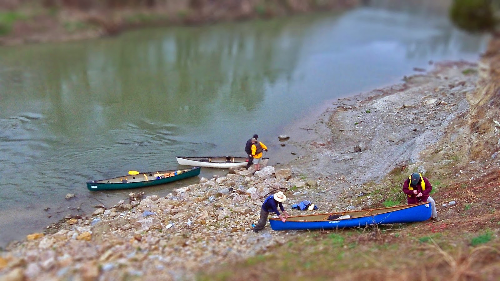
| Richard Grayson paddling past the Standing Wave and Santa Fe Trestle towards McCommas Bluff ten miles distant March 15, 2014 |
 |
| Under the I-45 Bridge on the Ides of March |
The iconoclasts of the Trinity rarely get a view of this part of the river. The wild river your great grandparents might have known before the levees went in. For the ignorant, their 30,000 foot view on such a place will forever remain as ones and zeros burned onto a computer screen or aerial map. The civic souled urban crowd would find themselves not at home in such a place but out of touch to boot. A shame that more people don't float the river. If you have not, you should.
Just like a hundred years ago, the river has not changed much in course, save for the tires, bridge spans and plastic bags that hang like Christmas ornaments on low hanging trees. Ancient man left behind plenty himself in the form of bleached bison bones eroding here and there from the banks and his stone tools litter the shores in spots. Maybe it's those who can only get indifferent about the patches of wrinkled hard used earth that lie between all the beauty down here that "get" these places. If you can't see it, then well this place might not be for you. Or anywhere else for that matter.
 | ||
| Photographer Sean Fitzgerald in his white Wenonah canoe on Elam Creek near the Trinity River Audubon Center March 15, 2014 |
 |
| Landing at McCommas Bluff under a heavy rain |
 |
| A Copperhead snake at McCommas Bluff Preserve March 2014 |
 |
| Cool dirt road which will be paved for a possible Spine Trail |
I recognized the tell-tales of a Buckeye or two last spring on the tail end of the blooming cycle at McCommas Bluff. Dogeared myself a note to visit the next spring to check it out.
 |
| The widescape view of Buckeye trees commanding the high ground over Elam Creek |
 |
| Trout Lilies growing among the Buckeyes |
It takes a half trained eye to pick up on the subtle nuances of some rare places in North Texas nature. They don't roar like a black bear, bugle like an elk or turn ten shades of red when they bloom.
The eureka moments of finding one, two and even three somewhat rare species of plants for North Texas sharing the same creek bank inside the city limits is a treat. Maybe being the first to ever notice it makes the find even better.
 |
| Trout Lilies in a state of bloom and post-bloom at McCommas Bluff Preserve |
 |
| Buckeyes growing along the slopes of Elam Creek in McCommas Bluff Preserve |
 |
| Trout Lilies growing out from underneath an old timber |
It was most likely decades ago that someone dropped the rough hewn board in the photo at left. The Trout Lily plant that was originally smothered by that long ago placed plank found a way to grow around it. These plants are old, the colonies ancient.
The mature plants seen in the photos are at a minimum seven years old. From seed to first flower, it takes seven full growing seasons for a Trout Lily to produce a first flower.

There is most likely no other place on the planet where trout lilies and Texas Buckeyes grow in the same spot. Rare times two.
 |
| Along the creek headed up stream. In the very far distance one can see the signature hill of the Trinity River Audubon Center |
 |
| Flowerless Texas Buckeye branch |

The Texas Buckeye is one of the earliest flowering trees in Texas but is beaten out some weeks ahead by the Trout Lily. Trying to catch them blooming together would be a near impossible feat and would likely involve some tricky winter weather to cause the plants to sync.
 |
| A Texas Buckeye foreground, Trout Lilies growing on the floor beyond and a Dwarf Palmetto Palm growing in the background |
 To add a triple crown to the rarity of the plants seen here, one can frame a Texas Buckeye, Trout Lilies and Dwarf Palmetto Palm all in the same shot. All exceptionally rare in DFW seeded in the wild. The pride in quality and quantity of plants here is really first rate. An undiscovered treasure perhaps that might yield interesting walks in the future from the Trinity River Audubon Center.
A native of Mobile, Alabama, Master Naturalist Bill Holston seen at right always gets a kick out seeing palm trees in Dallas. The often sterile winter scenes of Dallas bottomland take on a Deep South feel when palms are found.
Elam Spring
 |
| Hard hiking through heavy brush and Scouring Rush as one pushes up Elam Creek |
 |
| James Woods |
A native son of Pleasant Grove, childhood classmate of Billy Ray Pemberton, guitar player and lifelong farmer he told me the old stories of Elam Spring, where I might it and would it might look like when I got there. His last recollection of the place was in the 1950s when firefighters would draw water from it during the Big Drouth.

Elam Creek rises out of the riverbottom through cottonwood, willow as it transforms into a more mature hardwood bottomland forest. The red oaks and cedar yield to even a more interesting post oak savannah peppered with trees of the same name and the mighty bur oaks that once dominated this part of Dallas County.
 |
| The cliffs of Elam Creek |

 |
| A large stand of Scouring Rush draped over Elam Spring |
 It's a difficult if not near impossible traverse to reach Elam Spring. I would rank it a 10 out of 10 on the difficulty level when it comes to navigating invasive Chinese Privet. By far the thickest, most tangled mess of privet and greenbriar thorn vine thickets I have ever seen on the Trinity River. In some places it feels as if you are in a World War I field of concertina barbed wire.
The topography is very steep with multiple downed trees of great size which limit access.
 |
| Elam Spring at the source |
 |
| Old pump pipes at Elam Spring |
 |
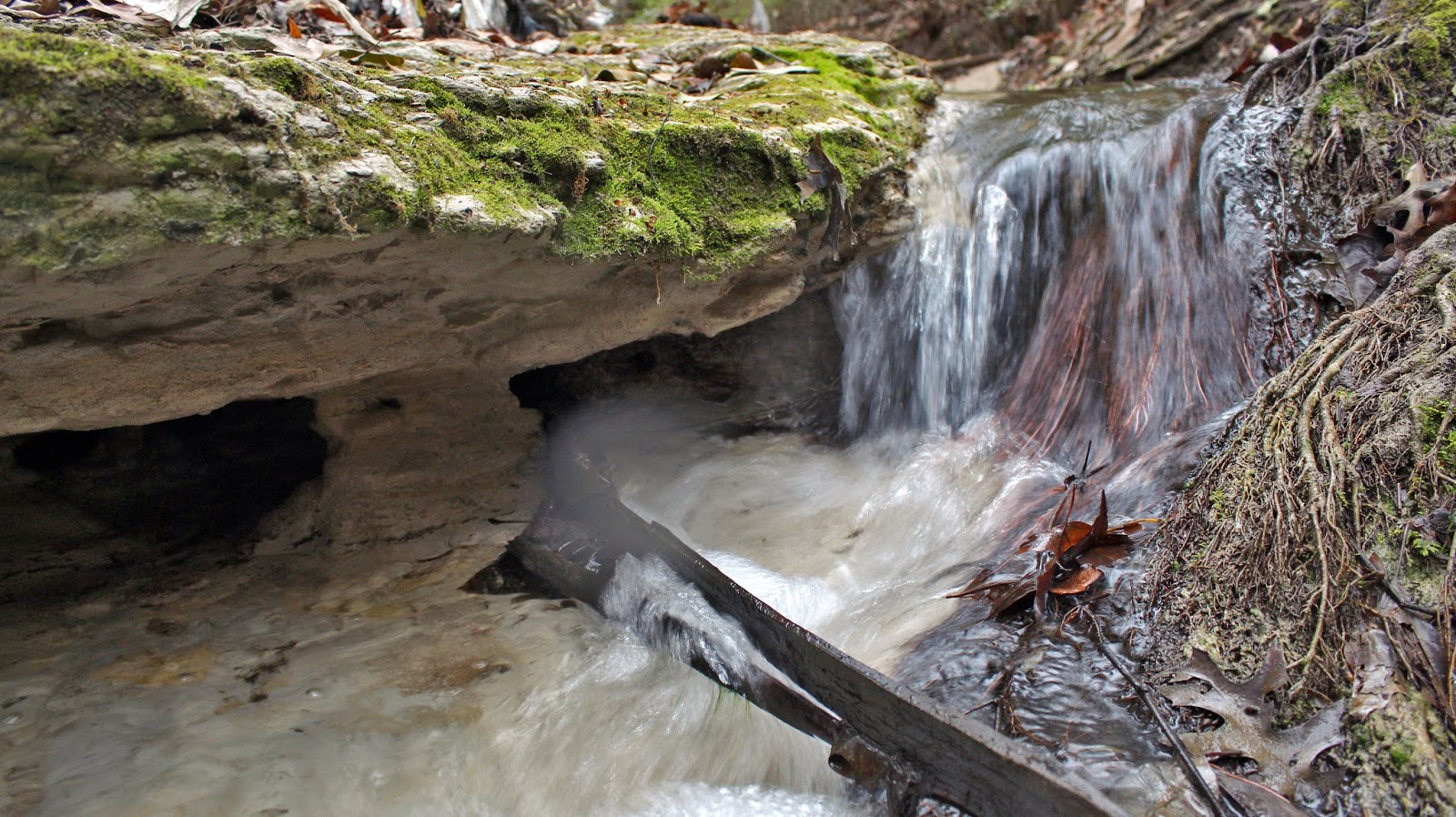
| Scott Hudson searching for a vent |
At left, Scott Hudson has his arm up in the bank stirring up silt to find a source. As the silt clears, like smoke would in the atmosphere, one can find a source. It might come up out of the bank or even up from under the streambed itself as is often the case in North Texas creeks.
Below is a video of Elam Spring, just 100 feet from where the dry bed gets damp. Watch as it roars to life.
This visit was in an abnormally dry winter for Dallas with only .80 of an inch in measured precipitation for the previous few months. The water in spring and spring channel was entirely of aquifer origin. During wet periods this spring channel appears to double as a storm water runoff for either Jim Miller or Loop 12 and is compromised as a result. It appears more than likely that in the 1960s as Camp Woodland Springs was subdivided that storm sewer outlets were built into the watershed, one such spot being that of the Elam Springs channel.
 |
| Outfall of Elam Spring into Elam Creek |
The stories of a place like this come from recollections of memories over a half century ago. Some of those stories were told to men like the Woods and Pembertons by the Old Timers, some who were original pioneers of Dallas. Those old sod busting pioneers were told stories of old Indian warriors surviving in the hills and creeks who they themselves had recalled something that happened half a century before. It's an unbroken chain of truth that runs clearer than the water that runs through these hollows.


