This practical guide takes readers to the best trails found in the Great Trinity Forest, all within easy reach of Downtown Dallas. Destinations include less traveled, low-traffic areas for hiking, mountain biking and horseback riding in the City of Dallas. Joppa Preserve, McCommas Bluff Preserve, Trinity River Wetlands, Texas Horse Park, Dallas Trinity Paddling Trail, Lower White Rock Creek, Sycamore Dixon, Texas Buckeye Trail, Dallas Whitewater Wave, Levee Trails, Rochester Park and more.
Texas Trinity River's Goat Island as seen from the saddle of a horse
Some of the first European American explorers to see the Three Forks of the Trinity River saw what we now call Dallas, on a horse. Accounts of bison, bear and plentiful deer were likely scribbled in journals from a saddle. The heavy brush thickets, triumph in the face of adversity and taming the wilderness of North Texas all offer the horse as the focal point of discussion.
Few see the Trinity in the natural channel like this south of town
Much has been written about man's exploration of the Trinity River by horse. The work to survey the land for settlement, the fierce battles to stave off Indian depredation, the eventual pioneer migration into Dallas County. The horse was a vital tool for traversing these bottoms.
The first settlers to this area were drawn by stories of the fertile lands, open range country and
plentiful wild game. They were told that the land could be farmed so easily, that in a whole days of plowing one would
not strike a stump, which were the constant enemy of
cultivating in the other states.
Modern man has for the most part lost the art of riding a horse and the joy that can come from working with a horse over varied terrain and conditions.
The tall grass and weeds of the river barely reach the heels of your feet through this countryside. A delightful journey through thickets, dark shadows and bright wide open prairie.
Dueling Scissortails
A horse with a fast lope and good company makes for a rewarding visit to Dallas County's Goat Island Nature Preserve. With a wetter than normal spring of rains and flooding, seeing Goat Island on the established levee and old farm access road is a great adventure.
Completely staying off and avoiding the fragile mountain bike trails and footpaths, sticking to the dirt roads is best for the flora and fauna here who face a detrimental impact from horses straying off into the heavier brush.
Goat Island Preserve is a great place to ride as the established roads are hard packed and established with over a century of use. The roads date back to the turn of the last century when this was part of a large working farm.
Indigo Bunting
Goat Island Preserve in Dallas County Texas, blue line is low road, red line is road following old Clint Murchison levee
Address 2800 Post Oak Road Trailhead at 2800 Post Oak Road Wilmer, Texas
From Dallas take I-45 south to the Fulghum Road exit, head east where it
eventually turns into Post Oak. Trailhead is easy to spot at one of the
90 degree bends in the road. New trailhead parking lot and sign note
the entrance. Parking spots are marked for passenger vehicles but not trucks with trailers. Since few ever visit Goat Island, parking crosswise along 4-5 spaces seems the best option.
One or two parking spots exist at the Beltline Road bridge
but are not formal parking like the trailhead up the street on Post Oak.
The higher levee road(in red on the map) follows the top of an old levee road which runs the
length of the preserve south to Beltline Road. The lower road which runs
between borrow pits for the levee and the Trinity River is slightly to
the east and meets the upper levee road at Beltline. A high water table
in the area ensures that even during the driest of weather that the low
road stays wet and muddy in spots.
Distance Six miles out and back to Post Oak
Jeff Lane
Jeff Lane and his family have been horseback riding in South Dallas for generations. For decades Jeff has been riding the river. A lifelong resident of the general Fruitdale area. Fruitdale was three miles south of downtown Dallas in central Dallas County. Some folks call it South Dallas or even South Oak Cliff. Fruitdale is the name.
The annexed land is now bounded by Fordham Road on the north, the Missouri, Kansas, and Texas tracks to the east, Five Mile Creek on the south, and Sunnyvale Street to the west. It was in the original land grants of J. K. Sloan and G. L. Haas. In 1886 the Missouri, Kansas, and Texas Railway was extended through Fruitdale. The settlement remained a quiet farming community into the twentieth century and annexed into Dallas October of 1964.
Through the 1990s and early 2000s Jeff tells me he had a volunteer agreement with Dallas County to mow areas around what is now called Joppa Preserve (River Oaks Park) and Goat Island. This basic maintenance with a tractor towed mower allowed access to horseback riding in Southern Dallas County. In addition to riding all over the river on a horse, he can often be found riding a bicycle along the Trinity Trail system from Loop 12 to the Audubon Center in the evenings.
Headed down the doubletrack from the parking lot on Post Oak Road. The area in the photo was once a formal farm and ranching area which sits up and out of the floodplain. The road splits around the bend with options for taking the high or low roads.
The lone cowboy noted in western lore never really reached this part of Texas. The hardened cowhands and the free range of cattle bypassed this area as western migration moved those pursuits west rather quickly. What Dallas did develop was a rich horse tradition based upon families riding their 640 acres of land, known as a section, awarded for service in struggle for Texas Independence or later during Peter's Colony settlement. A square mile of land often separated neighbors. The horse is what closed that distance.
The Low Road
On the low road, which is always wet. Always.
Up on the terrace headed down into the bottoms
Goat Island Preserve features two cutoff meanders that create islands in
the river channel when the water is high. On the west bank of the river
a large 1910-1920 era levee exists that runs from Post Oak to Beltline
Road. Borrow pits rest on either side and a lower
dirt road trail runs
between the levee and the river. Towering oaks and pecans are prominent
here among succession forest. Lock and Dam #2 sits on the Trinity River
just upstream of the Beltline Road bridge.
The low road seen from the saddle
Poison ivy runs ten feet tall on either side of the low road in spots. The only way to travel is to just ride through the water, about 6 inches deep. Clear enough with a visible bottom, the horses love it. Some places it is hard to keep the horse from taking a friendly roll into the puddles where they can play.
Lots of playful splashing, horses love this kind of water
The rough leaf dogwoods are in full bloom in late spring here, sitting 10 feet high on a horse allows one to get a great view of some low trees and shrubs that cannot be seen from the ground.
The flooded road would make for a horrible hike and a terrible bike ride. Both those activities would be impossible. A horse can negotiate it all fairly well and other than the wicked swarms of mosquitoes it is very enjoyable.
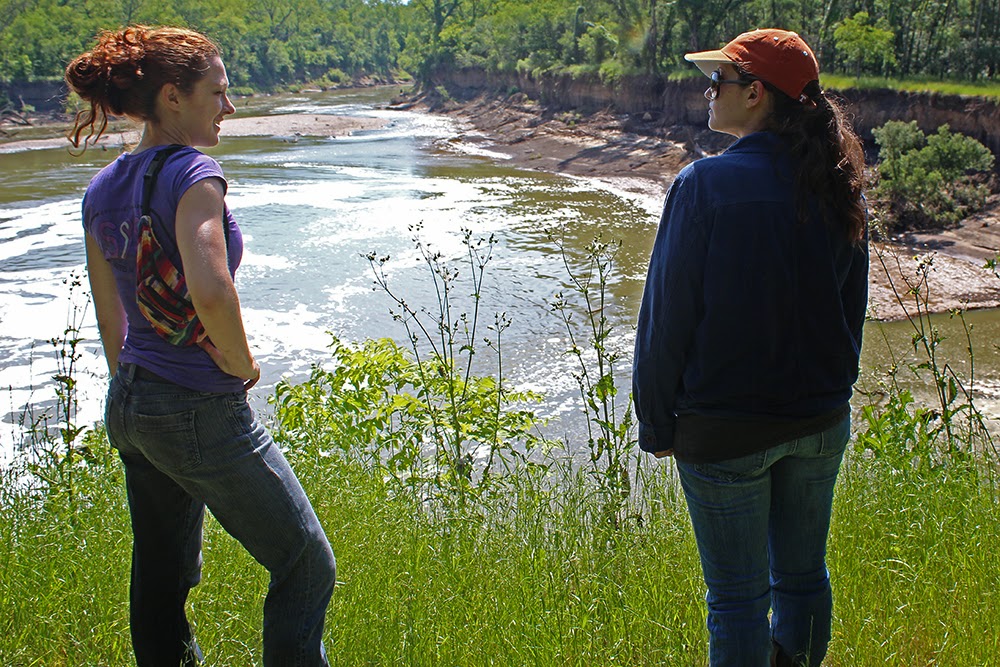
Jeri D'aurelio and her horse along the Trinity River at Goat Island
About two miles from Post Oak Road's parking lot, the low road opens up and follows the river down to Lock and Dam #2. Recent rains and flooding have severely eroded the bank in many areas, slowly encroaching on the old lower road. Trail Steward Joe Johnson said that vast stretches of river in this area are losing their banks and trees at an accelerated rate.
In the far distance, Lock and Dam # 2 appears
Stock Certificate for Trinity River Navigation Company
On quiet and windless mornings you can hear the roar of Lock and Dam #2 before you can see it. A folly in man's quest to change the river. A folly in idea and design to build something in the riverbottom that would never fit. Every generation takes their own design to the river and it never works.
Trinity River Lock and Dam # 2 sits just upstream of Beltline Road.
There are three locks on the Trinity River in Dallas County, #1 at
McCommas Bluff, #2 at Parson's Slough/Goat Island and #4 near the mouth
of Ten Mile Creek/ Riverbend Preserve.All were built between 1910 and 1916.
The locks and dams in Dallas County never saw much river traffic. The
idea to harness the power of the Trinity into a navigable water way was
abandoned shortly after World War I in 1922.
Leaps in technology with long haul trucks and improvements in road and
rail capacity sidelined the effort to move commerce via the river. Ideas
at rebirthing the locks and dams on the Trinity came in the 1930s, 50s,
60s and 70s. These ideas were fanciful pursuits for the most part,
grand visions with no science to support the effort.
Jeff Lane checking out the dozens of alligator gar in the foaming water below the dam.
Today we are left with the concrete foundations of the locks, twisted
metal and fallen flood gates. Lock and Dam #2 is the most photogenic of
the locks in Dallas County. The water literally roars here with long
vista like approaches on either end. The other locks are constrained to
some extent in the river channel and don't have wide eroded pools on the
downstream side.
Video of Lock and Dam #2and Horseback Riding Goat Island
Each Boule Gate that was used in the lock was 24 feet high, 30 feet long
and weighed 60,000 pounds. One gate formed half of a door, 1 door on
the upstream end and 1 door on the downstream end completed the lock
which was designed to raise and lower boat traffic.
Michelle Lane checking her horse in a grove of cedar elms at Lock and Dam #2
The construction of Lock and Dam # 2 required the closing of a subchannel of the Trinity called Parson's Slough.
Old map of Bois D'arc Island and Parson's Slough
The idea was to cutoff a 14 mile stretch of the traditional stream bed for a more
westerly course putting all water in one channel of the Trinity. The old riverbed became known as Parson's Slough and
the 22,000 acre area surrounded by the new and old river became Bois d'
Arc Island.
Jeri D'aurelio and Michelle Lane at Lock and Dam #2 at Goat Island Preserve
Trees, some rather large are calving off into the river below the lock
In 1911, the slough was permanently cutoff from the Trinity River near
Goat Island Preserve. The same construction company that built Lock and
Dam Number 2, built a concrete dam at the head of Parson's Slough where
it meets the Trinity. Twenty feet high and two hundred feet wide, the
goal was to permanently send the river down the new channel rather than
risk a flood putting the river meander back in the old. Now buried under
dozens of feet of silt, it cannot be seen from the west bank.
Mounting up and heading further towards Beltline
It sits near the outflow channel near the Southeast Wastewater Treatment
Plant. Buried. Only during times of the very highest water flows would
the dam become a spillway.
Combined with some levee projects in the
1920s, this left Parson's Slough high and dry from the Trinity. The
flood prone area now known as Bois d' Arc Island now serves as some of
the very richest farmland in Dallas County. Much of which is owned by
Trinity Industries for future gravel mining.
Through some young woods of Ash and Cedar elm, approaching a powerline right of way that connects the low and high roads
The Upper Road
Riding just outside the edge of a Dallas County corn field
The higher levee road(in red on the map at beginning of post) follows the top of an old levee road which runs the
length of the preserve south to Beltline Road. Until recently, trees and
vegetation were allowed to grow on the levees. The clearing was to maintain the functional facility for higher flooding
events on
the west side of the Trinity. I would believe they offer marginal
protection since they have not seen earthmoving improvements in so long.
The old levees today most likely still perform the job they were
originally designed to provide. Protection from all but the very worst
flooding that the Trinity River can dish out. These levees are about
half the height of the Downtown Dallas levees and hold back the seasonal
and annual floods of the Trinity. Beyond the levees millions of dollars in corn grows. A crop that would drown if flooded.
The dirt road here is much more open than the lower road. Here two horses can ride beside one another and conversation is much easier. There are only a few surprises along the route of note. In a few spots there has some been bore sample drilling of the levee with grass covered holes left behind. Care needs to be taken in watching for the holes which are just off the road in the high grass.
Time to kick it up a notch and letting the horses run on the smooth section of levee about a half mile from the end of the ride
The levee affords a great chance to loosen the reigns and pick up some good speed in a lope, or even faster. Lots of photos on the ride down the lower road, not many on the high road back. Lots of up tempo faster riding were the order of the day here where the horses were let loose to run. Hard to manage an SLR in one hand and ride a horse 20mph with the other.
Where to ride your horse in Dallas on the Trinity River
Often people ask me where to ride their horse. Goat Island is the place. There are a scant few other spots like Dowdy Ferry @ I-20 at the Gateway Park there but the options will become much more restricted when the trails are paved over with concrete.
Famous Texas bird guide Victor Emanuel spots a Mississippi Kite with a flotilla of canoeists on the wilds of the Elm Fork in Dallas, Texas
There are many areas in Dallas Great Trinity Forest that one can easily explore on foot. Vast wooded bottoms with surprises around every corner. There are other stretches where the wholesale experience of the river really needs to be seen by boat to appreciate. The Elm Fork of the Trinity River in Dallas is one such place.
Most Dallasites are not only unfamiliar with the Trinity River. The stretches outside the levees in the natural channels are completely unknown but to a few. These areas are obscure, beautiful and surrounded by the heart of the metroplex. Similar in many ways to the southern stretch of Great Trinity Forest below Downtown Dallas the northern section offers some of the best natural scenery in North Central Texas. Just ask Garrett Boone.....
Garrett Boone at historic California Crossing points out areas of interest and the route we will be taking down the Elm Fork
Garrett Boone must know more about the Elm Fork of the Trinity and the land that surrounds it better than anyone. His knowledge extends beyond that of what lies at every turn of the river. In about a ten minute executive summary of the river on maps one can tell he understands the hydrology, inflows of creeks, land use, industrial parks and ongoing infrastructure projects.
Garrett Boone and Victor Emanuel pouring over a map
The Trinity in this area is far more than a ditch, it is a complex set of old dam structures, naturally coursing river channel and connected lakes that create a deep expansive set of wetlands extending across a thousand acres.
The Elm Fork's headwaters lie north of Bowie, Texas up near the Texas/Oklahoma border. A prominent ridgeline known as the Devils Backbone forms the divide for the Trinity and Red River watersheds in this area.
As the water courses south it runs through two large man made impoundments at Ray Roberts and Lewisville. Below Lewisville, the river is often clear, cool and makes for exceptional paddling and recreation. The water comes from the base of Lewisville's dam and is a predictable flow except during times of flood.
Three small dams make up the Elm Fork known for great paddling:
1. Carrollton Dam at McInnish Park on Sandy Lake Road in the City of Carrollton
2. California Crossing dam at California Crossing Road
3. Frazier Dam just near Loop 12 and SH 183 straddling the city limits of Dallas and Irving.
All three dams require mandatory portaging around the structures.
On this trip we will explore a six mile stretch of river book ended by the dam at California Crossing on north end at the Frazier Dam on the south end. Between the two impoundments sit the natural channel of the river with an elevated water level. The result is a slower flowing river compared with other sections downstream of Dallas. 18 total riverbends and two small lakes off channel await us on this trip.
Charles Allen, the Trinity River's best canoe guide, seen coming out from a hidden pond off the main channel on the Elm Fork
Canoes, equipment and guide service were provided by Charles Allen. If I recall, Charles is celebrating 25 years on the river in 2015. His knowledge of the river, flora, fauna, geology and history is like a floating version of an encyclopedia. Top notch person and very competent guide. His website http://www.canoedallas.com/ and his Facebook https://www.facebook.com/trinityriverexpeditions.
Everyone listening to one of the better run downs on the Trinity I have ever heard
Garrett Boone has a wonderful vision for the Elm Fork. The natural building blocks of a slow snaking river with dozens of bends and turns make for a great setting for a future natural park area. Actually, it's all ready a park with some sections a Dallas County Nature Preserve. Wide greenbelt spaces abbreviated only by bridges and train trestles make it a near contiguous open public space.
Garrett has some great ideas on how to open the area up to low impact recreation along with education. He is a sponsor of Groundwork Dallas which is blueprinting a plan for the area. Their website has more information on their Groundwork Dallas Elm Fork Project.
Canoe Launch at California Crossing
California Crossing and the dam here were recently rebuilt and refurbished in 2012-2014. The dam features ingress and egress portage locations for canoes and a parking lot with easy trailer access.
It was a hair over a hundred years ago, about 1910 that one of the first California Crossing dams went in at this spot. The spot is one that dips into the vast reaches of history and looks rather unchanged from that of 100 years ago. Some of the trees in the photos here still stand today. The sturdy grove of Post Oak, Bur Oak and Elm that have seen generations of Dallasites stand at the same spot we are at this morning.
California Crossing circa 1912
In the turn of the last century, Dallas dabbled with the idea of using
the Elm Fork to meet municipal water supply needs. Various dams,
diversion channels and holding basins were constructed on this stretch
of river. Used partially for flood control and water conservation, the dams still serve as water supply in some capacity. Highland Park uses Frazier Dam from what I'm told.
People often wonder how California Crossing was named. The answer lies in a faded Texas Historical Marker at the site which reads "Here thousands of 49'ers crossed Trinity River in heroic trek west--following California Gold discovery. Crossing was in shallow part of stream on Southern Transcontinental route to Pacific. Later used by stage lines, railroad; route passed through Dallas and Cedar Springs on to El Paso."
Texas history often associates things with events that happen on her soil. Missed in the mix are often stories of manifest destiny that migrated through Texas to somewhere else. Cattle drives, human exploration and in this case those in search of fortunes on the Pacific. Stories of trappers rendezvous and Kansas railhead cattle saloons passed on the lips of migrants across this spot.
Victor Emanuel at right with David Litman at left
It's a different kind of migration we are looking for here on the Elm Fork today. One of the feathered kind. If there were ever anyone who knows more about migrating birds in Texas, it would the one and only Victor Emanuel.
Victor Emanuel speaks to Brent Jackson(in white hat) of West Dallas Sylvan Thirty development as Design District based photographer Scot Miller shoots some video footage
Texas Monthly calls Victor Emanuel "The Birdman of Texas", the absolute authority on all things ornithology. Read their 2011 story on his birding with heads of state, interesting folks and the depth of field he has for his craft Texas Monthly May 2011, The Birdman of Texas.
Garrett Boone glassing a Western Kingbird
In small talk before launching canoes, Victor was pointing out the common trees of the Elm Fork and pointing to each as he scanned the horizon at all points of the compass. Box elder, elm, pecan and slew of oaks. He pointed out a couple quick birds and then told a few of us about a similar bird in the plains of Africa that has the same behavior. Truly an authority wherever he goes. Based out of Austin his travel group called VENT http://www.ventbird.com/ goes to every continent on earth.
Today, Victor will put us on a kaleidoscope of birds from South America, Central America, the United States and Canada. All in Dallas. A treasure trove of bird life inside Loop 12.
Charles Elk VP of ONCOR in yellow life jacket
Along on the trip are an eclectic mix of folks from a variety of backgrounds. Corporate leaders, fund managers, entrepreneurs, long time conservationists and close friends. A great talent pool to see and experience the river as it can only be seen by floating it.
American Elm hangs over the river as the flotilla of canoeists pass by on the Elm Fork of the Trinity
Zach Wooldridge in the stern of foreground canoe
The launch from California Crossing on this day is much like entering a lake. Very little current is felt in this stretch of river which is impounded about 6 river miles downstream by the Frazier Dam.
As one leaves California Crossing, river left is the LB Houston Nature Preserve. The nature preserve is named for L.B. Houston who is known for transforming many public spaces in Dallas into world class park facilities in the 1930s. His tenure as Director of Dallas Parks and Recreation showed ambitious drive and pursuit to built out many structures and park amenities we still use today at places like White Rock Lake. Those 70 year old structures serve as a benchmark to future generations of designers and planners. Seems like anything designed or planned for the Trinity deserves that generational benchmark as well.
Scot Miller of Sun to Moon Gallery shooting from the bow of a canoe
The name LB Houston, without the punctuation is now known commonly as one of the more built out mountain biking trails in North Texas maintained by the Dallas Off Road Bicycle Association, DORBA. Information on the LB Houston Mountain Bike Trail can be found on the DORBA LB Houston Trail website.
To the river right are sections of the Campion Trail system in Irving/Las Colinas which someday will connect Dallas to Forth Worth. A planned 22 miles of concrete trail with a 6.5 mile stretch up the Elm Fork at the present time. More information can be found on City of Irving Campion Trail website.
Right off the bat, within 100 yards of California Crossing we are treated to a number of wading birds, pointed out one by one by Victor.
Every one of the eighteen turns is photogenic with a high water column and not much exposed bank. Lazy turn after lazy turn provides wildlife around every corner. Ducks, shorebirds, warblers, buntings brought a unique blend of birds into view during the paddle.
Wood DuckAix sponsa
Garrett Boone and his wife Cecilia watch a pair of Wood Ducks along the Elm Fork
The Wood Duck is considered by many bird watchers to be North America's most colorful waterfowl species. Its scientific name, Aix sponsa, translates into “waterbird in bridal dress.” Today the wood duck is one of the most common waterfowl species breeding in the United States. However, this was not always the case. Writings from the early 19th century indicate that wood ducks were in abundant supply and very popular for their tasty meat and bright decorative feathers.
The Wood Duck population declined seriously during the late 19th century because of hunting and loss of nesting sites. Its recovery to healthy numbers was an early triumph of wildlife management.
Patient Wood Ducks in far background as everyone pauses to get a good look
Railroad trestle approaching Cistercian
Only a few turns of the river do you see the hand of man. Those are a brief few turns near Cistercian where the athletic fields of the school are built along the river at river right. At river left, LB Houston Nature Preserve dominates the landscape with large trees, late season bluebonnets and many bird species.
Most of the man made structures on this six miles of river cannot be seen until one rounds the next bend. Otherwise the scene is quite natural.
Cistercian off to the left of photo with Las Colinas in the background
Canada GooseBranta canadensis
Canada Goose flies directly over our canoes
Bird Guide Victor Emanuel and Zach Wooldridge
Awakened from the river on a small island and taking flight directly over our head flew a loud pair of Canada Geese.
A large and distinctive waterbird, the Canada goose (Branta canadensis) can easily be recognized by its long black neck, black head and conspicuous white cheek patches, which extend under the head and neck. Loud and honking, the Canada Goose let out a number of protest calls as we paddled by.
Some of the Canada Geese population are now year round residents of North Texas, choosing to feed on the grasses of manicured lawns rather than migrate north for the summer. Such is most likely the case with these geese as they were slow to leave the river.
Charles Allen points out the Eagle Ford Shale formation outcrop on the Trinity River. This exact spot is the center of recent earthquake activity in the Dallas and Irving area.
Yellow Bellied Water SnakeNerodia erythrogaster
Yellow Bellied Water Snake
Not all wildlife seen on the float trip were high in trees or on feathered wing. Others were perched on logs sunning themselves in the strong morning light. One great example is that of a rather large and patient Yellow Bellied Water Snake Nerodia erythrogaster. It favors the river swamps and the forested edges of streams, ponds, lakes, and bayous.
Very common snake and the most common snake species that I see in the Great Trinity Forest. They are non-venomous but will bite if provoked. While their bite does not carry venom, their fangs can hold bacteria that can infect humans if the human skin is broken.
A slow paddle as a Great Egret stands perched in branches of a snag
Indigo BuntingPasserina cyanea
Male Indigo Bunting in an Ash tree
The Indigo Bunting, a member of the finch family, is a familiar summer
visitor to Eastern portions of Texas. This loud little songster prefers
brushy pastures and edge habitat where brushy fields meet the forest.
Its winter range extends through Central America and the West Indies.
Males vigorously defend their territory by singing and displaying from
the open top branches of trees or other visible perch.
On the Elm Fork we heard many Indigo Buntings, saw a few and managed to shoot a couple with a camera. Both the Indigo and Painted Buntings seem to be particularly camera shy and fly away at the first sign of a camera.
Indigo Buntings are actually black; the diffraction of light through
their feathers makes them look blue. This explains why males can appear
many shades from turquoise to black. An interesting fact is that they migrate at night, using the pattern of stars nearest the North Star to guide them.
Heading downstream with a huge grove of mature cedar elms and elms river right and native swamp privet river left
Where the Indigo Bunting is classified as a bird with black feathers, there is another bird visiting from the tropics that everyone associates with black. The anhinga.
AnhingaAnhinga anhinga Spending most of the year in tropical rainforests and sub-tropical areas south of the border, Anhinga anhinga feel right at home in the oppressive heat of a coming Texas summer. It's one of the few birds that one can easily remember when it comes to the Latin species name.
The anhinga is a large bird with a long S-shaped neck and a long pointed bill. The male has grayish-black feathers with a greenish shine to them. They have large wings with silver-white feathers on the top side. Females have a light tan head, neck and chest and a black stomach. Both the male and the female have long fan- shaped tail feathers and sometimes the anhinga is known as the water turkey.
The anhinga has poorly developed oil glands and its feathers aren't as waterproof as other water birds are. It will perch in a tree to dry its feathers.
Observing Anhinga
Anhinga are an uncommon bird in North Texas. Easy to spot at a far distance but not particularly here in large numbers.
A bird of the swamp, we find them on this trip in side channeled ponds with canoe access trails running from the main channel of the river. The ponds, running 3 to ten acres in size by my estimation are the fertile riparian habitat that so many aquatic birds crave.
The access spots are not marked and it takes either a guide or careful observation to see them.
One of the off channel lakes on the Elm Fork. I think the buildings in the background are the local office buildings for the FBI and ATF
Some of the lakes are large enough to hold a battleship or aircraft carrier. Much different than the confined spaces of the Trinity River south of Downtown Dallas. Here there is a lot of open room to roam, wide vistas and distant buildings to provide a sense of scale.
Charles Allen at a water processing and trash filter system at Fishing Hole Lake
Just past Storey Lane we pass a water intake facility which controls water flow at Fishing Hole Lake. Built out on a peninsula is the facility with a contraption that collects trash and other debris from the facility and places it into an industrial roll off dumpster.
Elm Fork just upstream from Frazier Dam
It is in this stretch of river where the trees continue to rise in height and the channel widens. The Frazier Dam is visible on the far horizon some 400 yards distant. It is here where man has begun to change the river, channelize it, as it enters the Dallas Floodway and levees. It is also where we turn off the main channel and paddle the old remnant historic channel left behind. It will take us about 1/2 a mile through galleries of tall woods, off shoot swamps, before reaching our takeout along I-35 and Hines Place.
This stretch forms the heart of what would be a future Elm Fork natural area for education and concentration on conservation efforts with natural surface trails and possibly a nature center.
It is the hidden river that is a stone's throw from Love Field that is a total unexplored resource for Dallasites.
Large logs, snags and 40 foot high trees draped with vines give the impression of a rainforest. The birds call loudly, many more than anywhere else yet unseen due to all the vegetation. Really spectacular. There is a catch to navigating the side channel there. The legacy of trash.
It is rather remarkable seeing a raft of trash on a stretch of river where we encountered virtually none during a 4 hour, 6 mile float. I even commented how much cleaner this stretch of river was compared to the main channel of the river south of Downtown. Garrett Boone told me to hold that comment till we made it to the trash raft.
A product of hydrology with the help of some litterbugs this 50 yard section of river creates a imposing challenge to navigate.
Garrett told me the trash flows in and is trapped. A unique pocket of a Bermuda Triangle of trash. Coolers, styrofoam cups, water bottles. Many bear the name of gas stations and fast food joints just up the road. Other trash is labeled with places in suburbs upstream. Lewisville and Carrollton.
It makes for a tough view to stomach and a tough slog to paddle and push through. Coming up with a solution to this problem will require some out of the box thinking and an innovative fix. Garrett Boone has some novel ideas cooking about it.
I-35 in the background as we approach the takeout spot for our trip
A few more minutes of paddling and we transition from the deep channeled Elm Fork with vine covered trees and pop out into the bright noon sun.
At the end of the journey at southbound I-35 and Webb's Chapel Extension, Hines Park area
It's a nondescript takeout for canoes. An old caliche fishing road blocked by a Trinity Watershed Management sign. The roar of traffic overhead makes for an interesting contrast to where we were just minutes before.
Back at California Crossing talking about what a great trip this was and the amazing sights and sounds. Smiles all around.
For many on this trip, it was their first exposure to the Trinity River and canoeing in an urban wilderness. It is a joy to see people view a Wood Duck or Anhinga for the first time. Better yet explaining that the bird flew 2,000 miles just to nest in Dallas for the summer.
Even better than that is realizing Dallas citizens like Garrett Boone are out there. Sharing these experiences with a broad audience. Being an advocate. Donating valuable time and energy. Educating residents and schoolchildren. His conservation efforts and plans are first rate. When his plans come to fruition Northwest Dallas and Preston Hollow will have a really unique wilderness experience right in their backyard.


 One or two parking spots exist at the Beltline Road bridge
but are not formal parking like the trailhead up the street on Post Oak.
One or two parking spots exist at the Beltline Road bridge
but are not formal parking like the trailhead up the street on Post Oak. 
 Jeff Lane and his family have been horseback riding in South Dallas for generations. For decades Jeff has been riding the river. A lifelong resident of the general Fruitdale area. Fruitdale was three miles south of downtown Dallas in central Dallas County. Some folks call it South Dallas or even South Oak Cliff. Fruitdale is the name.