Showing posts sorted by date for query piedmont ridge. Sort by relevance Show all posts

Sunday, March 8, 2015

Hiking Dallas Great Trinity Forest In The Snow

Sojourn in the snow swept woods and ridges of the Great Trinity Forest in Dallas
The stunning beauty of the snow covered scene could be any mountainous terrain in North America. The near deafening silence of this place would suggest the nearest human would be far beyond the horizon. The snow covered trail we followed over the course of a couple miles only has the footprint of a lone coyote. No human has walked here for days. A place so remote in feel is in the heart of Dallas, inside Loop 12 and just minutes from Downtown.
One of the limestone strewn gullies along the Devon Anderson section of the trail

Hiking across Renda Meadow east of Scyene Overlook
The encroachment of development over the last half century has left much of this area encased in concrete and manicured lawn. The landscape has changed in many ways and in other places, a quickly disappearing few, have remained essentially the same.


The White Rock Valley known to many from headwaters in Frisco to the mouth in the Great Trinity Forest has lost much of the natural character which drew Dallas first settlers.

The creek's course has been confined for millennia by Austin Chalk limestone ridges that it traverses to the east.

To the west of said outcrop lies a magnificent tangle of oxbow tied meanders and sloughs replete with hawks, otters and beavers that will make even an untrained eye awe in wonder.

Here, in the Great Trinity Forest and the escarpments one can see in places what White Rock Creek and the woods it feeds might have looked like hundreds of years ago.


Barred Owl in the snow on February 28, 2015


Few venture places in Dallas during winter weather events. The combined effects of warm gulf air in variegated layers often turns a beautiful snow event one day into one of treacherous freezing rain the next. Such is the case here in Dallas on this last day of February 2015.


 Pioneer Family Roots Run Deep
Trail junction signs for the JJ Beeman Trail which traverses bottomland and the Scyene Overlook Trail which quickly gains elevation to a commanding view over the lower White Rock Creek Valley
In the simpler times and by any stretch the hardest times, this area was the domain of the Beeman family. What I would call as the real first pioneer family of Dallas, the Beemans settled this part of what is now Dallas County in the spring of 1842 on an old Indian and Buffalo trace now called Scyene Road. John Beeman (1799-1856) and his family were the first of that larger extended family to settle here. The history and legacy that those families wrote along with their neighbors are what cut what was then true wilderness into the city we see today.

The extensive discourse one can provide on the local pioneer history would fill many a line of a blog.  The conduit between contemporary Dallasites and that of the pioneers still runs through the bloodlines of their descendants that still call North Texas home. The original settlers to Dallas County were a strong people and that is still evident today.
 MC Toyer, his mother Lois Beeman Toyer, MC’s sister Cynthia Toyer Fusco


Sam Beeman,Margaret Beeman Bryan, John Neely Bryan Jr


The two photos at the time taken, represent the matriarchs of the Beeman family, taken over one hundred twenty years apart. At upper left Margaret Beeman Bryan, wife of John Neely Bryan, founder of Dallas. At right in the 2015 photo is Lois Beeman Toyer, the oldest living member of the Beeman family.
Lisa Dye Bentley and MC Toyer, descendants of Benjamin Dye lay a wreath at the gravemarker at Warren Ferris Cemetery near White Rock Lake in January 2015
 The occasion was a rare event in 21st century Dallas, a gravemarker dedication for a War of 1812 Veteran who settled Dallas in the infancy of Texas. His name was Benjamin Dye and is buried a few short blocks from the Dallas Arboretum at White Rock Lake. Paul Ridenour wrote a terrific piece for the White Rock Weekly on the gravemarker dedication found here:
http://www.whiterocklakeweekly.com/14792/107815/a/patriotism-prevails-during-dedication-event


Some would like to think Dallas is a poor place for local history. That the depth of events happening on the soils of our county is thin. Simply not true. It is rich and features many of the romanticized touchstones of other Texas history events that make Dallas history a fascinating study.

What sets Dallas apart are the places of yesteryear. Where the first explorers clad in buckskin pants and coonskin caps wandered across Dallas for the first time. Many of those spots still stand intact. Places like the Beeman lands, at interesting places like Scyene Overlook.

 Scyene Overlook
Bill Holston standing atop Scyene Overlook
 It is from the top of Scyene Overlook that not just the Great Trinity Forest spills out beneath your feet but also a chance to see for a few miles distant, the immense land holdings once held by the Beeman family.

Fresh rabbit tracks are the only footprints on the trail
It was across this land in the distance that JJ Beeman guided President Sam Houston and his Treaty Party entourage visit in the summer of 1843. JJ Beeman guided Sam Houston's Treaty Party from their overnight camp at Big Spring up White Rock Creek to John Neely Bryan's cabin in what is now Downtown Dallas.

The best known overlook in this trail system is Scyene. Roughly one hundred yards south of the road bearing the same name the overlook gives one a commanding view of the Great Trinity Forest to the south.
Below the overlook in a stand of cedar
Scyene Overlook is named for an old frontier town two miles to the east of the named Scyene. The town center was at the present day intersection of Scyene and St Augustine . The name "Scyene" is a play on the ancient Egyptian town named Syene an old frontier outpost on the east bank of the Nile.

Piedmont Ridge Trail and Devon Anderson Trail
The millennium old natural bison path and hard bottomed ford of White Rock Creek made this a preferred ox pulled wagon route into Dallas prior to the railroads. The long haul freight transporters of their time.


The Lower White Rock Creek Trails are comprised of a roughly 3-4 mile(depending on route) soft surface trail network spanning three different City of Dallas Parks. JJ Beeman/Scyene Overlook on Scyene Road, Grover Keeton Park which includes Piedmont Ridge Trail and Devon Anderson Park south of Bruton Road.

Best Parking
2300 Jim Miller Road Dallas TX

The JJ Beeman Trail starts near the corner of Glover Pass and Scyene and continues east to the Scyene Overlook. From there the trail roughly follows an Austin Chalk Escarpment high above the White Rock Creek Valley.  One clear days can see the VA Hospital in South Dallas, Cedar Hill, Hutchins as well as Downtown Dallas. The trail continues through Grover Keeton Park, up Piedmont Ridge, across Bruton and into Devon Anderson Park. 

The trails here are comprised of a random mix of trails with no clearly defined start or finish. Over the last couple years, trail maintenance has fallen off and as a result some of the sections might become an awkward adventure to find. The trails are all still there just more faint in appearance for a first-time visitor.

Piedmont Ridge
Crossing an open field before hiking up Piedmont Ridge
Piedmont Ridge, which sits to the south and east of Scyene Overlook is slightly higher than overlooks to the north. The long ago built trail along the topographical high is reached by navigating across the Scyene Overlook escarpment and across the driveway entrance of Grover Keeton Golf Course. Heading south with Jim Miller on the left and the DART tracks to the right, one will find a trailhead kiosk and trail entrance.
Climbing up the short switchbacks that lead up the spine of Piedmont Ridge
Some short and steep switchbacks climb quickly onto a level topped ridge with a set of cedar hewn benches roughly 2/3'rds of the way towards Bruton Road.
Piedmont Ridge Overlook
Cactus covered in ice


The cedar benches here have some of the most photogenic views of Dallas and Oak Cliff to the west. A real showstopper of a place to take in a sunset and only a ten minute walk from where one can park a car. The smell of this spot is that of the Texas Hill Country and even during below freezing conditions, the cedar pollen of this spot is thick.


 Devon Anderson Trail

Mexican Buckeye seed pod


South of Bruton Road, the becomes nearly non-existent in many spots. Even in dry weather the trail is not much more than a faint trace of a path frequented more by that of a coyote, a couple rabbits and bounding squirrels. No human traffic as evidenced by the clean snow.

Footbridge across a very deep gully in Devon Anderson Park
The trail follows ridge lines and then switchbacks down into a series of gullies. The rewarding views of each new ridge afford different views of the forest and city skyline in the far distance. The gullies offer something much different this time of year, the first signs of spring.
Down in one of the deeper gullies

Trout lilies partially encased in snow
Residing in the organically rich leaf strewn soils just inside the sun dappled treelines for a short few days become home to one of Texas most unique natural blooms. The Trout Lily, Erythronium albidum. Along this trail system, particularly south of Bruton Road one sees vast numbers of these early bloomers, many of the plants grow next to and even up through the trail here.


Above is a video clip of trout lilies growing on the banks of a small arroyo stream in Devon Anderson that is swollen with ice melt from a recent winter storm to hit Dallas.

White Trout Lilies are known to exist in the State of Texas in 15 counties. Trout Lilies, also called Dog-Tooth Violets or Adder's Tongues are a spring flowering woodland native to Texas. The flowers have 6 white tepals (inverted petals), 6 stamens and bright yellow anthers that hang downwards forming an inverted shape. Each plant is about 6 inches tall and roughly the diameter of a dinner plate. It takes 6 long growing seasons before a Trout Lily will produce a flower in year 7.

Trout lilies take so many years to mature, so difficult for their seed to spread, so hard to see in other times of the year that they have become a splintered subset of colonies here in the Dallas area. Separated by great distances in geography and existing in ecological isolation they are a unique plant worthy of distinction.

Sunday, November 30, 2014

Autumn Fall Color at Scyene Overlook And Beyond

The bold and vivid colors of a Texas sunset over the Great Trinity Forest as seen from the Piedmont Ridge Overlook in Dallas, Texas November 2014
The prolonged drought in Texas coupled with early frosts have brought a different kaleidoscope of color to the Great Trinity Forest's Piedmont Ridge in 2014. The orange and red hues of the oaks on the thin soils commanding the view of the ancient White Rock Creek Valley are as spectacular as ever. The pecans, walnut and ash trees wilted quite quick in retreat due to early cold. Their traditional mustard yellow hued leaves are absent this year replaced by earth toned browns.
At the Piedmont Ridge Overlook twenty minutes before sunset November 2014
The overgrown and abandoned Gateway Trail Kiosk near Renda
2014 was a rather short and dry growing year in the Great Trinity Forest. A very cold and bitter winter of 2013-2014 stretched into April with cooler and drier than normal temperatures. The result was a late spring with a muted wildflower bloom.

Further into the season, the lack of rains manifested itself in fewer fruit and nuts on area trees seen in the pecan and oaks that dominate the landscape.

As recently as 4-5 years ago there was a spiderweb of trails in the park system here that allowed first time users to easily navigate to points of interest and overlooks. Those trails are quite overgrown or blocked by dead fall now. The epic October 2, 2014 storm that struck Dallas also hit the northern Great Trinity Forest head-on. Many trees on the terraces weakened in the drought fell, shed branches and limbs in the wind.
Thick stand of cedar which even on a sunny day barely allows sunlight to penetrate the forest floor
Scyene Overlook From Grover Keeton Golf Course

Getting to this area is quite easy. Bounded on the north by historic Scyene Road and the south by Lake June one can get here from US 175 or I-30 quickly from Downtown Dallas.


2300 Jim Miller Road Dallas Texas
Best parking will be found near the address above or at the parking lot for the Grover Keeton Golf Course across the railroad tracks.

When maintained the Lower White Rock Creek Trails are comprised of a roughly 3-4 mile(depending on route) soft surface trail network spanning three different City of Dallas Parks. JJ Beeman/Scyene Overlook on Scyene Road, Grover Keeton Park which includes Piedmont Ridge Trail and Devon Anderson Park south of Bruton Road. Many of those trails are hampered by blowdowns and overgrowth this year. First time visitors might not be able to find the unmarked entrances.

Towering oaks in the floodplain areas around Oak Creek which forms the watershed below the escarpment before draining into White Rock Creek
The climb to the high points and overlooks of the hike are still visible. Start in the Oak Creek drainage near Grover Keeton. One can start hiking this section of trail either from the right field foul line of the softball field at Gateway Park or on the west side of the DART Tracks at the Grover Keeton Golf Course where a Gateway Trailhead marker exists on the far north end of the parking lot. The Grover Keeton Trailhead in the golf course parking lot is overgrown but the sign still stands.

Vivid colors of oak and elm contrast the deep blue sky in the bottoms below Scyene Overlook
The trails are comprised of a random mix of paths with no clearly defined start or finish. Over the last couple years, trail maintenance has fallen off and as a result some of the sections might be a puzzling adventure to find. The trails are all still there just more faint in appearance for a novice visitor.


Oak Creek has a great influence beyond the escarpment here. It becomes a fundamental component to the lifeblood of the Great Trinity Forest by providing slow moving water that funnels into an area around Roosevelt Heights. The area is core habitat for beavers and otters who have large populations down there. Oak Creek also picks up the outflow of the natural spring Big Spring before joining White Rock Creek in Rochester Park.


Roughleaf Dogwood Cornus drummondii

Scyene Overlook

The trail up to Scyene Overlook is a confused jumble of poorly built old trails and equally poorly built newer ones that were designed to mitigate past problems. Having been here dozens of times, even I still get turned around trying to take the right path up.

Best advice is head northwest from Jim Miller @ Grover Keeton Golf Course and head towards the higher points seen in the distance. Just keep heading towards Scyene Road and follow the more worn trails. You'll hit some dead-ends and loops that double back. Chalk it up as fun.


Scyene Overlook is named for an old frontier settlement two miles east of the overlook named Scyene. The town center was at the present day intersection of Scyene and St Augustine roads . The name "Scyene" is a play on the ancient Egyptian town named Scyene an old frontier outpost on the east bank of the Nile. Around 500 BC, the same time the Book of Ezekiel references the ancient Egyptian town of Syene (Aswan), some ancient Native American left behind a Gary dart point(arrowhead) here on the bluff.

The knot of trails all approach Scyene Overlook from the southwest. Encountering fence posts, pickets and erosion control in a few spots the trail winds around to the northwest and eventually the north side of Scyene Overlook.

Scyene Overlook as seen looking south
A thin veneer of soil noted as the Eddy Brackett sits atop the high ground in this area. This soil was once common in a belt that stretched through Pleasant Grove, East Dallas and Lake Highlands. Paved and developed long ago very few places still exist to find these plants.


The focal point this time of year is of course the Red Oaks along the escarpment. Along the White Rock Escarpment through Dallas to San Antonio there are hybrids of Texas Red Oak Quercus buckleyi (Q. texana) and Shumard Red Oak, Q. shumardii. Smaller in size than most Red Oaks we Texans know so well, these trees thrive in alkaline soils and are very drought tolerant.

There is a close relationship between Texas Red Oak and Shumard Oak. This has caused many botanical classification problems. The two trees may be listed as two separate species in some manuals, while some list Texas Red Oak as a variety of Shumard Oak.

The colors that the trees exhibit in the Texas fall are a sight to behold. Using a polarizing filter in some of these photos takes the white shine of the leaves off and brings to true color of the leaves out. The intermittent sun and cloud cover changed the coloration of the trees from one minute to the next.


Piedmont Ridge

Oaks in the distance to the southeast as viewed from Scyene Overlook

Piedmont Ridge is slightly higher than Scyene Overlook. The long ago built trail along the topographical high is reached by navigating back across the Scyene Overlook escarpment across the driveway entrance of Grover Keeton. Heading south with Jim Miller on the left and the DART tracks to the right, one will find a trailhead kiosk and trail entrance.


Piedmont Ridge Trail looking south atop the level ridge
This is an easy section of trail to hike since much of the distance is atop the ridge. Some short and steep switchbacks climb quickly onto a level topped ridge with a set of cedar hewn benches roughly 2/3'rds of the way towards Bruton Road.

Beyond Bruton Road is yet another stretch of trail that has all but gone to seed. A lack of use, poor design and no maintenance has led to a trail that is treacherous in places and difficult to navigate if one has never been there before. The better trailhead to access this area is the southern anchor of the once existing trail.


Southern Trailhead at Devon Anderson
1700 Eastcliff Dallas Texas
This entrance is on the southern end of the trails. The City of Dallas actually wrongly installed the city park sign for Devon Anderson Park here, the sign reads "Devon Cr", assuming Devon Circle as the name of the street. Park at the wrongly installed sign(hey I called them about it and they never fixed it) and head back into the woods where a playground area once stood due west. Pick up the trail and head north.
Bare limestone area in Devon Anderson that some call the Comanche Storytelling place
The southern entrance is the best spot to start if one has never been here before. The issue parking other places to the north is that one will not be able to pick up the trail south of Bruton Road. Better to head from south to north, noting the southern Bruton entrance.

Up until recently at the first trail junction there were a couple trail signs noting the Comanche Storytelling Place to the south 1/10th of a mile and a scenic overlook some 1/4 mile to the north.

The Comanche Storytelling place serves as a prominent anchor to the southern end of the trails here. Beyond are steep root strewn gullies that lead nowhere to the south and west. The Comanche Story Telling Place at Devon Anderson Park has been identified by the Comanche Nation as a sacred holy ground. The Comanche nation tells us that the natural limestone shaped amphitheater was believed to have been used by Native Americans in the area prior to European settlement.

To the north the trail built here running towards Bruton has become a problematic source of accelerated erosion. Built substandard in areas the path vectors water in ways that are detrimental to the slopes and benchcuts upon which it was built. The result is a rugged piece of trail not by design but by lack of design. The blowdowns and trees across the trail are numerous from the October storm. As a result I would not recommend it for hiking.

Tuesday, June 17, 2014

Scissor-tailed Flycatchers and Kingbirds In Texas Trinity River Corridor

Texas Bird of Paradise, the Scissor Tailed Flycatcher perched on an Arkansas Yucca surrounded by Prairie Coneflower and other native wildflowers in Dallas, Texas

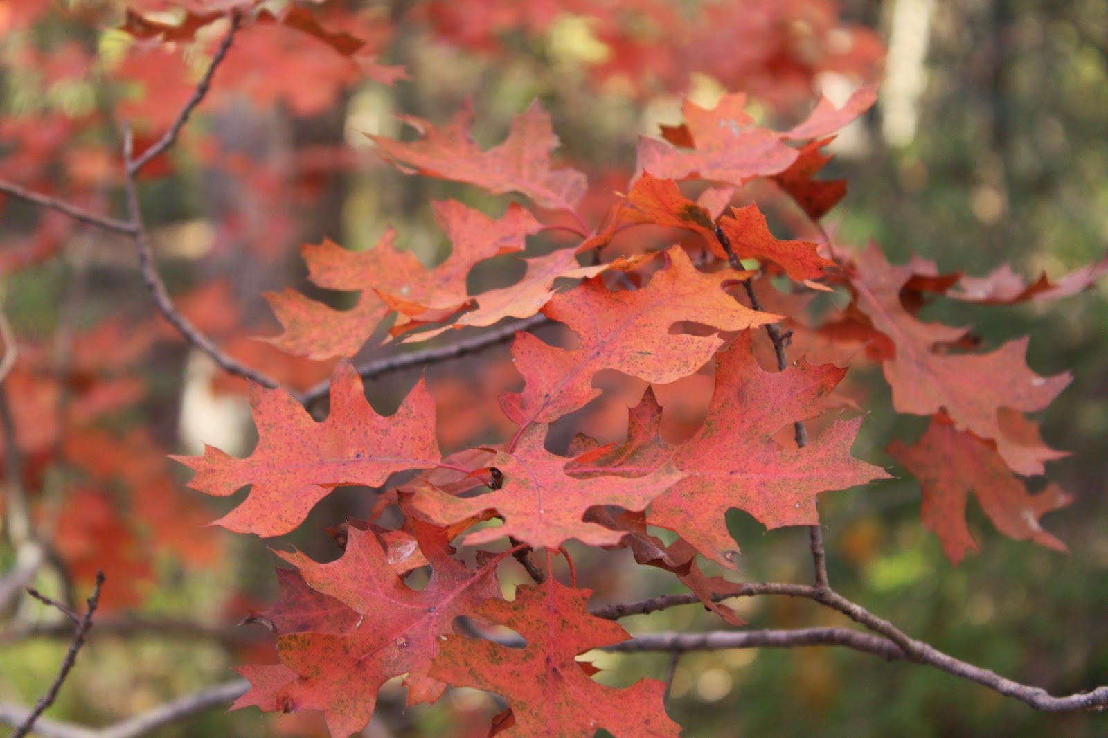
The strong southerly winds of a Texas spring bring more than humidity up from the Gulf of Mexico. Riding the air currents north from as far away as the tropical rainforests of Central and South America are the flycatchers of the bird world.

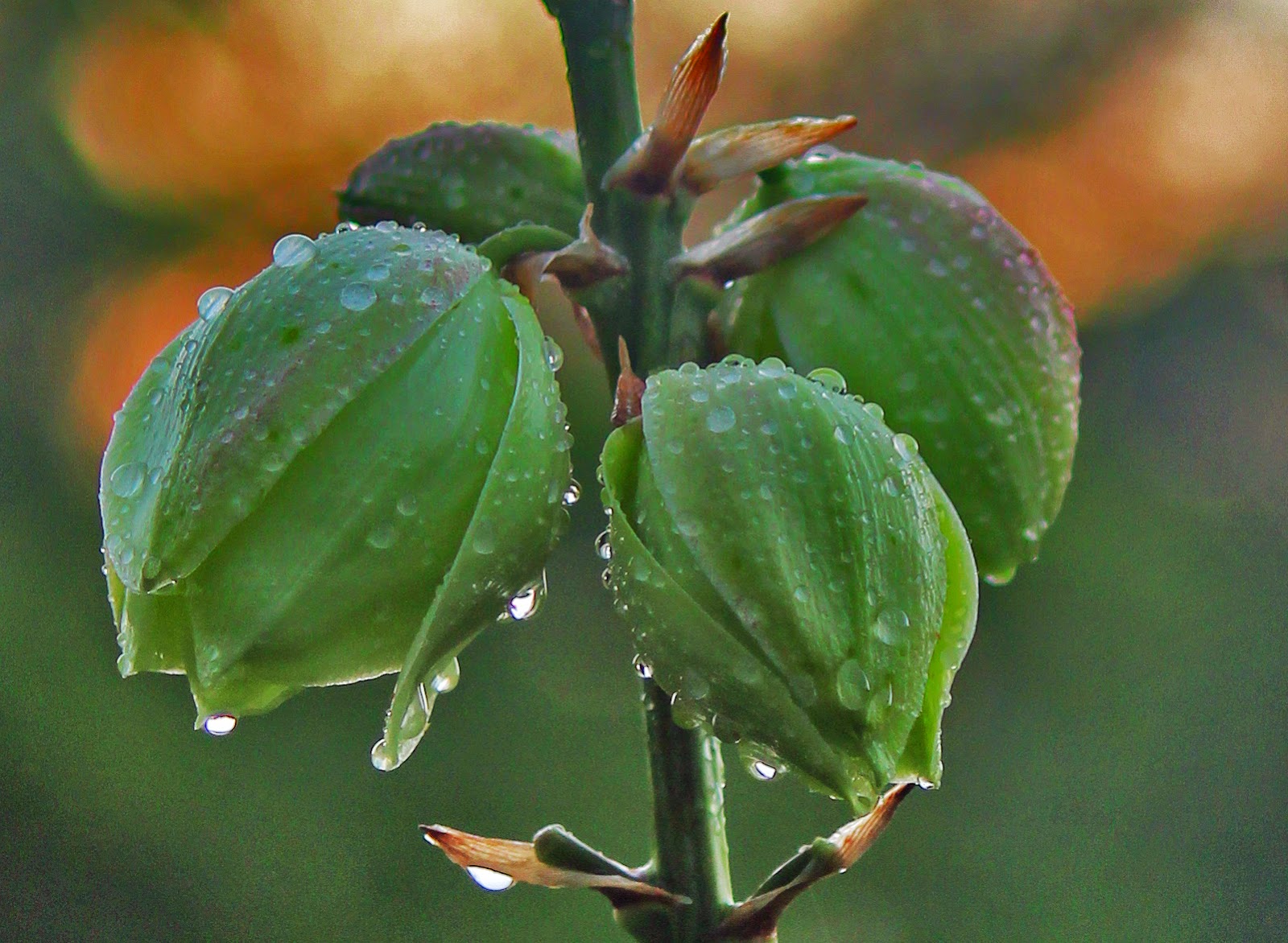
The dripping wet blossoms of an native Arkansas Yucca just after an spring thunderstorm at McCommas Bluff Preserve, Dallas Texas, Spring 2014
Scissor-tailed Flycatcher at the Mockingbird-Westmoreland Bridge in the Trinity River Floodway, Dallas, Texas. Downtown Dallas and Victory Park can be seen in the distance
The flycatchers are fond of the open spaces and fence lines of the Trinity River. In the late Spring, June to be precise, the birds move into Dallas in great numbers setting up shop among high insect populations that dominate the fields here. The three most dominant species seen are the Scissor-Tailed Flycatcher, the Eastern Kingbird and Western Kingbird. The Trinity River Corridor serves as a great overlap for the Kingbird species with near equal amounts of both Eastern and Western species.

Scissor-Tailed Flycatcher Tyrannus forficatus
The Scissor-Tailed Flycatcher Tyrannus forficatus is known by other names as well... Scissortail, Texas Bird-of-Paradise and Swallow-Tailed Flycatcher.


From the appearance, it is obvious how the bird acquired its common names, but its former Latin name - Muscivora forficata, describes the bird in even grander terms. Muscivora derives from the Latin word for "fly" (musca) and "to devour" (vorare), while Forficata comes from forfex, or scissors. The scissortail now is a member of the genus Tyrannus, or "tyrant-like flycatchers."

Strong willed and fearless, the best comparison one can make to such a bird is the familiar Mockingbird who also readily defends territory, nest sites and has a qualification for fighting dirty. 


Scissor-Tailed Flycatcher perched high above an endless meadow of coneflowers near Piedmont Ridge Trail in the Great Trinity Forest
Scissor-Tailed Flycatchers hunt by sight and by ambush. Many see Scissortails lining barbed wire fences, telephone lines or even road signs. Those artificial perches afford great over watch of a field.

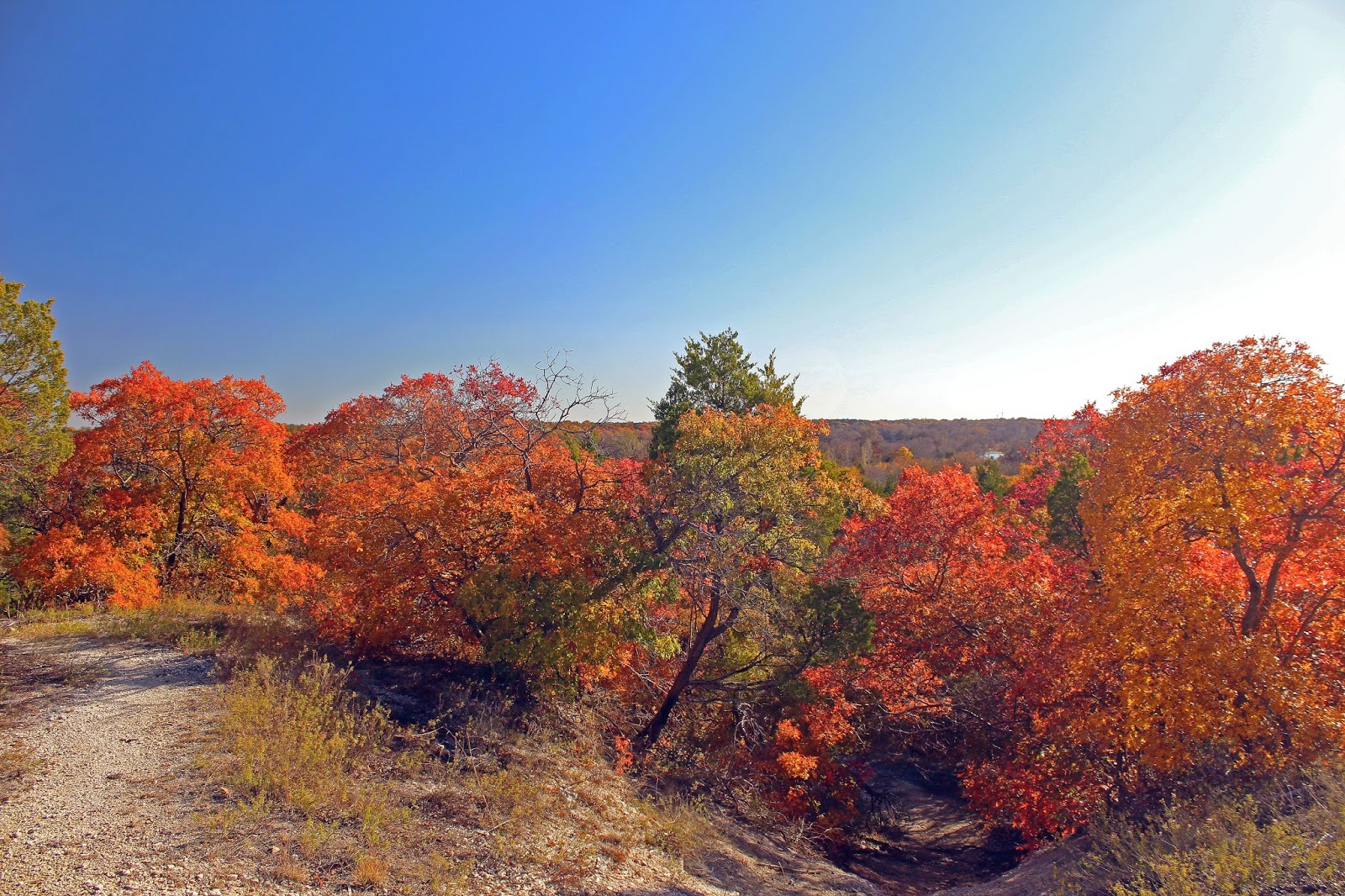
The photos here were taken entirely in wildscape. Meadows, fields and treelines along the Trinity River and in East/Southeast Dallas along lower White Rock Creek in an area called the Great Trinity Forest.
So many know White Rock Creek as it moves through North Dallas but so few ever see it beyond the outfall of the White Rock Lake Spillway where the creek slows, the trees get larger and the scenery much more photogenic.
A good look at a departing Texas Bird of Paradise, the Scissor-Tailed Flycatcher in full breeding plumage


Scissor-Tailed Flycatcher Attack Sequence On a Red-Tailed Hawk

Scissor-Tailed Flycatcher moves in on a trespassing Red Tailed Hawk
In some areas like the Trinity River Floodway, perches and tree cover for nesting sites are scarce. This is an area between the levees near the Industrial District and Downtown where lone Cottonwood and Pecan trees dot the landscape. They are the usual haunts of resident Red Tailed Hawks year round. When flycatchers come in to nest, there will be many nests in one tree as habitat is a premium. That leads to conflict and dramatic attacks result.


Red Tailed Hawks will actually prey on nests of other species. Documented cases of nestlings being eaten by hawks are well known. The Scissortail goes the extra mile to make a point with the Red Tailed Hawk in this photo, delivering what appears to be a quite painful strike to the back of the hawk's neck.
Contact with the hawk, the Scissortail is riding the hawk like a winged horse


The hawk screams in pain and maybe disbelief as the plucky Scissortail unleashes an aerial assault. Note the long Scissortail on the back of the hawk


Splash one hawk. The Scissortail returns to his nest.


This genus earned its name because several species are extremely aggressive on their breeding territories, where they will attack larger birds such as crows, hawks and even owls. Beautiful and ounce for ounce some of the heaviest hitters among Texas birds.


Rarely documented mirroring mating dance behavior of Scissor-tailed Flycatchers

Scissor-tailed flycatchers are easily identified by their long, scissor-like tail, which may reach nine inches in length. During flight, the bird opens and shuts its taillike a pair of scissors and folds or closes the "scissors" when perching. Since the bird is only 12 inches long, its tail is proportionately longer than any other Texas bird including Roadrunners.

The signature call of the Scissortail

Scissor-tailed flycatchers are considered Neotropical migrants birds that spend their winters in Central and South America, returning to North America to nest and raise young.

As a rule, scissortails are seen in Texas from early April to late October, though individuals occasionally are seen during the last week of March and some birds linger until mid-November.

Most likely their residency in Texas is tied to the first killing frosts of the Fall, which diminishes food supplies for the birds.
The scissortail is one of the earliest summer birds to arrive each spring. Across most of the Trinity River Corridor, Dallasites can begin looking for them during the first week in April. Their limited nesting range is primarily concentrated in the southern Great Plains states, from New Mexico to Louisiana and Nebraska southward to southern Texas and adjoining areas of Northern Mexico. However, the birds have wandered and documented as far north as Hudson Bay in Canada.
The brilliant colors of a Scissortail in near perfect light of a Texas sunset

The nape of the scissortail's neck and back are pearl gray, and the breast is white. Wings are smoke coal black with a touch of crimson at the shoulders while the sides and wing linings are pink. Females usually are shorter than males because her tail is not as long.

Breeding pair of Scissortail Flycatchers riding the stiff wind currents on the evening of June 16, 2014


A Scissortail bounds of the perch of a yucca to attack an unsuspecting insect below


Scissor-Tailed Flycatcher nest with four nestlings, June 13, 2014
The nesting habits for the Scissor-tailed Flycatcher include a small diamter stick nest lined with soft fiber material in an isolated tree where three to five eggs are laid. The female builds the nest and the male often adds the fiber material during the building process.
A Walking Stick becomes dinner for a Scissor-tailed Flycatcher nestling
Both parents work all day long to feed the nestlings. Moths, butterflies, June Bugs, grasshoppers and even Walking Sticks are standard table fare at these nests. 2014 seems to be a particularly banner year for these insects. Walking Sticks consume the foliage of oaks and other hardwoods. Severe outbreaks of the walking stick, Diapheromera femorata, have been documented in the Ouachita Mountains of Arkansas and Oklahoma. The insects eat the entire leaf blade. In the event of heavy outbreaks, entire stands of trees can be completely ravaged. Continuous defoliation over several years often results in the death of the tree. Birds like flycatchers help control the population of these insects.
Adult flycatcher removing waste from the nest site


Arkansas Yucca Yucca arkansana-- Photogenic Perch For Flycatchers

Native Yucca  in the brilliant sunset light growing on the bluff tops of the Trinity Forest
As a rule we think of Yucca as desert fare, but it is a common Texas plant often seen in undisturbed areas along the bluff tops of the Trinity River and White Rock Escarpment running through the Great Trinity Forest.

One  of the smallest yucca in Texas, Arkansas Yucca ranges from South Central to North Central Texas, into Oklahoma and Arkansas, preferring chalky pan soil on rocky hillsides and prairies. It has asymmetrical rosettes in small open groups.

Like most yucca, the leaves are bluish-green to yellowish-green with white margins and curly threads on the margin.

As is, the "stem" of the yucca looks woody (it has to be strong to support that mass of blooms.) Dead yucca leave a strong supporting "stick" for lack of a better term.  These particular groupings stand tall above the wildflowers, from 3 to 4 feet standard. 

There are over two dozen US species of these plants, much more widely distributed than agave, ranging across the Midwest, Great Plains and all the eastern states in addition to the south, in mixed environments including deserts, grassland, mountains and coastal scrub.

Yucca also extend through Mexico towards Central America. All species have the capability to grow tall and branch, though in some arid locations this does not happen, and the plants remain compact and single. Flowers are white and bell-shaped, growing in a great mass on a shortish stalk; they are usually produced once a year though may not appear if weather conditions are unfavorable.

Eastern Kingbird Tyrannus tyrannus
Eastern Kingbird Tyrannus tyrannus as seen hunting for insects among a grouping of wild Prairie Coneflower along a limestone escarpment along Lower White Rock Creek, Dallas Texas, 2014
The dressed to kill flycatcher of the Great Trinity Forest accolades go to that of the Eastern Kingbird Tyrannus tyrannus. A bird dressed in a tuxedo with fine lines and a descriptive ability to crush any and all insects that venture near.

The kingbird is easy to identify from other flycatchers with its contrasting black back and white chest, giving it the appearance of wearing formal dinner attire.  The black tail is tipped in white, making it easily recognizable. 

Black and white is not really the norm for flycatchers and songbirds. The Eastern Kingbird is unique in this way. Reds and yellows are more common.  But for what he lacks in color and song, he compensates for nicely in presentation and style.

An Eastern Kingbird weighs down an already blossom laden and top heavy Arkansas Yucca
Eastern kingbirds are flycatchers, which is considered the largest family of birds on Earth, with over 400 species.  The Eastern Kingbird exhibits that classic flycatcher silhouette, complete with the slight crown or ruffled head that is common among other flycatchers such as phoebes, wood pewees and so on.

Caught in mid air, an Eastern Kingbird hovers like a hawk in an effective technique to spook insects out of a hiding spot

Eastern Kingbirds also exhibit typical flycatcher behavior, called sallying, where they fly out from a perch in pursuit of flying insects, and then often returning back to the same perch (also called hawking). 

They feed mainly on insects during breeding season, but oddly enough, during migration and on their wintering grounds in South America, kingbirds change personalities and behave almost docile,  flying around in flocks, feeding on mainly fruit.
While as large as a Mockingbird and with similar colors, the Eastern Kingbird has a more robust and stockier build

Western Kingbird Tyrannus verticalis
One of the most common birds to spot in the Great Trinity Forest in spring are the hearty Western Kingbirds Tyrannus verticalis. From prairie areas of the Lower Chain of Wetlands to the deep swamps of Rochester Parks, these birds are visible at every turn from dawn to dusk.

Before the pioneer settlement of the Southern Plains the Western Kingbird range undoubtedly was restricted by the lack of advantageous perches in otherwise prime open country habitat.  Its range in Texas in the early 1900s was the western part of the state encompassing  the Panhandle, southern plains, and the mountains west and south of the Pecos River Valley.


Since the early 20th century, man’s opening of woodlands for timber harvest/farming, planting of trees on the plains, and construction of power lines, and other structures which accompanied settlement have facilitated expansion of Western Kingbird breeding range.

Nesting had spread by the mid 20th century east to Austin and by the late 1960s to the upper Texas coast.  By the early 1970s they were nesting in the Dallas Fort Worth area.
Western Kingbirds migrate from Central America to breed across the western United States during the spring and summer months--about April through the end of August/early September.

They leave their breeding grounds relatively early and are generally not seen in the western states from about mid-September through early May. They tend to be viewed around farms, meadows, and along fence rows near dry open fields with scattered trees and brush.


Western Kingbirds are members of the flycatcher family and are often seen hunting insects from fences and small bushes and trees along roadsides. They are about 9 inches long with a wingspan of about 16 inches. They have gray heads and chests, thick dark bills, yellow bellies, and dark tails with white edges. They can be aggressive and often harass large raptors

Western Kingbirds on guard


Just like Scissortailed Flycatchers, the Western Kingbird readily defends nest sites, habitat and favored trees from any predator or competing bird species. The telltale flash of yellow as the beat through the high grass is an easy way to spot these birds which very much resemble the Eastern Kingbirds, a distant cousin.