Tuesday, November 13, 2012

Exploring The Trinity River By Canoe --The Trinity River Paddling Trail


Quietly meandering from the heart of a downtown metropolis to the edge of the rural Texas countryside, the Trinity River Paddling Trail offers a unique look at a slice of Dallas few people will ever see. A float through The Great Trinity Forest.

The misinformed myths of the Trinity told by modern yarn weavers serve as more of an impediment to exploration than the physical barriers on the river itself. Seen as a blight by most, few realize that the navigable river mere blocks from their homes affords a simple inexpensive day adventure into some of the most remote and wild places in the state. It does not smell. There is little visible trash. Many of the stretches look like the Brazos, Colorado or Sabine. Snags are few and far between. Bad press and bad rumors have resulted in very little information about this stretch of river being posted online, in print or even by word of mouth.

This was a trip that I have wanted to take for some time. Many of the special places along the river cannot be accessed by land. Locked behind high fences of the industrial plants, behind railroad marshalling yards and impassable swamp. The places I could only view from afar or not at all. Floating the river gets you there. This particular trip follows the course of the Main Stem of the Trinity River from the Santa Fe Trestle Trail to McCommas Bluff. A ten mile route book ended by the Dallas Standing Wave and the Trinity River Navigation Company Lock and Dam #1.

Put in-Santa Fe Trestle Trail at the Trinity River

The real obstacle I had to wait on was the Trinity River Project itself. In order to legally put in canoes on the Trinity River, construction of the Santa Fe Trestle Trail had to be completed and open to the public. That happened in late October 2012. Launching canoes below the Standing Wave was the only real option with the Sylvan Avenue Boat Ramp closed until January of 2014.

Take out- McCommas Bluff Preserve

The idea was to transect the entirety of the Great Trinity Forest by canoe. Explore the mouths of larger creeks, bridges, rapids and obstructions that can only be seen by boat. The Dallas Trinity Paddling Trail is one of 38 Texas Paddling Trails that dot Texas. Half a dozen of which are in the Trinity River basin.

From the outset, the hardest part of the trip appeared to be getting the boats to the river itself. With a locked gate near the DART train station on 8th Street, the portage of carrying canoes down to the water would surely tax even the strongest of arms. Be prepared for the extra time and effort it takes to accomplish this. In addition, a number of news articles have been written about issues concerning the Standing Wave/Dallas Wave . One can easily avoid the soap opera surrounding all that by putting in just downstream.

Joppa Preserve on the Trinity River, November 2012
This trip would not have been possible without Charles Allen, owner of Trinity River Expeditions canoedallas.com based in Oak Cliff. He has thirty years experience guiding trips, the majority of those on the Trinity. While he did not accompany us on our trip, his knowledge of the Trinity is second to none. The shoals and obstructions he knows by memory, he can draw a precise map by hand and is easily the best Waterman in Dallas. If you are looking for a guide on the river here in DFW, he is your guy. Cost for a day on the river is very inexpensive, what many would pay for a trip to a movie or a happy hour bar tab. Charles is one of those special people that make Dallas worth living in. I wish the city would embrace him as an asset to the Trinity. They need him.

I'll also add, one last time, just to make it perfectly clear that we followed the letter of the law putting-in at the Santa Fe Trestle Trail. The park is now open to the public and construction is complete.

Once afloat it's easy to break this particular route up into three distinct sections of river.

-The early 20th Century industrial area in the shadow of Downtown Dallas
-The old trees, old ferry crossings and old Indian campsites near Miller's Bend
-The true wilderness of the Great Trinity Forest south of Loop 12

Each section of river has it's own feel. One section takes over where the other left off.

Trinity River Main Stem Dallas Wave to McCommas Bluff
10 mile route with mileage markers highlighted from Santa Fe Trestle Trail to McCommas Bluff


River Beta:
River height at Commerce Street Bridge: 15.2 feet
Flow: .355 kcfs
Length: 10 miles, 4.5 hours on river
Current Conditions :River gauge at Commerce Street Bridge
14-15 feet is a low flow height for the river. The sites we saw and some of the obstructions would not be visible if the water were a foot or two higher. Flow pushed the canoe along at a slow pedestrian 1-1.5mph through most sections.


Standing Wave to I-45 -- A look at the Industrialization of the Trinity River
1911 George Kessler Plan, Union Station seen at middle right
The founding fathers of Dallas always envisioned a grand inland port on the Trinity. Newcomers to Dallas might not know that the current Trinity River Project is not the first or second try at improving the river. It's version 3.0 or 4.0. If you are unfamiliar with the river's more recent past a great documentary exists on the subject.

The ten or so river miles floated from Downtown to the edge of the city limits allows one to see the three or four different attempts to tame the river. The first section is the most developed from the old Santa Fe Bridge to I-45. Running behind some of the old heavy industrial areas of Dallas.


Standing Wave/Dallas Wave 
32°45'9.26"N, 96°47'26.43"W
Standing Wave prior to submersion in December 2010
Constructed in 2010, the Trinity River Standing Wave serves as a Whitewater Park near Downtown Dallas. Part of the ambitious 1998 Trinity River Project the twin standing wave submerged dams create a hydraulic wave that can be ridden by specially designed whitewater kayaks. Canoe bypasses were built as part of the design on "river left", seen in the picture on the right side. The steel bridge in place here was built in 1904 and later elevated an additional few feet in the 1930s so that it would sit higher than the Trinity River levees just upstream. Thus making it flood proof.

Mouth of Cedar Creek
32°45'5.08"N,  96°47'17.34"W
Mouth of Cedar Creek, Moore Park
"To the memory of Colonel William G. Cooke and forty other members of the Regular Army, Republic of Texas, who camped in this vicinity in October, 1840 while locating the Central National Highway. The importance of this military road in the history of Dallas will not be forgotten. " Texas State Historical Marker 1936

Just downstream from the Standing Wave is the mouth of Cedar Creek. Most know it as the creek that flows through the Dallas Zoo. Where this creek meets the Trinity River a small fort once stood, built by the Army of The Republic of Texas during the expedition to scout a Military Road from Austin to the Red River. I-35 now follows that route.

Two maps, below, are courtesy of Mike Toyer a noted Dallas historian who accompanied us on the canoe trip. Cedar Creek is labeled "Houghton's Creek" in the maps, named for Captain M. B. Houghton. Both are very rare old maps that give a glimpse into the wilderness that was once Central Dallas. Both maps can be clicked on to enlarge.

Upshur's 1841 Map showing the Rio Trinidad, Cedar Springs and stockade on Cedar Creek, from Joseph Milton Nance's After San Jacinto: The Texas Mexican War 1836-1841

Colonel Cooke's Military Road and Campaign Map 1841
It's interesting to note that these 170 year old maps are still accurate in regards to navigating the Trinity River downstream of Cedar Creek. The creeks and unnamed sluices drawn on these old maps still reach the river today. An ice age bison, bison antiquus, that walked these banks 10-20,000 years ago was discovered here fairly recently testifying to the presence of the untouched stream channel in this area.


Old Forest Avenue Bridge
32°45'3.97"N,  96°47'10.74"W
Old Forest Avenue Swing Bridge
Downstream of Cedar Creek and just upstream of the new Cedar Crest Bridge sit the foundations of the old Forest Avenue Bridge. Designed as a "swing bridge", the circa 1917 structure was built to allow tall barge traffic to pass in the event the Trinity became navigable to large ships. This bridge was replaced with the newer Cedar Crest Bridge. In low water a shoal is just upstream of this feature. Keep river right to avoid.

River bend just past the Cedar Crest Bridge


MKT Trestle
32°45'0.06"N ,  96°46'38.94"W
MKT Railroad Trestle over the Trinity River, South Dallas
The old Katy bridge dates supposedly to 1905 and is one of the oldest railroad bridges still in operation over the Trinity River, if not the oldest. Few ever see this bridge. Tucked away behind a few bends in the river it stands a silent citadel to the river beyond. From this point on, save for a few freeway overpasses, the city that surrounds the river is silent. The river and the 4000 acres of trees that surround it soak up noise like a sponge.

Limestone Seeps
32°44'59.04"N,  96°46'36.47"W

Limestone seeps near the MKT Trestle - P&G Plant
Austin Chalk forms the backbone of the north(east for some) bank of the Trinity River from the MKT Katy bridge to the I-45 bridge. The geology here is simple. The Late Cretaceous age Austin Chalk and Taylor Marl were once part of a vast inland sea. This rock, known as the White Rock Escarpment, dips to the southwest at 15-40 feet per mile.

Ice Age gravel over Cretaceous Austin Chalk, Reverse Fault
Over the passage of time, the Trinity has cut into this old rock leaving behind the Trinity Terrace, the Ice Age reddish gravel seen in the photo above. Millions of years separate the ages of the two rock formations. No one knows what happened inbetween. The ice age gravels, are full of fossilized mammals from this era. Mammoths, camels, sloths that once walked here. The weather was a little cooler and wetter than it is today but not by much. Live Oaks, Osage(crabapple) and familiar grasslands were nearly the same as they look today.
Dripstone outcropping on the Trinity River
The porous nature of the loose gravel and the block sedimentary nature of the limestone create dripstone along this section of river. Much like the stalactite, water flowing across the rock has left behind minerals creating this unique rock formation.


Proctor & Gamble Pumphouse
32°44'55.95"N, 96°46'33.35"W
P&G Pumpstation circa 1919-1920
The Proctor and Gamble Pumphouse sits some 500 yards south of the Proctor and Gamble Plant on Lamar in South Dallas. Built in 1919, the plant was constructed at the vital crossroads of two major railway lines and in close proximity to the Trinity River. The two story structure here served the purpose of providing cooling water to coal fired boilers behind the plant and also non-potable water use not involved in the production process. By the time this pump was operational, new standards for sanitary disposal of wastewater were law. Pumphouses such as this can only lift water in feet height equal to the atmospheric pressure in water, 34 inches, which translates to 34 feet. Roughly the same height as this structure. This plant was modeled after a sister factory in Cincinnati on the Ohio River.


I-45 Bridge
32°44'16.29"N,  96°45'58.73"W
Negotiating the constricted narrowing channel at the I-45 Bridge (Bill Holston, Scott Hudson pictured)

The I-45 Bridge, built in 1971, was another bridge constructed with the belief that one day high profile barge traffic from the Gulf of Mexico might one day turn Dallas into an inland port. The constricting ballast on either side of the river speeds up the waterflow before entering Miller's Bend.

Sewage Treatment Plant Outflow
32°43'46.15"N, 96°45'48.27"W

Fisherman at the Central Wastewater Treatment Plant discharge site
Whatever floats your boat. The fisherman above said the discharge pipe area was a great fishing spot and his favorite on the river.


Miller's Ferry to Loop 12 -- Ancient Fossils, Ancient Indian Villages, Ancient Trees

Simple geography keeps this next section of the Trinity from ever being developed or molested by the hands of modern man. 

Prominently standing in the Yale Peabody Museum at the turn of the last century was a specimen of Elephas imperator recovered from an area near Loop 12 and the Trinity River. Seen in the photo(right), displayed at Yale with other fossils from the Pleistiocene era. Many of the other animals featured in the photo are part of the  O.C. Marsh collection. The great reserves of Ice Age fossils locked away here in the Trinity River are unknown to contemporary Dallasites. Over a dozen of these large animals were excavated from a small area here. I'm certain many more are still there, victims of an old quicksand flat.

Much of this area sits ignored. Which over the course of time has preserved much of it. Some bends of the river that still carry the names of the old pioneers are concentrated in history. Like Miller's Ferry and the 3000 years of history there. Much of that history never made it into a book, matter of fact it still sits on the bank today. Someday I hope that South Dallas realizes they have a place where the rich history of emancipation and freedom can be shown hands-on. It's one of the more powerful places on the river to experience.

Native Americans

Old cowboy westerns have seeded the idea that the Comancheria, the name given to the nation of Comanche once fearsomely lorded over what is now Dallas County. That might be true. But just for a brief moment of time. The Cotton Bowl might have been standing longer than the Comanche cavalry ran roughshod here. The real story is not the Cherokee either. It's the Caddo.

The Hasani are a populous nation of people, and so extensive that those who give detailed reports of them do not know where it ends. They live under an organized government, congregated in their pueblos and governed by a cacique who is named by the Great Lord, as they call the one who rules them all -- Bishop Of Guadalajara, 1676

The lost village of the ancients

Thousands of years ago some ancient race of people lived in the woods you see in the photo above. Their history is unwritten. Here in these woods, in this very spot a great ancient civilization flourished for centuries. Charcoal analysis from their cooking fires tell us the woods looked the same today as they did when this site was called home for those ancient forefathers of Dallas.

A civilization that were master hunters. Master craftsmen. Masters artisans. Master traders. They are a group of people to whom no current humans alive will claim as descended from. Wichita? Caddo? Proto-Caddo? Maybe some unknown race of Anasazi that vanished without a trace?

Often, great leaps of theory and conjecture accompany wild stories of the lives and old hunting tales of the Native Americans who called Texas home. Those stories are not needed here. Over two millennia of well preserved occupation exist here. The only Native American site on the river and maybe in Dallas, that has been suggested for inclusion on the National Register of Historic Places. In the spring of 2012 I found a stolen truck here and called the police to report it. A detective went to investigate. Speaking with him over the phone after seeing the site, he said two words " Holy S%#@".  Indeed. This is another one of the "hopefully someday _______" will preserve this place. It deserves recognition and preservation.


Miller's Ferry
32°43'39.49"N,  96°45'40.75"W
Miller's Ferry Site
Owned by pioneer William Miller, later owned by his freed slave Henry Critz Hines, founder of Joppa. Above Mike Toyer is looking at what is most likely the original landing spot for the hand pulled ferry that was fashioned from cottonwood logs. Unchanged in appearance since the turn of the last century. Site of the first railroad crossing in Dallas, first highway crossing. First. First. First. Too many to mention. Native American site. Confederate muster encampment site.


Old Central Expressway/Highway 310
 32°43'42.32"N,  96°45'29.19"W
Highway 310 Old Central Expressway Bridge


Buckeye Trail Overlook
32°43'40.55"N, 96°45'8.64"W
Paved Buckeye Overlook
The photo above was taken looking downstream towards the paved circular overlook for the Rochester Park/William Blair Buckeye Trail Overlook. The trail was paved a few years ago from the levee on Bexar Street to the Trinity River. Billed as an ADA compliant trail, it in theory affords access to those with special needs. No real river access to the bluff where the pavement starts. Visible in this stretch is an old rusted pipe folded over itself several times at 32°43'41.04"N, 96°45'11.16"W and can be seen "river right" as one approaches the overlook.

 Buckeye Grove Overlook
 32°43'31.46"N, 96°44'51.53"W
Buckeye Grove in Rochester Park
Further down the river sits the Texas Buckeye Grove. Easy to spot from a distance after seeing the large trees canopied over the invasive Chinese Privet. In the left side of the photo, one can see a small white bench marking an overlook for this natural surface trail.

Mouth of White Rock Creek
32°43'25.85"N,  96°44'2.16"W
Up a creek with a paddle, canoeing up the mouth of White Rock Creek
Mouth of White Rock Creek
Other than the Trinity, White Rock Creek is the best known waterway in Dallas. Criss crossing a dozen golf courses, countless neighborhoods and a lake that shares the name, you would think the mighty creek would have a large expansive mouth and grand entrance into the river. Nope. If you blink, you might miss it. A small shoal nearly blocks the entrance and numerous old cottonwood logs prevent access up the creek more than 100 yards. A great canoe camp sits on the east side of the mouth, among a grove of Cedar Elms and Ash trees. In the city, this is as far away from other people as one can get.

From the mouth of White Rock Creek, the river makes a quick turn to the south and a long straightaway stretch to Loop 12. Large cottonwoods line the bank here which serve as cormorant roosts in the fall and winter months. On a day with a strong south headwind, I imagine this would be a difficult stretch for some.


Joppa Preserve to McCommas Bluff -- Old Growth Forest and the River Wild
The Dallas 9's Otis Dozier's Gathering Pecans, 1941 WPA commissioned mural
Scenes painted in the waning days of the great depression still play out seventy years later along the Trinity River. We were greeted by a grandfather and his grandsons picking pecans south of Loop 12 with 5 gallon buckets half full of pecans. Excited to tell us about the four deer they had just seen in large pecan grove. It's that wild down here.

The tracks of the river otter, beaver and swimming pigs in their daily commute are evidenced by marks left here on the shore. The majority of photos featuring coyotes, weird tropical birds and deer come from this area. A place very few ever walk and fewer take to paddle.

Loop 12 Boat Ramp
32°42'25.65"N,  96°44'9.28"W
Like the other bridges on the Trinity in Dallas, the Loop 12 Bridge constricts the flow of the river. Charles Allen suggested running it straight down the middle of the channel, one boat at a time.
Loop 12 bridge, Loop 12 Boat Ramp on river right
Beyond this point the river slows some, the water feels deeper and the river is wider. I believe this is from the old remains of lock and dam number 1 at McCommas Bluff. While compromised, the obstruction backs up the river some distance above.

Lemmon Lake Dam Beach
 32°41'49.95"N,  96°43'26.36"W
Lemmon Lake Dam and Wood Stork Roosts
A focal point for so many migratory birds in the summer, the large cottonwoods seen above serve as the roost location for hundreds of Wood Storks. These old trees sit atop the river bank and a slightly improved levee/dam and floodway that dates back to when Lemmon Lake was a private hunting and fishing club.

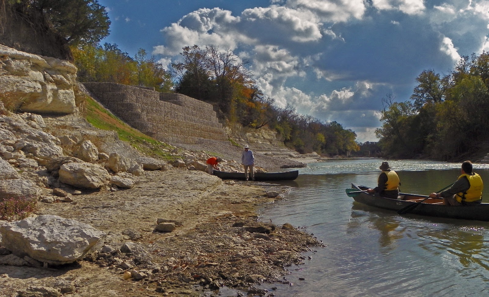
Dallas Water Utilities Retaining Wall
32°41'46.97"N, 96°42'43.89"W
The Great Wall---Thousands of feet of retaining wall
A year behind schedule and much larger than originally planned, the monolith of a 2012 Dallas Water Utilities construction project commands the south bank of the Trinity River. The wall was built to protect a 72 inch water main that runs near the river. The glacial pace of construction at this site left the Trinity Trail between Simpson Stuart Road and the Audubon Center incomplete for a year and a half.
Demolished pecan grove 2009
Many large pecan trees were bulldozed to build the wall. Seen in the photo at left taken in 2009 before construction, a dozen large and mature trees were destroyed along the bank. The pecan grove down here has been known for generations by local residents. The pecans grow large and prolific. Feeding not only humans but the ever growing numbers of feral pigs who camp out under the trees in the fall for feeding frenzys.


Great Trinity Forest Trail Bike/Pedestrian Bridge
32°41'58.80"N, 96°42'7.35"W
Trinity River Trail Bridge
Built in 2011, the Trinity River Trail bridge spans the river southeast of the Trinity River Audubon Center to link up with the Trinity River Trail from Joppa Preserve. There is no suitable landing site of note to visit the Audubon Center or take out boats. The section of river from Loop 12 to McCommas Bluff has very limited spots suitable for on shore excursions.

Mouth of Elam Creek / Woodland Springs
 32°41'58.33"N,  96°41'57.06"W

Floating through the heart of McCommas Bluff Preserve on Elam Creek
Elam Creek is one of three larger creeks that drain Pleasant Grove. Just downstream of the Audubon Center, the creek mouth is much wider than White Rock Creek and easier to canoe up. Had the water in the river been higher, we could have paddled up to Schepps Parkway without difficulty. This creek is also fed by Woodland Springs, situated on the site of an old boy's camp run by the Salesmanship Club of Dallas. The camp has long since been bulldozed but the former spring area near Loop 12 still remains. This creek forms the western boundary of McCommas Bluff Preserve and gives the more determined paddler a chance to canoe into the woods.


The fish in this creek are large and numerous. Rough fish, some quite large like the Buffalofish were 2-2.5 feet in length through this creek area.


The trees here are true old growth forest. Rare in North Texas. They grow tall and strong, old trees that have stood the test of time.

McCommas Bluff Preserve Bluff takeout area
32°41'48.26"N, 96°41'27.60"W
McCommas Bluff Preserve Take-out
McCommas Bluff is one of only large rock outcroppings on the Trinity River. Anchoring an abrupt bend of the river, the bluffs serve as an out-of-place dramatic Hill Country postcard scene.  The same 72 water line project responsible for the Great Wall upstream, also knocked a large hole in the historic bluffs here in 2012. The permanent scar is pronounced and interrupts the long river vistas that made McCommas Bluff so special.


 The Texas Historical Marker for the bluffs reads

 Navigation of the Upper Trinity River
Since the founding of Dallas, many of the city's leaders have dreamed of navigation on the upper Trinity River, but none of their attempts achieved lasting success. Fluctuating water levels and massive snags in the river below Dallas hindered early navigation. In 1866 the Trinity River Slack Water Navigation Co. proposed dams and locks for the waterway. Capt. James H. McGarvey and Confederate hero Dick Dowling piloted "Job Boat No. 1" from Galveston to Dallas, but the trip took over a year. In 1868 the Dallas-built "Sallie Haynes" began to carry cargo southward. Rising railroad freight charges spurred new interest in river shipping in the 1890s. The Trinity River Navigation Co., formed in 1892, operated "Snag Puller Dallas" and the "H. A. Harvey, Jr.," which carried 150 passengers. The "Harvey" made daily runs to McCommas Bluff, 13 miles downstream from Dallas, where a dam, dance pavilion, and picnic grounds created a popular recreation spot. In 1900 - 1915 the U. S. Government spent $2 million on river improvements, including a series of dams and locks, before World War I halted work. A critical 1921 Corps of Engineers report ended further federal investment. Despite sporadic interest in later years, the dream of Dallas an an inland port remains unrealized.

McCommas Bluff


The fossil rich limestone here features shells the size of hubcaps that provide a look into the life of the old inland sea that once inundated much of the Central United States. The photo above, in the far background is the best location to disembark canoes. A fishermen's trail exists there which winds through the trees to the top of the bluff. From this point, the river reaches a point of no return where paddlers must commit to an hour long portage of the lock and dam. In addition, the next takeout location would be Dowdy Ferry some miles downstream. It was here we took our boats out of the river and began a loose scramble hike downstream to the historic lock features. Ropes and elbow grease are required to haul boats up the cliffs.

McCommas Bluff has two old navigation projects worth visiting. The crib work for an 1893 dam and Lock and Dam #1 further downstream.
1893 dam crib work
The remains of the 1893 dam are accessible only when the river is below 16 feet. Sitting on river left, the rock and cedar log structure is anchored into the riverbed with iron rods. The rectangular box like structure served as a partition between a spillway and river gates on the river.

1890s design for the dam

Same dam in the 1890s
The dam here stayed in place for some time. The lock was abandoned after navigation of the Trinity was deemed too difficult. The dam increased the depth of the Trinity some distance, all the way to the Commerce Street Bridge in Downtown Dallas. The added depth allowed day long sight seeing excursions on the Steamboat Harvey from Downtown to a picnic ground at McCommas Bluff.

McCommas Bluff Lock and Dam #1
32°41'35.58"N,  96°41'29.44"W
The 100 year old Lock and Dam #1 at McCommas Bluff
The federal government and private investors spent millions of dollars in the early part of the last century to turn the Trinity into a navigable waterway. The proof of that standing today is Lock and Dam #1. Log jammed, silted in and undermined the old lock shows the power that the river can exert on man's ideas to change it. The river wins every time. Featured in the photo are David Mimlitch and Chris Jackson. David's aerial photography of Trinity River engineering projects fill the pages of the city's municipal website and sometimes even the front page of the morning paper. Chris was particularly interested in the locks at McCommas Bluff after his recent visit to Lock and Dam #4 at Riverbend Preserve in Dallas County. If you were interested in crawling around on one of these structures #4 is your best bet.

A century old two story lock keeper's house sits on the bluff above Lock and Dam #1 and is a currently occupied private residence. Please respect their privacy.

This was an exceptional trip with exceptional people. A high value experience with deep rewards in seeing a side of Dallas few will ever lay eyes upon. It should be high on every Dallasite's checklist of life.

Handy links:
Trinity River Expeditions: http://canoedallas.com/
Dallas Downriver Club http://www.down-river.com/
Commerce Street River Gauge http://water.weather.gov/ahps2/hydrograph.php?wfo=fwd&gage=dalt2
DORBA Trail Conditions http://www.dorba.org/trails.php

Friday, November 2, 2012

Trinity River Trail Between The Levees Becomes A Reality

Newly Paved Trinity River Bike Path, November 1st, 2012
A planned multi-use path between the Trinity River Levees near Downtown Dallas took a step closer towards reality in the first week of November 2012. This first segment runs from I-35 to the Santa Fe Trestle Trail on the south side of the Trinity River in Oak Cliff. The brainchild of city council members Angela Hunt and Scott Griggs, this new paved path will connect four different city parks in Oak Cliff and provide off-street infrastructure down the Trinity River Corridor.

This trail is advertised to run from Sylvan Avenue to the Santa Fe Trestle Trail and run a little over 4 miles in length. Connecting various city parks, an overlook and future bridge crossings, the trail will be useable by many different neighborhoods on both sides of the river.

The trail was first announced in mid-August and construction was to be funded by 2012 bonds. Maybe that funding source changed and construction was able to proceed much sooner than thought. With a slated completion date of 2014, this first leg of a Trinity River trail is a welcome surprise.
Trinity River Trail meandering along south bank of Trinity River Dallas, Texas
Like many, I thought the all encompassing 1998 bond election for the Trinity River Project included recreational amenities like bike paths inside the Trinity River Floodway. Apparently this was not the case. For the last decade millions of eyeballs have glanced over guardrails of the freeway bridges hoping to spot something that resembles a park, a bike path or even a solar powered taxi. While many projects like the Audubon Center have been a great success, few others especially around Central Dallas have seen the light of day.

The frustration was shared by many and became the butt of many jokes. Thoughts turned sour when the Trinity River "parkway", which we all though was a way-to-the-park, was really East Coast Yankee lingo for a tollroad. Fooled us hayseeds!

Construction workers sawing expansion joints in the new Trinity Trail
The Post-Katrina Corps of Engineers

Hurricane Katrina exposed the soft under belly of the nation's aging levee system. The old levees that were over topped, undermined and failed in New Orleans were in many cases built to the same standards as the Dallas Levees. Dating back to the 1930s and built over a loose conglomerate of water permeable sand, the levees no longer met some of the flood protection guidelines set forth in a post-Katrina standard set by the Corps of Engineers. You could hear the money from the 1998 Bonds and the Trinity River Project just being sucked down the drain, tens of millions of dollars at a time with new requirements for flood protection. The money for fun stuff, the trails, parks and playgrounds evaporated.

Trinity River Trail looking west towards I-35

In addition to new flood protection standards, the Corps placed new requirements on construction in and around levee floodways. In Dallas, the floodway is designed to move water as efficiently as possible away from Central Dallas. Any new construction could not impede that. In order for the Corps of Engineers to approve a bike trail, it had to meet road standards, in this case 16 feet wide and thick enough for maintenance vehicles. The maintenance road aka multi use bike/hike trail is what we see under construction now.

I-35 and Margaret Hunt Hill Bridge as seen from the new bike trail
I know many would have liked to have seen a natural surface trail here constructed with decomposed granite or mulch. The reality is, that could never happen. The concrete here will serve as a spine or backbone to other dirt trails in the future. I could easily see a series of casual dirt trails that lead from the concrete down to the river. White Rock Lake has a whole host of these smaller no-named trails that lead off into interesting scenic spots and features. Maybe each neighborhood on the opposing side of the levee could develop their own little 300 yard natural surface trail looping off this new concrete.
Late season Mexican Hat Wildflowers as viewed from new Trinity River Trail
I would imagine for instance that with minimal effort a natural prairie could be installed here between I-35 and the Cedar Crest Bridge that would cost very little to maintain and provide a stunning backdrop for photographers, family photos or dog walkers. I was surprised to see so many wildflowers here this late in the season. Outside the heat island of Downtown, many areas of the Great Trinity Forest have already seen a first frost. As close as this area is to major vehicle arteries, it's really pretty quiet down here.
Corinth Street Viaduct and new Trinity Trail

There are thirty miles of dirt roads on and off the levees that are open to the public for non-motorized vehicles and foot traffic. Most are in great shape and easy to ride on a mountain bike or beach cruiser. There are few spots to access these trails and I would suggest just riding from Deep Ellum, Downtown or the Katy Trail.  The Santa Fe Trestle Trail can be easily accessed from Riverfront Blvd on the north side or an annex lot for the Corinth Street DART Station at 8th Street and Parkway Avenue

Tuesday, October 30, 2012

Trinity River Wetlands -- Waterfowl and The Cormorant Roost


The lengthening shadows of autumn and the cold crisp of the morning dawns are slowly ushering in the birds of the Canadian wilderness into the Trinity River Wetland Cells. The muted squawk calls of tropical storks and spoonbills are replaced by the cacophony alarm calls of ducks and cormorants.

Mallard Ducks Overflying Trinity River Wetlands Dawn October 27, 2012

These are the early arrivals. The Mallards, Wood Ducks, Teals, Coots and Cormorants who arrive in late September and leave around Easter. In larger numbers around Thanksgiving the Northern Shovelers, Ruddys and Canvasbacks will appear in great numbers if form follows the past several winters. Late October is a great time to get your bearings down here and the vegetation along the edges of the cells still provides great cover till the first frost.

Access to the Wetland Cells is easy. One can park at the Loop 12 Boat Ramp lot on Great Trinity Forest Way. Then walk up the embankment of the divided road, entering the Wetland Cells via the old Sleepy Hollow Country Club parking lot. Currently the gate is broken at the Sleepy Hollow entrance, the weld failed on the padlocking portion of the gate. In theory one could park on that old Sleepy Hollow parking lot but I'd discourage it if you follow the letter of the law.

The other parking option is in the Freedman's Town of Joppa, where Fellows Lane dead-ends at a bar gate 4900 Fellows Lane. Like the bar gate near Loop 12(Great Trinity Forest Way) this entrance has also been undermined to some degree. Though the gate is locked, one can navigate through the vacant lot to the west and then into the Wetland Cell 4x4 roads. This footprint of vacant lots will eventually become a gateway park for Joppa into the Wetland Cells. More about the interesting twists, turns and hurdles this park might face can be read about on the Dallas Observer website in an article To Build Joppa Gateway Park...

This is also one of the few areas currently accessible for horses. Using the workaround on Fellows Lane you can get into the wetland cells via horse without an issue. The old access roads are horse friendly and routinely ridden by locals that live in the area.


---
If one wanted to see this with a group, next weekend, Saturday November 3rd the Corps of Engineers will host an informative hike at the Fellows Lane entrance. Their information for that event is below: Gather/park at the end of Fellows Lane in the historic Joppa neighborhood. Tour leaves about 8 a.m. through the gate to the nearby wetlands. Dr. Gary Dick, a research ecologist for the Corps of Engineers in Lewisville, will lead the tour of the Trinity wetlands. They were designed by the Corps for the city of Dallas to lower flood risk and create a quality grassland and aquatic habitat that provides food for both migratory and resident birds. Jane Ramberg, of Trinity Bird Count, will lead efforts to record what species can be spotted in this zone of the river basin in Dallas County to continue building an important historic record. Bring good hiking shoes and suitable outdoor apparel – and your binoculars. Contact: Jim Frisinger, U.S. Army Corps of Engineers, 817-901-9644 james.c.frisinger@usace.army.mil
---
The ducks are not the half-wild birds of White Rock Lake looking for a sack full of Mrs Bairds. They are as wild as they come. The only way to get close and get a good look at them is to get to the Wetland Cells thirty minutes before the first crack of dawn -or- be in the Wetland Cells and stay put an hour before sunset. During these times the birds move around quite a bit and offer the best views as they awaken to start the day or preen themselves for the evening.

Ducks in Wetland Cell G, Trinity River Wetlands
Timing and patience is everything. Without treelines and brush to hide your approach, the sightlines of the wildlife can be 400 yards are more. Even at the limits of their sight, they will readily take flight at anything resembling a human form. The ducks above flew into the wetland cells from the east around 45 minutes prior to sunrise. Coming in staggered groups of six to eight they formed an impressive collection by the time the sun rose over the riverbottom.

 The Cormorant Roost
Ducks in flight over the Trinity River Wetlands Cormorant Roost Site
Cormorants on the river
This fall, Double Breasted Cormorants have taken roost in the large grove of cottonwood trees that line the banks of the Trinity River just downstream of the confluence of the river and White Rock Creek. The trees are 2000 feet due east of the Fellows Lane gate and 1000 feet due east of the large manmade "pyramid" mound that sits just north of Wetland Cell G.

I would estimate the current cormorant population here of 300-500 birds. They arose later in the morning than the ducks, right around sunrise. Taking off in flights of three dozen or more at a time to feed for the day. Less timid than their waterfowl counterparts the cormorants seem to be much more tolerant of a human observing from a distance.

Double Crested Cormorants at dawn forming up to leave for the day


The cormorants here seem to just roost in the trees and do most of their fishing on the actual river instead of the Wetland Cells. Last winter I saw a great number of cormorants fishing a large shoal where White Rock Creek feeds into the Trinity. The quarry species looked to be shad that day and I expect the cormorants feed mostly on that species in this part of the river.

The flock returns to the roost around an hour before sunset in groups of no more than four or five. The view on a clear evening of this ingress of cormorants is best viewed from atop the "pyramid" feature. From here one can spot the birds over half a mile away with Downtown Dallas as a backdrop.
Cormorants on evening roost at the Trinity River Wetland Cells
Cormorants consume a couple pounds of fish per day. Some parts of the country consider them a growing nuisance in the summer months when their roosting threatens to defoliate the trees they call home. Since these birds roost in Texas during the winter months the threat to trees in negligible. A large population such as this also puts a dent in the fish population to some extent. So little is known about fish populations in the main stem of the Trinity and since consumption of fish by humans is ill advised, the birds seem to have picked a great spot to be left alone.

Cormorant numbers have rebounded in the last 40 years. At one time the widespread use of DDT decimated their numbers due to weakened shells caused by the chemical. The rapid rebound of the species seems to be near exponential in the past ten years. Another large roosting group of cormorants overwinter on the northwest corner of White Rock Lake near the intersection of West Lawther and Mockingbird. Having seen both roost sites, the White Rock Lake site is very quiet compared to the loud and noisy Wetland Cell location.


Waxing Gibbous Moon and Egret at Wetland Cell F
Many of the other resident species found down here year round seem to keep their distance from the cormorants. The egrets that are usually found in Cell G have moved into Cell F further up the chain.

Cell F cascades into Cell G via a short dam, sluice and aqueduct that can be seen from the Fellows Lane entrance. Upstream one can walk/hike/bike as far as the I-45 bridge. The wetland cell here is known as Cell E and has a resident beaver population.


Wood Ducks
The Corps of Engineers has also built Wood Duck boxes along the Wetland Cells in various locations. Last year there was a breeding pair at Lemmon Lake and in Wetland Cell F. The birds at right were flying over that same Cell F area this fall.


American Kestrel at Wetland Cell F
I'm not much of a bird person so I'm sure that I have missed the dozen or more species of smaller birds that flyby and live in the brush. The larger ones catch my eye and this time of year a large number of hawks, eagles and vultures of all shapes move through following their food. Kestrels seem to be in abundance here where they pick over the short cut grass over the wetlands. The same can be said of the Kingfishers who make easy work of baitfish in the cells.
Trio of Kingfishers at Wetland Cell G near Honey Springs

The Ongoing Affair With Poaching

Wanna drink beer and shoot? Come to Joppa Nature Preserve!


One of these days, someone is going to get hurt down in the Great Trinity Forest by irresponsible individuals firing their weapons at anything that moves. These two were on a leisurely stroll on Saturday October 20th on the Great Trinity Forest paved path in Joppa Preserve. Shooting at ducks in Little Lemmon Lake from the powerline right of way, then shooting at birds perched on the powerlines and powerline towers that bisect the preserve between Little Lemmon Lake and Lemmon Lake.

This trail cost millions and millions of dollars to build. It sits unused to a degree because of the stigma attached to the neighborhoods that surround it, crime, unsavory people etc. Most of the negative news is overblown to a degree. The stink sticks though.

The trail is built to the same standard as the Katy Trail and White Rock Lake trails enjoyed by so many. Imagine seeing two men with guns shooting and drinking at the lake or in uptown. Imagine the trouble they would be in. The city ordinances and state laws broken would have them in jail all weekend. Not so down here.

The Dallas Police Department merely told these guys that they might not want to shoot down here anymore because someone complained. The police were kind enough to call me back after I got the hell out of there awaiting a response from calling 911. I could not believe they let them go. I could not believe there is not a zero tolerance policy for rifles of any kind, firing of any kind, hunting/killing of any kind in a city park. The laws are on the books but not enforced.

I have no problem with hunting, shooting, guns. Feel free to buy and shoot as much as you want. Not inside the city limits, not in a city park, not in a nature preserve, not when you are drinking beer and especially not shooting over someone's head that you can plainly see through your scope. It's not a joke, it's not funny. I have been trying the last ten days to see if I'm missing something here. If there is some loophole in the city code that allows for this kind of Walker Texas Ranger hobby down here.

Shooter at River Oaks Parking Lot Sunday October 21st
The problem is epidemic, it's not isolated. Even the next day, a Sunday, after the Cowboy game on October 21st another individual was down there shooting and drinking beer. I wonder how and why this all happened.

The Audubon Society has volunteered hundreds of hours down here to count birds, right in the very spot where these individuals were shooting. Counted in the morning, shot in the afternoon. The city will need to decide what they want this place to look like in five years. Do you want families using the trail or beer drinking man children on a faux hunting safari? It's an easy fix. Lock them up.

Friday, October 19, 2012

Ghost Of An Old Swamp In The Great Trinity Forest

Unpretentious. Gritty. Genuine. A backward neck of the woods turned wet six months of the year rarely visited and rarely explored. A place where the pavement ends. These are The Bottoms. A mix of prairie, wetlands, woods, forest and an old ghost of a place called Roosevelt Heights.

High watermark stained trees near the swamp junction of Ash, Oak and White Rock Creeks in the Great Trinity Forest
This is the remnant of a once vast hardwood bottomland forest that stretched from DFW clear to Florida. It was an integral part of prime wildlife habitat that supported black bears, mountain lions and wolves. Trees dominated the floodplain, forming the basic building blocks that supported other species. Early Indian groups were attracted to the water here. They first used the land to gather the rich bounty of pecans, acorns and walnuts. Then shifted to hunting and later to subsistence farming. Right here in these very woods. Evidence of them is still easy to find today. Early Texas settlers took their cue, staking these very woods as the first homesteads in what is now the city of Dallas. In the succeeding century and a half, these same woods were lumbered for building the first structures in Dallas, later the plow took over and this same area became the most fertile farming land in the state. Pockets of this old hardwood bottom still exist. They are hard to find, hard to traverse and hard to explain unless you have been there yourself.

Knee deep hiking through a crystal clear hard bottomed swamp
Looking at a map, the bodies of water here have no name. No signs exist, no tell tale trails to guide you across what little dry ground is down here. Those who rely on Google Maps, printed maps and aerials will quickly find themselves humbled by an area that scarcely resembles that as viewed on the internet. It's deep and dark. The maps will betray you here. On a cloudy morning you will lose your sense of direction. Every tree, every opening, every thicket all looks the same. Towards sunset it could puzzle even the most seasoned hiker. It's a place where few if any mistakes are allowed. A bobble, a fall, a twist of an ankle could be the catalyst towards a life threatening situation.

I have been in this area a number of times before. An area where White Rock Creek begins to slow and meander into a complex cursive shaped set of U's before entering the Trinity River. The best and safest street address for access is the 3000 Municipal in the Rochester Park neighborhood. If one wanted to lengthen their mileage some, parking is also recommended at the Buckeye Trailhead located at 7000 Bexar. On weekends, especially Sunday, I would recommend parking at the Bexar entrance since the Lord's Missionary Baptist Church nearby holds services most of the day. Far safer than parking in Rochester Park.

William Blair/Rochester Park Trails
Crossing White Rock Creek in Rochester Park
The map above is by no means complete. It represents some of the more maintained trails in this section of the Great Trinity Forest. Not represented on the map is a trail that begins near the lake and roughly follows White Rock Creek to the terminus with the Trinity River. The particular hike mentioned in this post, the swamps and hardwood bottoms follows a Dallas Water Utilities Right of Way and ONCOR Powerline as noted in the upper right hand corned of the map. No trail from there, blaze your own!

Crossing White Rock Creek along the right of ways is made easier by the rocks placed by the utility companies to prevent erosion. Seen above, this crossing is located not too far from the Rochester Park Levee and is only a short 5-10 minute walk.

Crossing White Rock Creek in Roosevelt Heights
Upstream is another concrete crossing of White Rock Creek which leads to the real heart of the swampy bottoms. The crossing seen above is along a Dallas Water Utilities right of way which hitches off from the ONCOR high power transmission lines near Rochester Park. If you refer back to the map above, you can see the route which will take you there. This particular crossing will put you at the back end of lower Roosevelt Heights and an area recently described as "Tune Avenue" in an article by Jim Schutze in the Dallas Observer entitled The Bushwhacker's Guide To Exploring Dallas. The article notes the location of Tune Avenue near the junction of Second and 175 but I would never recommend leaving a vehicle there unattended. Since you'll be getting your feet wet anyway, park elsewhere.

Water and where it flows dictates the terrain in a swamp. Hiking in other environments you can find higher ground to work your way out of bramble thickets and tight spots. Not so in a submerged area. Here, literally going with the flow, is often the path of least resistance. That means the water is often deeper but also easier to navigate through the vegetation. It might seem kind of spooky at first but there is some deeply hidden primal instinct one taps into about ten minutes after getting your feet wet. Getting your swamp legs is what the Acadians call it.

Roosevelt Heights

This is a part of town that Dallas gave up on forty years ago. Named after President Franklin D Roosevelt and his New Deal programs that are believed to have spurred development of low income housing in this area. Reading up on the background I think most of the Roosevelt Heights area was developed in the post war boom of the 1940s at a time when Dallas saw an influx of skilled African American laborers from East Texas. The epic drought of the 1950s in Dallas allowed home construction in areas well within the 100 year flood plain. Unaware for years that their new homes were in peril when normal rain patterns returned.

Roosevelt Heights grew in the interim. A population of less than a thousand, three churches, two grocery stores, hair salons and a sundry store or two. It was a real community. That came to an abrupt end in 1957 when Roosevelt Heights saw the first major sustained multi-day flood. The aerial photo(inset) shows the extent of the flooding that spring which inundated Roosevelt Heights and Rochester Park. In the photo, Second Avenue can be seen running lower left to upper right. Roosevelt Heights in the foreground and Rochester Park in the background left. Many of the refugees from this flood were forced to live in railroad boxcars until flooding subsided. Few moved permanently after this flood.

The 1960s brought flood after flood to Roosevelt Heights. The flooding was magnified by new levee construction upstream and urbanization of former agrarian lands. The result was not a devastating flash flood but a backing up of flood water from the Trinity into the White Rock watershed. In the early 1970s, talk began of flood control improvements. Rochester Park was earmarked for a levee and Roosevelt Heights was bought out by the city. In the lower section of Roosevelt Park, the last homeowners around 1973. North of US175, one homeowner still resides today.

Intersection of Roxana Avenue and Bush St, Roosevelt Heights, October 2012
Since the 1970s, the area fell into extreme neglect. The grid of old streets served as a favored illegal dump for cars, tires, shingles and the occasional human. During those forty some odd years of abandon, the outer areas of this bottomland began to heal. Trees slowly began to take root, old farmed areas went to seed, then weed, then tree. Groundwork Dallas has done much of the volunteer cleanup of this area, removing scores of old tires, appliances and furniture. The patchwork grid of old asphalt roads is by no means pristine but much cleaner than it was a few years ago.

White Ibis above Roosevelt Heights
The 1998 bond for the Trinity River Plan lists Roosevelt Heights as a future campground. I imagine if it were really cleaned up and with a number of basic services like water, restrooms and security, it could serve as a viable area for RV visitors to the State Fairgrounds or the ever popular chuckwagon roundup horseback rides held across the river in Joppa.


Like the the old Floral Farms "ghost" neighborhood off Simpson Stuart, the old Roosevelt Heights area does give one an interesting look into how the natural environment works to reclaim areas if people leave. Saplings growing through tires, brush growing across old driveways, cracked foundations hosting colonies of cactus.

Roosevelt Heights sits just ever slightly above three creek intersections on a small peninsula rise of land running north to south bisected by US 175. In the southern half, large swampy ponds sit on either side of the peninsula. In the last several years 2008-2011 these swamps have gone bone dry no later than mid June. This year, 2012 was somewhat different. I was surprised to see the bodies of water close to capacity. I had planned on our hiking party crossing a dry bed here and was taken aback that so much water held here all summer. Beavers. Lots of them. Nature's engineers. They have constructed large and complex sets of dams through the bottoms here, keeping much of it flooded through even the hottest parts of the scorching Texas summer. A great example of their work can be seen below. The first photo was taken in October 2012 of the water body just east of Roosevelt Heights. The photo below it was taken in June of 2009, about a week after the pond went dry.


October 2012

June 2009
I think the photos should be just about dead on in the same spot using the treeline in the background as a frame of reference. The mass of willows in the middle of the pond has really grown in the last few years and I believe now hosts a beaver lodge.

Texas Ground Skink
The impoundment of so many acres of water has drastically increased the amount of waterfowl seen in this area. Wood Ducks, Diving Ducks, Cormorants, Ibis all seem to have taken up residence here. In the late spring of 2009 and 2010 these ponds hosted the earliest sightings of Wood Storks and Roseate Spoonbills on record in Dallas.


Even the intersection of Bryan's Slough and Oak Creek now hosts a sizeable beaver pond. Using an old set of abandoned concrete pipes as a base, the beavers have steadily built up their dam using mud, willow and nightly cuttings of giant ragweed.

Yellow Bellied Water Snake
This rather large water snake a native to Texas is called a Yellow Bellied Water Snake. Slender in appearance and with a rounder head than a Water Moccasin, these snakes thrive in the backwaters here. This particular snake was a little too friendly and got a little too close for comfort as I stood on the beaver dam here. Had I not moved I believe it would have slithered across my feet.

The fish population here really thrives. Like most I thought that below White Rock Lake the fishing would be quite poor and worse the further downstream one goes. Not true. I have been placing underwater cameras over the summer in various creeks and sloughs down here, one of the more remarkable was recently in the Bryan's Slough/Oak Creek drainage. This is in an area where Big Spring aka White Rock Spring drains off an into a larger creek. Nearby homeowners, Mr and Mrs Pemberton told me about schools of catfish they spotted on a recent walk of their property. I placed a camera in the water for a couple hours.


Sure enough, the camera caught not just catfish but also a black bass. The fish I believe travel between the swamp areas we walked through and this small creek like channel. During large floods, this area is completely inundated by the Trinity. Left behind are often gars and rough fish like carp.

The Black Bullhead Catfish seen in the clip are most likely a brood hatched in early summer, biding their time before the next big flood carries them away. They are a smaller non-sporting version of the channel catfish which most Texans are familiar with. The Black Bullheads feed on almost anything dead or alive while the channel catfish prefer to eat only live quarry.

 Rare to see a bass though. The particular bass in the video is a native Spotted Bass, one that is unlike those of Florida strained bass stocked in area lakes. Or so I have been told by a biologist. The water clarity is a result of the strong flow of spring water off of Big Spring.

Gulf Fritillary in the Great Trinity Forest
The Gulf Fritillary or Passion Butterfly are currently migrating through the area. Monarchs, Buckeyes, Viceroys and Queens add to the mix. Fond of nectar bearing flowers, some flowering areas around these swamps were just loaded, hundreds of butterflies at a time. The Gulf Fritillary seen here might travel as far as Argentina to winter. A long trip.


A Note On Personal Safety

With regret on this outing we came face to face with an armed pair of poachers in Rochester Park carrying shotguns. They were actively bush meat hunting and firing their guns at birds sitting along the high powerlines not far from the levees. It's unfortunate that not much can be done to stop these individuals from hunting within our city parks. While our encounter was brief and I did all the talking, I cannot underscore the personal safety one needs to take this time of year in areas frequented by armed poachers. Don't dress like a deer! Wear an orange hat, day glow vest or something that screams human not four legged. Don't be a hero if you see something happening. I was an idiot for confronting them and should have just gotten as far away as possible. Take note of their vehicle, description and call authorities. I would say call 911 but the police won't show when I call.

Poaching and game crimes can be reported directly to Texas Parks and Wildlife here:
1-800-792-GAME
Operation Game Thief