Sunday, July 14, 2013

Painted Buntings at the mouth of Five Mile Creek -- Dowdy Ferry Southern Gateway Park

The colorful male Painted Bunting Passerina ciris at Gateway Park Dowdy Ferry. Dallas, Texas

The New World French Explorers called this bird the Passerin Nonpareil which loosely translated into English means "without equal". The Painted Bunting. The swamps and wetlands those French once claimed for their King Louis XIV in what is now Louisiana centuries ago are filled with the summer song of the bunting. A bird whose loud call is only second to that of their vibrant color. According to Native American legend, when the great spirit was giving all the birds their colors, he ran short of dye so he gave the very last one, the Painted Bunting, a coat of many colors made from dabs of whatever was left.

Painted Bunting in flight
Europeans were so awe struck by the colors of these birds that during the 18th and 19th Century the Painted Bunting was caught in the wild and sent to Europe as caged pets. That practice still continues in Central and South America today.

Painted Buntings live in semi-open habitats with scattered shrubs or trees. Birds from the south-central U.S. breeding population use abandoned farms, strips of woodland between overgrown fields, brushy roadsides or streamsides, and patches of grasses, weeds, and wildflowers. Individuals of the coastal Southeast population breed in scrub communities, wooded back dunes, palmetto thickets, edges of estuaries, hedges, yards, fallow fields, and old orange groves.

There are two distinct breeding populations in the United States. A population in Florida through the Coastal Carolinas and another in Texas and Louisiana. The two groups were once one, habitat loss has separated this species much like that of the Endangered Wood Stork.
Dawn breaking over the trees of a marsh meadow in the Great Trinity Forest July 2013

The east coast populations winter in shrubby or grassy habitats in Florida and the northern Caribbean. Birds from the south-central United States winter in similar habitats in southern Mexico and Central America. I imagine there is an old plantation in the Yucatan that looks similar to all this Trinity River Bottom that the birds hang their hat in during the winter months.
White Ibis feeding in a Great Trinity Forest swamp July 2013


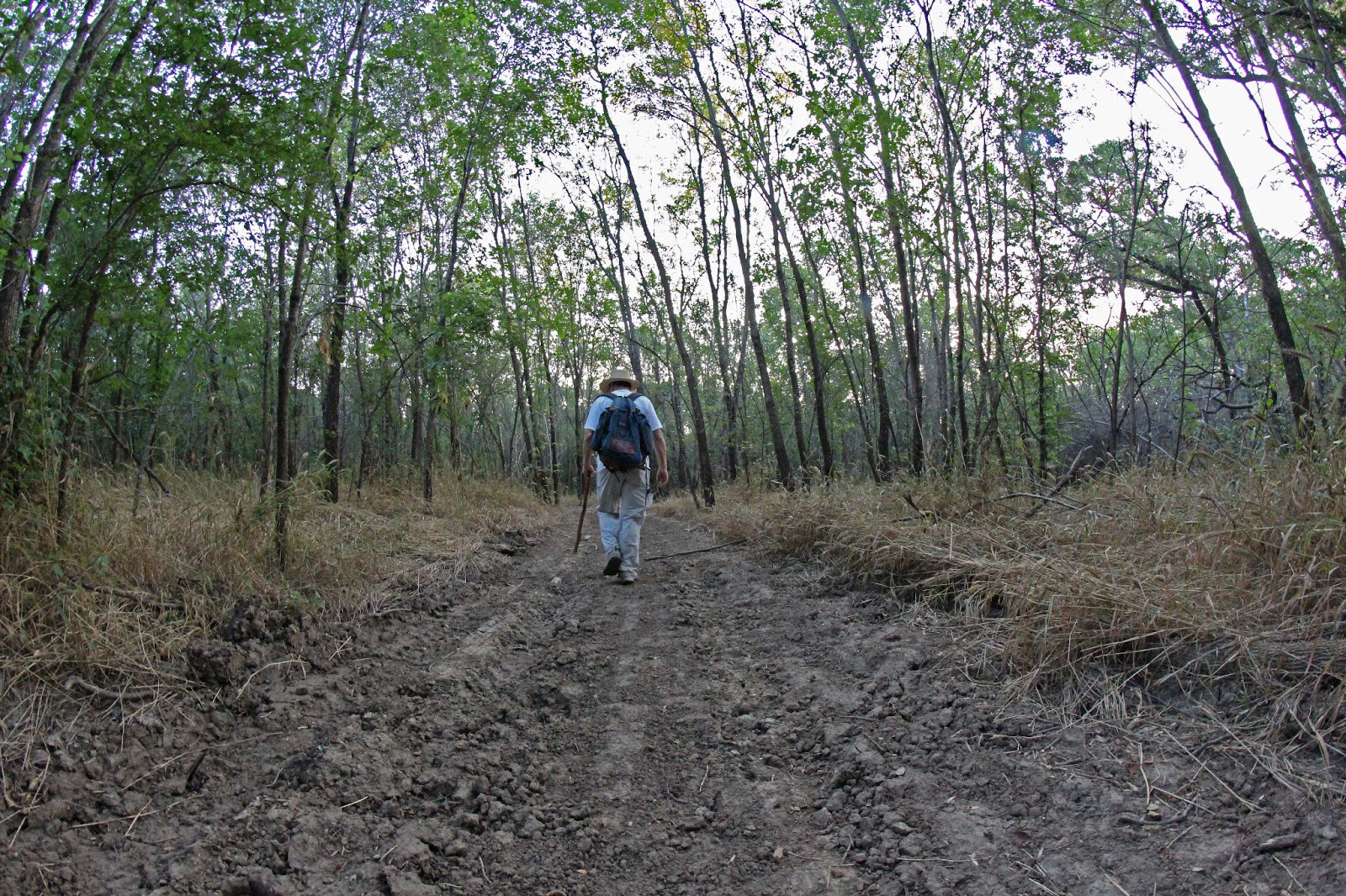
The small caliper trees in this area down near Dowdy Ferry and I-20 serve as ideal habitat for the birds whose numbers are quite large this year. A walk north up the dirt road from the Dowdy Ferry park towards McCommas Bluff Preserve will yield many sightings and songs of these birds.

The rarity of seeing a Painted Bunting is not the population being so few. It's the hunt for the habitat that they relish. Find their favorite environment and they are thick like flies. In Dallas we simply lack the habitat for such birds. Mostly that has to do with our annual rainfall in North Texas and to a lesser extent the amount of development inside the floodplain and transitional areas these birds enjoy so much.

Mating Dance of the Painted Bunting


Male Painted Buntings engage in a visual display including fluttering around like a butterfly or in an upright display, body-fluff display, bow display and wing-quiver display. These displays are used in conflicts with other males or in breeding displays for females, with females rarely engaging in displays. Occasionally, males may physical clash with each other and may even kill each other in such conflicts.


Below is a textbook display of a male Painted Bunting from start to finish, in the full ritual of a courtship dance.


Male Painted Bunting diving off of a tree perch to a gravel road below, beginning the mating ritual
The ritual begins with a dive out of a nearby tree onto a wide open patch of gravel road. I have never seen anything like it before. A calculated swaying back and forth with wings extended at different times, fluffing, mock flight and plumage display. Really something to see.


The land down here has very few clearings and openings. Covered with acre upon acre of Giant Ragweed during the summer, not many places fit the bill for a display of such type. Thus, a gravel road that parallels the Trinity River serves that purpose.

Satisfied, the male Painted Bunting finishes his dance and flies back to a nearby perch


Indigo Bunting

The more common bunting seen in this part of the Trinity River is the Indigo Bunting Passerina cyanea.

Indigo Buntings are actually black; the diffraction of light through their feathers makes them look blue. This explains why males can appear many shades from turquoise to black.

They are more common now than when the Spanish first explored Texas. This is due to an increase in their favorite habitat of woodland edges, such as power line clearings and along roads. The Trinity River Wetland Cells, the Trinity Trail around Simpson Stuart and the powerline right of way near Big Spring are all excellent places to see the Indigo Bunting in abundance.

An interesting fact is that they migrate at night, using the pattern of stars nearest the North Star to guide them.


Male Indigo Bunting


The Mouth of Five Mile Creek
Channelized Trinity River and the channelized mouth of Five Mile Creek as viewed from the Dowdy Ferry Horse Trail
Dowdy Ferry Trail Map
The Dowdy Ferry Southern Gateway Park and Trail

Address for the Southern Gateway Park/ Dowdy Ferry @ I-20:
2067 Dowdy Ferry Road Dallas, Texas

Park is open sunrise to sunset and features an old gravel pit turned fishing lake, complete with a fishing pier, picnic gazebos and restrooms.

A separate parking area near the dirt trail head has trailer parking, hitching posts and water troughs available for livestock.

No motorized vehicles allowed, no hunting, no guns.

Built with horses in mind, I'd like to call it the "Horse Park For The Rest Of Us". A place where anyone can visit, ride your horse, a mountain bike or take a walk. Wooded and shaded nearly the entire distance, this is a nice trail to wander on in dry weather.

Much of the trail here is a scraped bulldozed path through the woods cut in the spring of 2013. Six to eight feet wide in most spots it's about a mile and a half long. No formal signs exist and it loosely follows the Trinity River. From the parking lot the trail travels near due west till it reaches a high bank with a view of the mouth of Five Mile Creek.

Overlook of the Dowdy Ferry Trail at the Trinity River

The opposing bank to the river here on the west side is punctuated with thousands upon thousands of dumped vehicle tires that create an enormous artificial sand bar of rubber just downstream of the Five Mile Creek mouth.


I have visited this area a number of times in the past several years. It is prone to holding water for extended periods of time and can remain very muddy even through dry periods. I would use caution on this trail after rains as the trail surface will be permanently impaired by trail users who do use it in muddy conditions.

Time will tell if the rough cut trail will weather the test of time and periodic flooding of the river. Maybe the oddest thing regarding the trail here is an area with recently purpose planted Dogwood trees. Way out in the middle of nowhere and caged in with chicken wire. Odd choice but what do I know?


Dog Friendly

People always ask me where they can take their dogs out hiking in the Great Trinity Forest. This would be high on the list of places to walk with a dog.

Just be mindful of horses out on the trail and yield to those on horseback.

The guys pictured at left were seen near the Lockkeeper's House at McCommas Bluff Lock and Dam #1. They had ridden up from Hutchins and were headed up the river first to Joppa(pronounced "Joppie") and then up to Cadillac Heights.

They were looking for places off the pavement to ride that were easy on their horses and away from any road traffic. 

Guys like this really form the soul of the river. The Trinity has one, you know. People who have grown up here, lived their whole lives on the river and know it better than I ever could. They learned the river from the generations before them. It's always fun to learn who they are kin to and where they live.

The unfinished and sloppily constructed McCommas Bluff gabion that forever ruined the view of McCommas Bluff

Up A Creek

This section of Trinity River was channelized in the early 1970s to straighten the river in anticipation of ocean going barge traffic for the planned Trinity River Project.

The canal project was a total bust. The river never saw barge traffic in North Texas, the turning basin planned for the Trinity River eventually became the McCommas Bluff Landfill.

Five Mile Creek at one time had a natural channel that once emptied into the Trinity River miles to the north, near Loop 12 and what is now Little Lemmon Lake. Over the last century, the course of the creek was drastically changed to a more southerly course with every revision.

Five Mile Creek's current mouth is an ugly cuss of a place, more of a drainage ditch than a creek revered by so many upstream. Although the creek is now neutered and channelized it still adds a vast amount to the biodiversity of the Great Trinity Forest. The high water floods of Five Mile when coupled with the Trinity River deposit vast amounts of silt onto the Dowdy Ferry Park area making it fertile soil for tree growth. The east bank of the river here has many large Bur Oaks that thrive in bottoms such as this.
Near the headwaters of Five Mile Creek in southwest Dallas.
You would never know, following Five Mile upstream, that the muddy slow creek down on the river is a roaring limestone spring fed tributary sourced in a place the pioneers of Dallas County dubbed Cedar Mountain. Even in the 100 degree temperatures the creek runs shockingly cold.

Biologist David McNeely
Invited by Biologist David McNeely, we surveyed the aquatic life of Five Mile Creek using a large and humane net to study the various fish that call the creek home. All the fish were returned unharmed back to the creek.
Historian MC Toyer surveying an upper reach of Five Mile Creek


Shallow in many areas the limestone bottom here often gives way to deep holes many 10 feet deep or more. The larger fish congregate in these holes, bass and catfish in what is most likely great numbers.

The water here has near perfect clarity and has only the thinnest of algae films on the bottom.


With the water so clear, the aquatic life expend an enormous amount of energy in attracting a mate with the coloring of their body. The wild color combinations and patterns rival that of the Painted Buntings further down the creek at the mouth with the Trinity River. The fish colors here are far more brilliant than any fish on White Rock Creek in North Dallas and might only be eclipsed by small populations of isolated fish in Hill Country chalk creeks.
longear sunfish (Lepomis megalotis)

One of the most colorful of native Texas fish the Longear Sunfish is so named for an ear flap that is elongated, especially on breeding males, and has a light margin. The back and sides are usually olive to brown, becoming yellowish orange on the venter. Breeding males have numerous metallic blue spots on the back and sides and wavy blue longitudinal lines on the head. The venter becomes brassy orange, as do the interradial membranes on all vertical fins

In the warmer months of spawning season longear sunfish are generally found in shallower, warmer waters near the sources of streams which have pools with a flowing current. They prefer streams with a hard bottom of clay or gravel with clear waters and they usually stay in or near aquatic plants. Although more abundant near the sources of streams, they can be found in streams and rivers of all sizes and are also found in lakes. Compared to other members of the sunfish family, longear sunfish are better at getting food in moving waters than still waters. This may explain why longear sunfish are more abundant in streams than lakes compared to other members of the family. They cannot tolerate cloudy water. Throughout the 20th century their populations have been reduced in areas where their native streams have suffered increased cloudiness.

Red Shiner, Stoneroller and Mosquitofish
The Red Shiner (Cyprinella lutrensis). Cyprinella is Greek for "small carp" and lutrensis is derived from the Latin lutra which means "otter", a reference to Otter Creek, Arkansas, where the species was first captured. Coloration is similar to the blacktail shiner, olive green above and silver on the sides. Spawning males become bluish on the sides and the fins redden. The native fish


Red Shiner Cyprinella lutrensis
Red Shiners are often considered an invasive species in other parts of the country. They are a native and hearty species here in Texas, often living in water that other fish cannot tolerate. The color patterns of these fish on Five Mile Creek are exceptionally brilliant and not seen in fish commonly used for fishing bait. The fish above were put in a small aquarium supplied by biologist David McNeely.


Green Sunfish Lepomis cyanellus
The Green Sunfish is a thick-bodied sunfish with a large mouth, the upper jaw extending to about the middle of the eye. Back and sides are bluish-green, grading to pale yellow or white on the belly. Black vertical bars are sometimes evident on the sides. Blue stripes and streaks are present on the side of the head. Pelvic fins in breeding males are white or pink; and the tail and anal and dorsal fins are tipped with white or salmon-pink. They are highly tolerant of low oxygen water, warm water and slow moving streams. Prolific and tough they are some of the best fighting fish found in North Texas streams.

Below is a different perspective on Five Mile Creek, an unattended underwater camera left for some time in one of the pools of the creek.  In the clip, the Longears, Green Sunfish and minnows all are going about their business.


Segment of the Five Mile Creek Trail that will eventually connect to the Great Trinity Forest
At some point in the future a planned paved path will run the length of Five Mile Creek from Oak Cliff to Joppa Preserve on Simpson Stuart Road. Only bits and pieces of this facility are built, construction is not evident on other portions slated for completion.

Sunday, June 30, 2013

The Rare Hexalectris Orchids of the Great Trinity Forest

A Crested Coralroot Orchid Hexalectris spicata in the Great Trinity Forest, June 2013
The needles in the haystack. The drinking straw sized plants so obscure that many would walk right past them without notice. They are the native Hexalectris spicata, the Coralroot Orchid. The rarity of these orchids make for a difficult search in the Great Trinity Forest of Dallas, Texas. They exist only in the most untouched of places down there where the soil conditions and tree canopy must be just right.

The Piedmont Ridge Trail
The home range of Hexalectris covers some of the most inhospitable terrain in the Southwest. These orchids represent a genus of eight fully myco-heterotrophic species, which persist largely undetected due to their rarity, inconspicuous and unpredictable flowering patterns, and because they occur in harshest of habitats to man.The remote desert canyons of West Texas and Mexico, the dry tropical forests further south and in the case of the Great Trinity Forest, the dense cedar thickets of Oak Creek and lower White Rock Creek. It's tough to find these things.

A plant so specialized that it cannot be transplanted or curated in another environment. Attempts in the past to move these plants, transplant or take one for study have all failed.

Below is the Hexalectris nitida (Glass Mountain crested coralroot). So rare that it is listed as an Endangered Species in the State of New Mexico. In Texas they are a little more common but up until the 1980s they were thought only to exist much further to the south and west than Dallas. It rarely has open blooms in the Dallas population, it self pollinates according to those who have studied them.  The State of Texas doesn't formally recognize any plant species as Endangered or Threatened unless the US Fish & Wildlife Service has already done so, therefore, in Texas the federal and state lists are the same.

A lone Hexalectris nitida (Glass Mountain crested coralroot)  under a canopy of cedar and oak trees growing in the unique detrius of the Great Trinity Forest
The orchids here are not run of the mill wildflowers. They do not even require sunlight to grow. The fancy term is nonphotosynthetic orchid from a mycorrhizal fungi. Their evolutionary story centers around the very unique soils that lie in a paper thin layer covering the Austin Chalk uplands in this part of Dallas.

A thin veneer of soil noted as the Eddy Brackett sits atop the uplands here. This soil was once common in a belt that stretched through Pleasant Grove, East Dallas and Lake Highlands. Paved and developed long ago very few places still exist to find these plants.


A Special Partnership

The soil here harbors a special host for the orchids to survive, a special fungus known as mycorrhizal fungi. It's believed that the decaying leaf matter from the surrounding oak trees above provides the nutrients needed for the fungi to thrive. The undisturbed plant matter is a vital part of the success for the fungi and the orchids. The rhizome of the orchids tap into the fungi which provides all the nutrients that the orchid needs to thrive. As a result, the orchid requires no sunlight for growth and relies completely on the nutrients of the host fungi for food.
Hexalectris nitida (Glass Mountain crested coralroot)

The orchid extracts food and nutrients from the mycorrhizal fungus without providing any apparent benefits to the fungi. Thus, the orchid is parasitic on the fungus and because the fungus obtains its food from its host(oak trees), the orchid is an indirect parasite of the oak.
Coralroot Orchid as seen from above growing through a floor of acorns and leaves


A Super Long Lifecyle
Earlier this spring I posted about the Trout Lilies that reside in the woods here that take seven long years from seed to flowering adult. The Crested Coral Root Orchid takes an estimated ten to twenty years from seed germination to flowering adult. During the decade or two between germination and flowering there might be many individuals in an area that are simply unseen.

All species of orchids require fungi for seed germination and early development, but species vary widely in their dependence on fungi as they mature. The Coralroot needs the underlying fungi for carbs and nutrients for it to survive.

Hopefully the orchid pictured at left had a successful flowering and will seed offspring. Look for them in the year 2033.
Hexalectris spicata


The overlooks, canyons and diverse terrain in this part of Dallas are only a fifteen minutes by mountain bike from the Spillway at White Rock Lake. A short hop, skip and jump away from the Lake lands you in what looks smells and tastes like the Texas Hill Country. The blazing heat of an early summer night smells of hot cedar down here. The radiant warmth of sun baked limestone comes up through your shoes into your feet.

The waning days of the wildflower season here are drawing to a close. Most of the flowers are starting to go to seed save for the late blooming Horsemint and the ever random late yellow flowers whose names escape me.

Wednesday, June 26, 2013

Supermoon Over Dallas -- Tracking the Moonrise

The Supermoon as it rises through the thick humid air of a Texas June night
Around once a year the Moon is a whisker closer to Earth than the the other lunar cycles, setting up for what some advertise as a bigger and brighter Moon. Coinciding in 2013 within a day of the Summer Solstice this astronomical event is interesting to see especially when one can find a suitable backdrop to frame a photo. In Dallas we lack a mountainscape, ocean or even much of a hill that gives enough perspective to capture a full moon. We do have a bridge and some tall buildings to work with that make for a fine backdrop for a moonrise.

The term Supermoon is not used within the astronomical community, which uses the term perigee-syzygy or perigee moon. Perigee is the point at which the Moon is closest in its orbit to the Earth, and syzygy is a full or new moon, when the Earth, the Moon and the Sun are aligned. Hence, a supermoon can be regarded as a combination of the two, although they do not perfectly coincide each time. On average, about once a year (14 months) the moon becomes full within a few hours of perigee.

Waiting for the sun to set within a day of the Summer Solstice is often like watching grass grow or waiting for paint to dry. Gives someone a chance to explore the Trinity River bottoms between the levees and see some of the sights and do some unconventional things that few check out. Killing a few birds with the same stone.


Surprising to see more and more people out at these things. Just a couple years ago I'm certain that I was the only one out there on the levee photographing the moon. On this particular night there were about one hundred. Some here on their own, some in pairs, some in groups.

The Dallas Marshal's Office has upgraded their vehicles to patrol the Trinity River. Seen at left is one of the new Chevy Silverado 4x4's equipped with heavy duty mud tractor style tires. This deputy marshal was up on the levee near the new Pavaho Pump Station watching for illegal motorized vehicles on the levees. Inset above is David Mimlitch who is best known for his award winning aerial photography of the DFW area and Trinity River. This evening his camera gear was on two wheels instead of two wings.

Fading light over the wildflower filled floodway looking towards Downtown Dallas near the Sylvan Avenue Bridge
Sun setting behind the Hampton-Inwood Bridge over the Trinity River
As the sun slowly descends out of the way and the skies begin to darken, the real reason most people are here on the river can begin.....

The Rise Of The Super Moon


You really don't need the Moon to be in a "super" phase to photograph the full phase down here. Advertised as 12% closer and 30% brighter the moon looks the same to me year round. The best time of year to photograph the moon in Dallas is actually in the winter when the atmosphere is clearer, the sun sets earlier and the chance for clouds out to the east is lower. Many people, in any event, use the annual Supermoon event as an occasion to dwell on Earth’s only natural satellite and chose the levees as their location.

In the summer months I have found that storms and cloud cover in East Texas some 100 to 150 miles away can often impact the sighting of the Moon as it first rises above the horizon. If the Tyler, Kilgore or even Texarkana area is experiencing early evening storms then one must wait thirty minutes or more after moonrise to see the Moon as it clears the distant high clouds.


The light bouncing off the Moon through all that thick East Texas humidity creates an orange glow at first then into a mustard yellow as it passes by Reunion Tower.  It's usually around this time that many people photographing the Moon will migrate towards a better spot for their liking. The Moon moves at a fast pace diagonally from lower left to upper right. The pace of which allows for a shot or two at most before requiring a move of a few steps if one wishes to re-rack the same shot. Below is a real time clip taken in June 2013 of the Moon as it travels from left to right across the night sky moving directly behind the Margaret Hunt Hill Bridge


Gotta move fast to get the shot you want and need to be able to pick up and move with your gear when the time is right.


Full Moon directly behind the Santiago Caltrava designed Margaret Hunt Hill Bridge June 2013

The sweet spot for photographing the Moon down here is about 1/4 mile downstream of the Sylvan Avenue Bridge on the west levee. If you push further out towards the Hampton/Inwood Bridge the moon perspective will be much larger but the powerlines along Sylvan will be in the way. Pushing even further out toward Singleton/Eagle Ford area has been tried too with mixed results. If any clouds are low on the horizon to any extent then the trip is also a bust.

The Supermoon as it continues past the Calatrava Bridge onward and upward

We live with the Moon and see a Full Moon every 28 days. Few realize the speed that it travels across the night sky until they watch it move across the night sky. Great vantage points and worth attempting sometime if you have a camera that can be manually set. The bright white lights of the bridge make for a challenging shoot, there are tradeoffs with getting details of the Moon or details of the bridge.

The late Spring rains in 2013 have kept the small ponds that dot the floodway full of water. They serve as a great reflective backdrop when the winds are absent. In wet periods when the river floods between the levees the ponds here will fill with small fry, baitfish and crawdads that serve as a food base for wading birds. The Trinity did not see large scale flooding rains this winter and as a result the small patchwork of ponds down here lack any real forage for birds.

Small pond between the just downstream of the railroad trestle that services Downtown Dallas
A mountain bike really is the best form of transportation if you want to explore the levees between the Caltrava Bridge and the Santa Fe Trestle Trail. A bike makes quick and easy work out of the gravel access roads here and one can travel from one site to another in just minutes.

Trinity River Trail near the Santa Fe Trestle and DART rail line
The City of Dallas calls this a 16 foot wide access road. Looks more like a bike path don't you think. The final section seen above was paved about two weeks ago and now connects the Santa Fe Trestle Trail with this new section that stretches almost to I-35. I have heard it called the Trinity River Connector, Trinity River Trail. It still does not connect with anything nor does it serve as a functional piece of infrastructure. It's just sort of there.

David Mimlitch riding the new Trinity River concrete trail thing near the Corinth Street Viaduct
Mountain bikes had no trouble negotiating the soft surface road that was here before. The concrete smooths things out a little. This particular section from Corinth to I-35 was paved in about a week, the whole thing. The contractor had a machine that just laid out a smooth ribbon of concrete the whole distance. Wish they would have kept on going as many of the trail users come from the Continental Avenue and West Dallas area to recreate down here. Recent news is that the trail is stalled for planned construction of new highway interchanges. I bet it has something to do with........

That Big Gigantic Hole Near the I-35 Bridge


I bet a million people pass within rock throwing distance of this ten story deep hole everyday and don't even know it's there. It's big. It's deep. It's spooky. Larger than a missile silo and if above ground would rival an office building or two in size Downtown. This hole is part of a Dallas public works project to tunnel underneath the Trinity River. The project is supposed to link the east and west banks of the Trinity River water system, carrying via gravity waste water from the Downtown side of the river to the Central Wastewater Treatment Plant. A twin bored hole of similar size sits next to the Cadiz Pump Station not far from Old City Park. Construction of this project began in early 2012 I believe. In the past year the site for whatever reason has sat empty. The fencing, signs and equipment all disappeared with the passage of time. So, we're left with this big hole.


There is a bit of a lip to the top of it, 4 feet or so. No danger of falling in. It's also not high enough to keep floodwaters at bay. In the spring of 2012 the Trinity inundated the site.

You can read more about it below:
http://www.tawwa.org/TW11Paper/20110131%20DWU%20EB-WB%20Interceptor%20Connection.pdf
The twin access vertical tunnel at the Cadiz Pump Station
The Cadiz Pump Station sits in the shadow of Downtown Dallas and spitting distance from I-30. I believe when the new I-30 freeway project begins construction, the century old pump station will be demolished for the "Horseshoe Project".
The long forgotten limestone cliffs of the original Trinity River near Downtown
The old Cadiz Pump Station once sat on the banks of the Trinity River. Prior to channelization and realignment some half mile away, the natural river channel near Downtown was a picturesque limestome cliff lined river with large groves of mature trees. Remnants of that old Austin Chalk lined channel can still be seen like the one above. The Sportatorium wrastlin' arena once sat in the abandoned lot above. Without much imagination you can picture what the river once looked like through here.

Speaking of the river being re-channeled..................

Walking On Water At The Standing Wave
Trinity River Whitewater Park at the Lower Wave

At the far end of the levees stands the Santa Fe Trestle Trail and the Trinity River Whitewater Park. The century old Santa Fe Trestle has been converted into a pedestrian/bike bridge that spans the Trinity right at the very end of the southernmost portion of the levees. Just upstream a mere 50 feet or so sits a purpose built DART Light Rail bridge that services the Red and Blue lines to the Corinth Station from Downtown.

Below the bridge sits the Standing Wave, the Trinity River Whitewater Park.

Birdseye view of the Trinity River Standing Wave as seen from the Santa Fe Trestle

The Standing Wave feature serves as a sort of endless surfable whitewater wave. If you have the right equipment you can get into the wave and surf it, do tricks, spins and such. There are two water features here, the Upper and Lower Wave. A concrete divider on river left(north bank) separates the surfing waves from a "canoe bypass" that is more like a flume.

Trinity River Whitewater Park, the Lower Wave, watch your step
When the water is low in the summer during dry periods I have noticed that some of the larger wading birds have been able to hold their own at the top lip of the lower standing wave feature while they are fishing for a meal. Maybe it was the Full Moon pulling on my brain that made me decide to try it myself.
Making Rooster Tails as I walk out onto the Standing Wave
Footing is firm under what is an algae mat of sorts that blankets the Lower Wave. I was able to walk out there without issue and into the middle of the main channel and wander around for a few minutes. A slip would not have been a good thing as I would have been laundered through the Lower Wave which is rated Class II-III whitewater. Some video standing out on the Trinity River in mid-channel:


It's a great view from here. Looking straight up the channelized Trinity River one can see right under the Corinth Street Viaduct channel and much further beyond. A real unorthodox way of seeing the Trinity River. In the very near future, the Corps of Engineers plans to dismantle the wooden sections of bridge here on either side of the river. If you want to see the old woodwork here you should make plans for a trip here soon.

Standing on the Lower Wave of the Trinity River Standing Wave, mid-channel, looking upstream at the Santa Fe Trestle Trail