Saturday, July 12, 2014

Big Spring's Rare Plants Roar Into The Record Books Of Texas Botany

Famed Botanist Julien Reverchon's Spermacoce glabra specimen collected August 1, 1902 at Buzzard Spring, White Rock Creek drainage in the riverbottoms of South Dallas. Part of the Botanical Research Institute of Texas herbarium collection. Photo courtesy Master Naturalist Jim Flood

It was a cool August 1st in the year 1902 that the world famous pioneer Texas botanist Julien Reverchon would have been found collecting plants by horseback in the sandy soil east of what was then Dallas. One of the plants he collected that summer day was that of the Smooth False Buttonweed Spermacoce glabra. 112 years later in 2014 and modern day North Texans are probably not familiar with the sight of the plant, one whose native habitat of swamps and wetland areas no longer exist in Dallas. Not a rare plant points east in the Mississippi Valley but exceptionally rarely seen in the Trinity drainage and especially Dallas County. A species thought to be extirpated, a local extinction due to habitat loss and lack of sightings. Reverchon's collection site, the once well known to every Dallasite, Buzzard Spring does not even exist. Destroyed through channelization, infill and development, the ancient swamp became urbanized and forgotten from memory.

Many contemporary Dallasites associate the name Reverchon with a park bearing the same name on the popular Katy Trail. Few know that the man behind the name forever changed how Dallas was viewed abroad as a growing town of refining culture and class. Julien Reverchon's observations and collections drastically changed how the North Texas landscape was seen and written about in late 19th century dissemination and publication.

The long lost Spermacoce glabra rediscovered at Big Spring 2014
Julien Reverchon (1837-1905) was a pioneer of the La Reunion colony in what is now West Dallas/Oak Cliff. Reverchon's family immigrated with La Compagnie Franco-Texienne to Texas in 1856. The eclectic colony of French, Swiss and Belgian immigrants settled in 1855 at La Reunion across the Trinity from Dallas. Within eighteen months the colony of artisans, musicians and philosophers was more of a marked failure than success. Julien's family led by his father Jacques Maximilien Reverchon arrived in 1856, seeing the less than stellar gains of La Reunion as a community, purchased land to the southeast from the Anson McCracken Survey near present day Davis and Hampton Roads.

It was here on the family farm, later coined Rose Cottage that Julien Reverchon began his study and collection of plants in Texas. At the time North Texas was still very much a frontier with Indian raids, cattle drives and true wilderness out the front door of any home on Main Street. The natural environs around North Texas were completely undocumented and explored to any degree. The rough hewn lines of surveyors marks on maps and the occasional fence were the only boundaries of note.

A bumblebee visits a Milkweed at Big Spring, Dallas, Texas as a summer thunderhead rapidly builds 5 miles to the north over White Rock Lake, July 2014
Unpeopled and undeveloped North Texas was land ripe for discovery. For the next fifty years, Julien Reverchon studied and collected the plants of Texas. His well documented excursions to West Texas with famous Swiss scientist Jacob Boll and Harvard's Asa Gray led to new plant species on every trip. Gray named the genus Reverchonia in Julien Reverchon's honor. Others in the scientific coterie bestowed Reverchon's work by naming species of aristida, diplachne and panicum in his honor. Botanist Charles Sprague Sargent of Harvard University and author of North American Silva named Crategus reverchoniia a type of local Dallas Hawthorne tree for Reverchon. The list goes on and on.

Thousands of plants were collected and distributed by Reverchon to universities of high standard at the time. These plants, many of which were unknown at the time became groundbreaking additions to collections being studied for pharmacutical and medicinal use. One such field trip to collect plants was August 1, 1902.
Closer view of the BRIT archived herbarium of Julien Reverchon, with notation "sands east of Dallas". Photo courtesy Master Naturalist Jim Flood
Bank of America Building as seen from Big Spring
As a resident of Dallas, Reverchon made numerous trips afar collecting plants but based much of his effort in Dallas County. Many of his collection site describe places known and unknown to current residents, White Rock Creek, Turtle Creek, Trinity River, Oak Cliff. Others are slightly vague in descriptor, like "rocky outcrop", "river bottom", "rocky soil".  In the case of the photo card at the beginning of the post Spermacoce glabra is noted in "sands east of Dallas".

The record of Reverchon's trip that day in August 1902 was immortalized in plants collected in the field. To preserve their form and color, plants collected in the field are spread flat on sheets of newsprint type medium and dried, usually in a plant press, between blotters or absorbent paper. The specimens, which are then mounted on sheets of stiff white paper, are labeled with all essential data, such as date and place found, description of the plant, soil and special habitat conditions.

Hurricane #2 track over Texas summer 1902
By Texas standards, the summer of 1902 was an abnormally cool and wet season with large tropical systems moving across the state with great frequency. In late June and into early July, Hurricane #2 which made landfall in Port Lavaca slowly ground across Texas dumping record rains on the Sabine, Brazos and Trinity River basins. The farm reports from that autumn posted record yielding crops of cotton and corn in North Texas.

Bumper crops parallel bumper conditions of native flora as well. A great period for documenting the water loving swamp plants of Dallas. Many of the plants that Reverchon collected were native grasses, sedges and plants that were studied for medicinal uses and agriculture.

Solving the puzzle of Buzzard Spring
The complete picture of what Reverchon collected that day in 1902 requires some detective work to trace. Scattered across herbarium collections in Texas, Missouri and Massachusetts the puzzle pieces were hard to pull together. When Jim Flood contacted me about his rare find at Big Spring of Smooth False Buttonweed and that Julien Reverchon had collected the same species at a vaguely described spot east of Dallas, the hunt was on for more information. The off-chance to tie the collected species together in the same creek drainage was a distinct possibility.

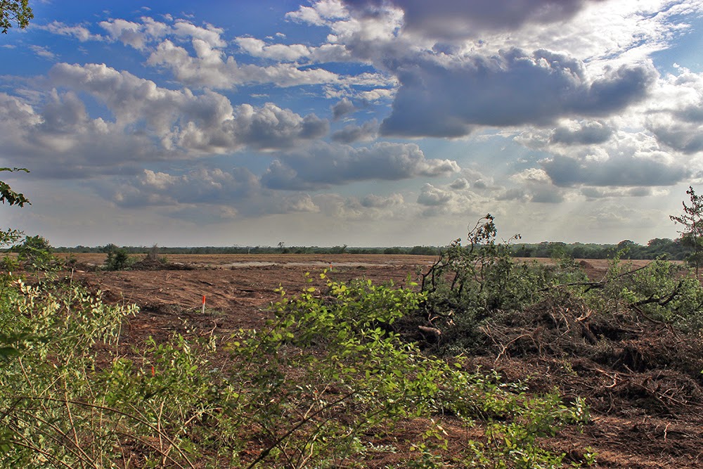
Lagow League sands, part of the Pleistocene (Ice Age) Trinity Sands formation in Dallas, Texas July 2014. Excavation at the corner of Lagow and Hatcher in South Dallas. Notice the fine sedimentary layers of sand laid down as a result of prehistoric Trinity flooding which once inundated much of Dallas. These sands hold vast reserves of fossils featuring tigers, bears, mastodons, antelope, sloths and many other Ice Age animals that once roamed Dallas.

Searching the herbariums across the country provided lists of species collected by Reverchon on August 1, 1902
I knew that the descriptor "sands east of Dallas" most likely meant an area not far from the city proper. Using different databases and searches I was able to find other plants collected the exact same day by Reverchon.
Allionia nyctaginea var. ovata (Pursh) Morong tag labeled by Julien Reverchon at Buzzard Spring, Dallas, Texas August 1, 1902 from Tropicos, botanical information system at the Missouri Botanical Garden - www.tropicos.org
What we have from Reverchon are his botanical tags cut from the original paper and pasted onto newer sheets. The tags contain brief notes on species collected, date, location, collected by whom and conditions under which collected. Keen observational powers and a systematic approach are what Reverchon is known for, his notes solved a part of the equation in 2014.

Allionia nyctaginea var. ovata (Pursh) Morong collected by Julien Reverchon August 1, 1902 at Buzzard Spring Dallas Texas herbarium plate from the botanical information system at the Missouri Botanical Garden - www.tropicos.org
Buzzard Spring once sat east of what is now Fair Park in what old texts describe as "swamp" or "marsh". The location today would be very near 32.774641,-96.741704 near the intersection of Spring Ave and Wahoo.

 Looking back through Reverchon's collection records he has visits to gather plants here at Buzzard Spring and the woods beyond dating to as early as 1876. Nearly three decades of regular visits to this spot, well documented through his collection. 1876 was a banner year for Reverchon discovering a dozen new plant species. Further work in the years to come added on that groundbreaking work.
Allionia gigantea Standl collected at Buzzard Spring by Julien Reverchon August 1, 1902 from the botanical information system at the Missouri Botanical Garden - www.tropicos.org
Walking those wooded slopes and fields, set only a few miles from what was then outside the city limits of Dallas one can only imagine what Reverchon experienced when looking for plants here. Buzzard Spring fed Wahoo Lake or Lake Wahoo, a natural water body known to 19th century Dallasites as a good fishing spot. This was a time before area lakes were built, even before White Rock Lake. Ponds and lakes did not exist to any degree at the time, Wahoo was a popular spot for residents.

The land was first settled by the Beemans who owned near continuous tracts of land between what is now Fair Park and the Trinity River Audubon Center. One recollection from the early settlement of Buzzard Spring comes courtesy of historian MC Toyer from a memoir passage of JJ Beeman describing the lake area in the 1840s. The blockhouse mentioned would be just south of present day Military Parkway on the west side of White Rock Creek and behind the Beeman Cemetery east of Dolphin Road:

John's family and mine lived in the block house until we built another house close by.  I had selected me a place about a mile southwest of the block house and built a house in the timber where there was a fine pool of water with plenty of fish in it.  By this time we had become somewhat careless and would venture further than we had before, so in order to be convenient to my work I built a camp and moved to the place before I built the house-- James Jackson Beeman, Memoirs.1886.

Buzzard Spring fed into what we now call the Great Trinity Forest, a vast urban bottom land that so few current Dallasites have seen with their own eyes. Some of the plants collected by Reverchon in this area no longer are known to exist in Dallas. Or are they? They have not been seen by anyone alive in generations and all but forgotten.

As Dallas growth marched east at the turn of the last century, Buzzard Spring and Wahoo Lake were filled in and dewatered. Gone forever.

Rediscovering Reverchon's Work Through Botany At Big Spring
An early evening thunderstorm drenches Big Spring leaving the Great Trinity Forest a foggy and steamy backdrop for photography May 31, 2014. Pictured hiking with his gear is Chris Rankin, a photographer who drove from the Bryan/College Station area to photograph Big Spring. He is walking up from Bryan's Slough, dwarfed by the large ash and willow trees that grow in the bottom

This photography event at Big Spring was through the North American Nature Photography Association one of the cornerstone initiatives to expose more people to the Great Trinity Forest
It remains one of the wildest places left in Dallas County. It has always been this way. Since before the Pembertons. Since before the pioneer Beemans. Since before the Caddo. Wild. Farther off the beaten path than anywhere else inside Loop 12. Farther from concrete anywhere inside Loop 12. Here among the outfall of  another natural spring outfall in the White Rock Creek watershed called Big Spring lies the ever growing realization that the land here offers a refugium for rare plants thought to have been lost in Dallas.
Spermacoce glabra in full bloom at Big Spring in the Great Trinity Forest July 2014
Bursting into bloom are the plants maybe just three or four people alive have ever seen blooming in Dallas. The Spermacoce glabra Smooth False Buttonweed is just one of a growing number of plants that simply are not found in this part of Texas with regularity.

Master Naturalist Jim Flood
It was Master Naturalist Jim Flood and Geoarcheologist Tim Dalbey who first found the plants during a weekly plant survey at Big Spring in late June 2014. Jim Flood is most well known as the trail steward for the Buckeye Trail in Rochester Park, about a mile as the ibis west from Big Spring. Jim's tireless work in the Great Trinity Forest often goes unappreciated and under-recognized.

It seems rather impossible for many to understand Jim's important contributions to the well-being of the Great Trinity Forest and how his foundation of efforts over the years will most likely serve as a launching pad for the future.
Spermacoce glabra Dallas, Texas July 2014


The work in rediscovering the lost plants of what Reverchon documented so long ago will be rewarded with a new herbarium collection card with Jim Flood's Big Spring Spermacoce glabra preserved in the Botanical Research Institute of Texas, right next to that of Julien Reverchon. Tremendous honor for the plant making it out of what many thought was extirpated status, honor for Jim Flood and Tim Dalbey and also an honor for Big Spring adding yet another special element to the land.

Eastern Bluestar Amsonia tabernaemontana at Big Spring 2014
A number of other plant species not traditionally seen in the area are also being found. Species in the Dogbane family like the Eastern Bluestar Amsonia tabernaemontana have been documented this spring and summer of 2014. Like the Buttonweed, these plants live in wetlands, marshes, ephemeral wetlands and wet meadows. This is another species identified by Tim Dalbey and Jim Flood in 2014 at Big Spring.

Biodiversity at 265+ plant species and counting
Master Naturalist and DFW Texas Stream Team coordinator Richard Grayson walking among the thigh high wildflowers at Big Spring in the bottoms. The Eastern Bluestar plants are just to the right.
Non-flowering Eastern Bluestar at Big Spring's large wildflower meadow 2014, Brett, Sarah, Aaron in the background 2014
 Expanding on plant species data is just one aspect of the work at Big Spring in 2014. Tasked on a whiteboard discussion at Dallas City Hall in late 2013, scopes of work were outlined for the new year. Historical designation, water quality testing, flora-fauna surveys and public access were cornerstones to be established and built upon.
Federal, State and Local government representatives at Big Spring for an en plein air discussion May 29, 2014. Left to right, Texas Parks and Wildlife Biologist Brett Johnson, City of Dallas Asst Director of Trinity River Watershed Management Sarah Standifer, Corps of Engineers/UNT LAERF Aaron Schad
Aaron Schad discusses his research and observations to Richard Grayson and Tim Dalbey under the Bur Oak at Big Spring. Aaron has been contracted by the City of Dallas to develop a management survey of the aquatic environment at Big Spring. His work has found an interesting beetle species living in the spring water not found across the river.
Brett Johnson, Paul White, Aaron Schad, Sean Fitzgerald
Lots of meetings and discussions on the issues at hand. How best to develop a management plan for this unique area and how to maintain it for generations to come. The absence of human disturbance has left much of the ecological functionality of Big Spring intact indicating that preservation and management of the site should be somewhat of a “hands ‐ off” or “less ‐ is ‐ more” approach.
Left to right Aaron Schad from COE/LAERF, Brett Johnson from TPWD, Jennifer from Trinity Watershed Management, Paul White Enforcement Officer City of Dallas Stormwater Management, Geoarcheologist Tim Dalbey, Richard Grayson Texas Stream Team, Biologist Becky Rader, Sarah Standifer Trinity River Watershed Management, May 29, 2014

The limited human management will allow the natural processes to continue undisturbed. Continual monitoring and assessment of Big Spring will allow decisions to adaptively develop or hone site specific management.


From this eclectic mix of individuals a greater understanding of Big Spring has emerged and will continue to expand in the future.  Quarterly plant and wildlife inventories, water testing and future planned projects merely scratch the surface. The ability for these citizens to do things the right way, the first time is just what Big Spring needs.
Big Spring's back meadow, Clasping Coneflower Meadow in full bloom May 31, 2014.

The approach to managing the spring has been driven by a deep pool and knowledge base of experts in professional disciplines of science, education, archeology, history and engineering. Some of this work comes from the membership of the North Texas Master Naturalists who have been helpful as a guiding hand in future management plans.

Working More People Into The Fold


One of the many cornerstones laid with work this past winter were plans to draw more people into the mix at Big Spring and the Great Trinity Forest. It seemed like a simple idea to broaden the horizons of many who had never experienced the vast areas of the Great Trinity Forest, off the beaten path. How to do that is a bit complicated with larger groups.

Sunset over Big Spring after a heavy late day thunderstorm
The exposure for many Dallasites to the Trinity River is that seen through a car window at 60mph or from a visit to the Trinity River Audubon Center(TRAC). Lots of great views from bridges or from the TRAC trails but there is so much more beyond that.
Big Spring
Photographer Sean Fitzgerald suggested using the framework of a website called Meetup and a
photography organization called NANPA, the North American Nature Photography Association. Through the website and the organization, Sean suggested cherry picking the very best weekends at the peak of bloom for sites around the Great Trinity Forest.
Barred Owl seen at the NANPA Photo-Hike Buckeye Trail

NANPA event in the GTF, checking out a Barred Owl
The first was the Trinity Audubon Center in the Great Trinity Forest, an after hours event in the golden hours before sunset. The second was a late March visit to the Texas Buckeye Trail in Rochester Park and the third was in May at a day long event at Historic Big Spring.

We had some candid discussions about how to best get more people aware and interested in the Trinity. If you look at what product is turned out every year for things like the Trinity River Photo Contest, you realize that the photographers and public in general have yet to really get down into the forest and experience the real nature that resides there. So much goes unseen and undocumented down on the river with only a few sets of eyes even visiting these grand places. It's a shame because vast stands of flowering trees and fields of wildflowers go to bloom without ever being enjoyed or visited.

These well attended events this spring exposed many dozens of people to the Great Trinity Forest and to places few have even seen before. Their photos, shown in a gallery of over 100 images Big Spring NANPA event highlight through the eyes of dozens, the beauty and nature at Big Spring. The main website is here NANPA Photography Group of North Texas.

The desire to preserve what’s authentic, what holds substance and what aspires to the whole shines through the experience of those who visit. The future looks brighter than ever for Big Spring. A picture is emerging of knowing a place intimately that only the giants of Texas history like Julien Reverchon ever knew. The pioneer spirit is still alive here. Those belonging to it more fully and to take responsibility for its preservation feel it in the work they do.

Ground fog developing in the pre-dawn light across the millions of wildflowers at Big Spring. Thirty second exposure in near total darkness at 5am.

Friday, June 27, 2014

Wood Storks Taken Off Endangered Species List And Return To The Great Trinity Forest

A Juvenile Wood Stork at Joppa Preserve on the evening of Juneteenth 2014, Dallas Texas. One of the most rare and special animals in Texas.
It was an early summer Thursday, June 26, 2014 to be exact that marked a significant moment for one of the most imperiled wading birds in the world, the Wood Stork. A mere thirty years ago, biologists said that by the year 2000 the Wood Stork would be extinct from the planet. It was on that Thursday, Sally Jewell, Secretary of the Interior announced the down listing of the Wood Stork from “endangered” to “threatened,” finding that the birds, which breed only in the Southeastern United States, no longer face imminent extinction.

A young Wood Stork stands alone in the Great Trinity Forest June 2014 taking a brief break from foraging the submerged bottom of a lake for food.
Wood Storks were protected in 1984 under the Endangered Species Act after the birds had declined from approximately 20,000 pairs in the late 1930s to 5,000 pairs in the late 1970s, largely due to draining and development of wetlands. After the Wood Stork was designated as endangered, work began to preserve and restore wetlands and protect nesting areas. According to the US Department of Fish and Wildlife the most recent three-year population average ranged from 7,086 pairs to 10,147, however, the five-year average of 10,000 nesting pairs identified in the recovery plan as the target for delisting had not been reached.

Wood Stork spreading wings with the imminent approach of a fast moving storm over the Great Trinity Forest, June 2014
The change in designation by the U.S. Fish and Wildlife Service marks an important step toward full recovery but will not reduce the species’ legal protection. Some believe political pressure by golf course corporations and homeowners associations pressured the move from endangered to threatened. The rigid enforcement protections for the birds and their habitat remain in place despite the change in designation.

About The Wood Stork Mycteria americana


Wood Stork Mycteria americana exhibiting the unique to the species feeding technique

Few Dallasites have ever heard of a Wood Stork. Only a handful of even experienced birders have even seen one.

Wood Storks (Mycteria americana) also called the Wood Ibis are large water birds that stand 4 feet tall and are the only stork in North America. They have wingspans as wide as 5 1/2 feet. They are mostly white, but have a black tail and many black feathers under their wings. Storks are related to ibises, herons and flamingos. Adults have no feathers on their head and neck, so the black skin underneath shows. This makes wood storks the only tall water birds with black, bald heads. Since they have no muscles attached to their voice box, they are very quiet birds.

Best Places In Dallas To See A Wood Stork
Trinity River Audubon Center

John Bunker Sands Wetland Center

 Both nature centers have sightings of Wood Storks off and on from the 4th of July till August. The Wood Storks move around between feeding and roosting zones so they are not round-the-clock residents on any given day. You can call ahead and check for sightings. Both locations have confirmed sightings in 2014.
Wood Stork and three Snowy Egrets working a nearly dried up Little Lemmon Lake under darkening skies of a thunderstorm, June 19, 2014
Faster than a hummingbird, the quick snaps of the beak are blurred even in high speed photos
Wood storks use the massive beak as their source of food gathering.  The feed in water no deeper than their beak and catch a variety of things in their bill which they then toss their head back and swallow.

This technique is known as “grope feeding”.  This because the stork does not use vision in food collection, but instead does everything by touch.


The reflex of the bill after it touches food is thought to be the fast of any reflex in the vertebrate world. When it feels a fish, the stork can snap its bill shut in as little as 20 milliseconds—an incredibly quick reaction time.

Video footage of the Juvenile Wood Stork at Little Lemmon Lake during a gathering thunderstorm and downbursts of wind


Their diet has been known to consist of fish, crayfish, salamanders, tadpoles, shrimp, frogs, insects and an occasional snake. Storks also use their feet to stir the bottom when collecting prey.  This technique startles the food from the vegetation into the beak. Some think that the water turbulence caused by this action simulates the water movement of a feeding frenzy, and can attract fish to become prey. 

Wood Stork with another catch, a small fish most likely one of the hardy species of Mosquito Fish that are found here

A Dry Spell And Habitat Loss For Wood Storks In The Great Trinity Forest
Seabreeze storms boiling up from the Gulf as seen from Miller's Switch in the sleepy community of Joppa, evening of June 23, 2014
Wood Stork in the Great Trinity Forest June 2014
The seabreeze fronts that start in the Gulf of Mexico push northward during the daylight hours. They track roughly up the Trinity River from the Gulf of Mexico to about Corsicana. If they are long lived fronts they can make it as far as the Dallas area with a pronounced gulf smelling breeze and cool humid laden air. Most evenings, like the photo above illustrate, the storms make it to Navarro or Ellis Counties.

Spring 2014 came in late, cold and dry for North Texas, third year in a row. Dry years stacked on top of one another start changing the look of things down here on the Trinity. Ponds and small lakes don't hold as much water or none at all. Those water bodies that do have some depth to them go dry in June rather than August.

The weather might be late but a few brave Wood Storks ventured into the Great Trinity Forest weeks ahead of years previous.


In years past, especially in 2011 and 2012 there were many overbanking events with the Trinity River that filled Little Lemmon and Lemmon Lake. These events created ideal habitat for Wood Storks which gathered in the hundreds seen here in 2012


And of course the African safari like backdrops of wild pigs wading across Lemmon Lake with well over 100 Wood Storks and hundreds of other wading birds in the lake:


Little Lemmon Lake going dry months earlier than normal, June 2014


The past half century has borne witness to dramatic changes in the quality and quantity of wildlife habitat. Throughout the United States, Mexico and South America, wetlands continue to be drained and filled, forests cut and fragmented, and grasslands developed for construction. Other less intrusive land use practices like golf courses have upset the natural balance as well.
Caterpillar D6R clearcutting a large swath of the Great Trinity Forest for the Trinity River Golf Course


http://www.dallasnews.com/sports/golf/headlines/20121129-city-att-smu-plan-championship-golf-complex-in-southern-dallas.ece
From the article written by Bill Nichols and Rudolph Bush "Suhm and Rawlings pledged that the Great Trinity Forest will not be disturbed by the golf course development. The land for the course will be limited to the bare landfill property.  “They won’t be doing things in the forest. No taking down trees. They will be planting trees,” Suhm said."

One could take a guess as to whether or not those were sincere promises now.
Same spot a few days later as viewed from across the fence standing on the Trinity River Audubon Center property. Better wear your sunscreen if you plan on visiting the Byron Nelson when it moves here.
Many of these habitat changes from natural woodlands to managed groomed greenspace are not what they appear. While forest and woodland cover in some areas has actually increased, the quality of those habitats compared to the original woodlands may not be similar at all because of changes in vegetation composition and artificially abundant predator populations.
Wood Stork working for crawdads and small fish among the dilapidated pilings of a circa 1920s fishing pier in the Great Trinity Forest
Without some heavy tropical systems brewing in the Gulf this summer, the habitat for wading birds will be quite scant in the Great Trinity Forest. The moonscaped clearing of the Great Trinity Forest and landfill areas for the golf course will impact the wading bird habitat that use the pocket ponds in that area during the height of the summer months. Perhaps it will be a permanent change.

The rare places left inside the city limits of Dallas that attract such wildlife seem to be in real peril from planned development. These smallish ponds and drying beds are the real endangered species of note. Oh so rare and important to so many species of birds, the world over, who seek out the water here for habitat. It would be a tremendous loss to the city as a whole, we would all be poorer for it, if the planned development here impacted the wildlife in any way.

Where does a federally protected threatened species fit into the mix remains a cloudy picture.

Up A River Without A Paddle -- Tracking The Fascinating Inland Dispersal Of The Wood Stork
Eye to Eye with a Wood Stork not 15 feet away at Joppa Preserve June 2014. In the higher resolution version of this photo I can see myself in the eye reflection. Too many people rush for shots of wildlife. Patience pays off, in this case sitting among the high swamp grasses and mud, then letting the birds slowly march along foraging for food. Stalking or slow walking up to these birds never works. What does work is letting the wildlife decide what is comfortable. The result is a look into the bird few see. A slight turn of the head look but without the flighty facial expression of profound shock so many pictures often exhibit.
Wildlife, both fleet footed and on the fly, use the Trinity River as a main artery of travel from the parched uplands northwest of Fort Worth, clear to Trinity Bay on the Gulf of Mexico.

The Wood Stork that we see in Texas, moves inland after nesting along the Gulf of Mexico during the spring. The birds seek out shallow drying ponds and water bodies where concentrations of fish exist in great numbers. A reverse migration of sorts that when seen through human observed reports read like a ten mile march up the Trinity every day from May through July.
A Wood Stork mimic marches the gait of a Snowy Egret as a Tri-Colored Heron watches in the foreground
The easiest way to track movements of Wood Storks or any migratory bird species is to use Ebird, a google map based website http://ebird.org/ebird/map/ which allows the user to search for specific species, locations, dates and years that birds have been spotted.

Wood Stork migration and dispersal has likely been this way for hundreds or thousands of years, a route implanted upon the DNA of the species who frequent the river. Wood Storks are most likely no exception to that process. Many of us humans were not born into the intimacy of our natural environs, using tools like Ebird gives us the ability to see the ebbs and flows of the natural world transformed into data we can understand.
As mentioned earlier, Wood Storks have a unique feeding technique and require higher fish concentrations than other wading birds. Optimal water conditions for the Wood Stork involve periods of flooding, during which prey (fish) populations increase, alternating with drier periods, during which receding water levels concentrate fish at higher densities coinciding with the stork's nesting season.

The Wood Stork, Bald Eagle and many other species of migratory birds owe their current existence in the United States to the determined, last-ditch efforts carried out under the legislative milestones of the Endangered Species Act. Attempting to pull species back from the brink of extinction can be an expensive and contentious proposition.

Even today, despite considerable conservation gains in the past few years, many challenges still threaten to drive species away from healthy populations, and onto the endangered species list. There are many cheap and smart ways to increase habitat for these type birds in the Great Trinity Forest with no impact on planned "World Class" amenities as they are called for the area. Money can buy a lot of things, almost anything, a Wood Stork and their free will to call this neck of the woods home is not one of them.

Wednesday, June 25, 2014

Swamp Hiking Beyond Big Spring In The Great Trinity Forest

The maze of wetlands, swamp and lush vegetation in the Great Trinity Forest within walking distance of Big Spring
Dawn on the longest day of the year lights the eastern sky well before 6am, the earliest of early sunrises. The solstice fell on a Saturday in 2014 a day chosen to venture into the large wetlands and swamps beyond Big Spring in the Great Trinity Forest. Most people avoid such areas full of high water, snakes and dense vegetation. A difficult hike and wade through some of the harshest topography in Dallas.

Jim Schutze who writes for the Dallas Observer referred to this area as "Nature Post-Apocalypto" in a 2012 article entitled A Bushwhacker's Guide To Dallas. A part of town that was left to be forgotten due to the high floods that came with every storm in the watershed.

Sean Fizgerald sitting next to the silver pipe structure visible from Big Spring which sits to the south. In the background is a bar gate leading to a Water Utilities ROW with swamp and wetlands beyond.

Diamondback Water Snake cruising the swamp
The goal for this hike was to push north from the relative serene nature of Big Spring and hike northwest through some great swamp country, under 175 and up into an area Tim Dalbey calls Bruton Bottoms. A mass of felled timber and ephemeral wetlands that make for some very tough going.

Getting there is a little bit of a trick from Big Spring. We needed to cross some private property owned by Father Richard Hill and his wife Paula Pemberton Hill. They were kind enough to grant us access across their property towards Bryan's Slough, Oak Creek and White Rock Creek. That land and many of the adjoining parcels were part of the larger Edward Case Pemberton farm that was purchased from Margaret Beeman Bryan, the widow of John Neely Bryan founder of Dallas.

One of the larger beaver impounded bodies of water in Dallas. A stunning view inside Loop 12 few have ever seen.

An emerging Swallowtail Butterfly preparing for first flight
It would blow away most long time Dallasites and natives to know that places like this not only still exist but the fact that they exist at all. Dallas as a city gave up on this land many decades ago.
Hibiscus taller than a man ringing wetlands in Dallas

 For the last forty years, the area fell into extreme neglect. The grid of old streets served as a favored illegal dump for cars, tires, shingles and the occasional human. During those forty some odd years of abandon, the outer areas of this bottom land began to heal. Trees slowly began to take root, old farmed areas went to seed, then weed, then tree.

Roosevelt Heights sits just a hair above three creek intersections on a small peninsula rise of land running north to south bisected by US 175. In the southern half, large wetlands sit on either side of the peninsula. In the last half decade these swamps have gone bone dry no later than mid June. The water height and impoundment is determined by rainfall and to a larger extent by beavers and their engineering of dams in the area.

A male Indigo Bunting making a territorial call from his perch in the early morning light of the Summer Solstice 2014. These birds fly from Central America to the Great Trinity Forest every spring to breed

Roosevelt Heights is named after President Franklin D Roosevelt and his New Deal programs that are believed to have spurred development of low income housing in this area. Reading up on the background I think most of the Roosevelt Heights area was developed in the post war boom of the 1940s at a time when Dallas saw an influx of skilled African American laborers from East Texas. The epic drought of the 1950s in Dallas allowed home construction in areas well within the 100 year flood plain. Unaware for years that their new homes were in peril when normal rain patterns returned.
Arrowhead plants in the foreground
Roosevelt Heights grew in the interim. A population of less than a thousand, three churches, two grocery stores, hair salons and a sundry store or two. It was a real community. That came to an abrupt
end in 1957 when Roosevelt Heights saw the first major sustained multi-day flood. The aerial photo(inset) shows the extent of the flooding that spring which inundated Roosevelt Heights and Rochester Park. In the photo, Second Avenue can be seen running lower left to upper right. Roosevelt Heights in the foreground and Rochester Park in the background left. Many of the refugees from this flood were forced to live in railroad boxcars until flooding subsided. Few moved permanently after this flood.

The 1960s brought flood after flood to Roosevelt Heights. The flooding was magnified by new levee construction upstream and urbanization of former farming lands.
A channelized branch of Oak Creek with a pronounced levee running on the west side. This levee was built between 1968-1972 to provide a degree of flood protection from smaller flooding events from the Second Avenue/175 intersection
The result was not a devastating flash flood but a backing up of flood water from the Trinity into the White Rock watershed. In the early 1970s, talk began of flood control improvements. Rochester Park was earmarked for a levee and Roosevelt Heights was bought out by the city. In the lower section of Roosevelt Park, the last homeowners around 1973. North of US 175, one homeowner, at last check, still resides today.

Masters of Construction and Engineering -- The Great Trinity Forest Beavers
Up close and personal with a beaver on June 21, 2014
The beaver pictured here came to check us out and see what we were up to. Friendly in every way, it approached within twenty feet or less of us and watched us with great interest. Perhaps it had never seen a human before and wondered what we were.
Beaver at a distance creating a bow wake as it approaches with great interest June 21, 2014
 Once among the most widely distributed mammals in North America, beavers were eliminated from much of their range in the late 1800s because of unregulated trapping. With a decline in the demand for beaver pelts, and with proper management, they became reestablished in much of their former range and are now common in many areas.  Beavers are found where their preferred foods are in good supply—along rivers, and in small streams, lakes, marshes, and even roadside ditches containing adequate year-round water flow.
One of many great beaver dams. Pictured is Master Naturalist Bill Holston admiring the construction of the dam
 In areas where deep, calm water is not available, beavers that have enough building material available will create ponds by building dams across creeks or other watercourses and impounding water.  Beavers dams create habitat for many other animals and plants of Texas. In winter, deer frequent beaver ponds to forage on shrubby plants that grow where beavers cut down trees for food or use to make their dams and lodges. Raccoons, and herons hunt frogs and other prey along the marshy edges of beaver ponds. Migratory waterbirds use beaver ponds as nesting areas and resting stops during migration. Ducks often nest on top of beaver lodges since they offer warmth and protection, especially when lodges are formed in the middle of a pond. The trees that die as a result of rising water levels attract insects, which in turn feed woodpeckers, whose holes later provide homes for other wildlife.
Flooded willows and water covered with cottonwood seed
Beavers have constructed large and complex sets of dams through the bottoms here, keeping much of it flooded through one of the driest spring seasons on record in Dallas.

Their tireless work has left large sections of the woods here submerged for most of the year, forming great habitat for ducks, wading birds, aquatic insects and fish. The water is quite clear and in some spots has a hard bottom suitable for careful wading.


A prime example of Great Trinity Forest sedge


Sedge grasses in large pockets like the one above provide critical wetland habitat for dragonflies, crawfish and in wet seasons fish. These sedge patches are often overlooked by many but perform a critical role in establishing biodiversity in the Great Trinity Forest.
A huge wetland forest area dominated by native hedge in the background and invasive Alligatorweed in the foreground
Adult White Ibis


Alligator weed Alternanthera philoxeroides is a perennial plant native to South America and often forms very dense stands or mats that make shoreline access difficult in the Great Trinity Forest.The water loving aquatic stems are hollow and can be single or branched. Leaves are opposite, long, elliptical or lance-shaped up about an inch wide and half a foot long with a prominent midrib. Often roots develop at leaf nodes. Soft, whitish hairs are found in the leaves. Single flowers are small (about 1/2 inch in diameter) white, fragrant clusters of 6 to 10 florets, borne on long branches (to 3 inches). The flowers resemble those of white clover. A single seed develops within the fruit.

Juvenile White Ibis fishing from a log in the Great Trinity Forest June 21, 2014
When alligator weed invades waterways it can reduce water flow and quality by preventing light penetration and oxygenation of the water. It can also reduce water bird and fish activity and cause the death of fish and native plants. Alligator weed mats create a favorable habitat for breeding mosquitoes. Alligator weed is also difficult to control and such is prohibited from owning.
Tri-Colored Heron sprinting through the shallow water for a mosquitofish in the Great Trinity Forest June 21, 2014

The Halberd Leaf Rosemallow -- A Texas Native
Wild hibiscus growing in the Great Trinity Forest
At first glance one would wonder how hibiscus could naturally grow in Dallas wetlands. The second question is who planted them? The answers are that they are native to North Texas, have always grown here and thrive naturally just as they have for centuries in this special swamp. These plants go by the name Halberd-Leaved Rose Mallow due to their distinctive shaped leaves that resemble a medieval battle axe sword called a halberd.


The Halberd Leaf Rosemallow is commonly known by its Latin name Hibiscus laevis. Sometimes it is also called soldier hibiscus. The "militaris," "soldier" and "halberd" parts of its various names allude to the similarity between the shape of its leaves and the lance end of a medieval pole-ax called a halberd. The leaves have pointed tips and a broad, deeply lobed base with a silhouette similar to a double-headed ax. Unlike many hibiscus family members, the Halberdleaf rosemallow has smooth leaves and stems.

A pollen laden bumblebee tries to wiggle out of a hibiscus flower

Each plant grows upright, reaching a height of 3 to 6 feet. Each five-petal blossom grows out of a leaf axil, the point at which a leaf joins the stem.

The harsh winter of 2014 had little effect on the hibiscus here that tower over eight feet in some cases

Hibiscus blooms emerge from the bottom to the tip of the stem. The Lady Bird Johnson Wildflower Center notes that the flowers may bloom from May to November, depending on the region. In the Great Trinity Forest they bloom only in the mornings from June through October. The blooms will stay open longer on cloudy or rainy days.

Many volunteer hours are now being put to good use in studying the flora and fauna of Big Spring and the immediate wateshed. Continuing the great hands on management plan developed by Billy Ray Pemberton plus the added knowledge of many experts will help keep the aesthetic of the place going for generations to come. It will also allow many of the plants that were traditionally mowed to flourish and bloom out for years to come. Big Spring has a number of  native hibiscus growing on the conservation and future landmark footprint. They should be blooming in the next several weeks.

The easy walk back towards the icon of the forest, the Histori Big Spring Bur Oak
 As we walked back to Big Spring, in the far echoing hollow we could hear the faint yell of Master Naturalist Jim Flood and Geoarcheologist Tim Dalbey who had been conducting a weekly plant census. Horse trading field notes, Jim Flood pointed out some unique specimens of plants he had gathered for further study. A couple days later, he reported that one of the plants had not been seen in Dallas County for a very long time and was originally first documented by none other than famed Botanist and La Reunion Colonist Julien Reverchon. An important find.

As we learn more about Big Spring, what makes the woods tick, how the swamp and wetlands connect with Big Spring as an ecosystem we can begin to paint a picture of how special this part of Dallas is and something that should be forever preserved and protected.