
“I'd like to take a walk far back in the flinty hills and search for a souvenir, an old double-bitted ax stuck deep in the side of a white oak tree. I know the handle has long since rotted away with time. Perhaps the rusty frame of a coal-oil lantern still hangs there on the blade.”
-Wilson Rawls, Where the Red Fern Grows
If you could jump in a time machine and travel back to yesteryear Texas where would you go? What would you want to see? Who would you want to meet? If you like Texas history, serious deep woods, old artifacts and friendly conversation there is a place that still exists. Untouched by time and the city that has grown up around it.
 |
| Bill and Zada Pemberton, King and Queen of the Great Trinity Forest, Bryan's Slough |
Bill Pemberton grew up in what is now called the Great Trinity Forest. Just west of the Elam road and Pemberton Hill road intersection. He shares a deep connection with the surrounding woods with his wife Zada, who grew up in Arkansas. They are a rare breed. Some of the nicest people I have ever met. I wonder if there are any other families living in Dallas where the street name still carries the name of the family that lives on it.
Joining me for the hike this day was Bill Holston. Prior to our visit neither of us knew the Pembertons other than an email exchange and a couple phone call conversations I had with Mrs Pemberton. Bill and I showed up at the Pemberton farm early on a Saturday morning. Ready to hike, we were invited inside where we were surprised with a full breakfast of waffles, pure cane Louisiana syrup, molasses, real butter, bacon, coffee and juice. Remember, we were perfect strangers up until five minutes ago.
After grace, a number of things were discussed over breakfast. Some of the background of their home and farming. Mr Pemberton is big on farming. He and his tractor plowed under Paul Quinn College's football field into a vegetable patch. Helping to turn Paul Quinn into the home of the Fightin' Okra. He has a real interest in educating people on where food comes from. How a field is prepared and how things are grown. In an odd full circle moment, Bill Holston said he attended a dinner where the guests were served food from the very field Mr Pemberton plowed. How about that. Note: I'm starting to think Bill Holston knows everyone in Dallas through two or three degrees of separation. That guy gets around.
At the conclusion of breakfast, Zada had a collection of photos and videos on her computer taken on their property and in the Great Trinity Forest. She is a great photographer. When their lower meadow fills with wildflowers in the spring, they are both in the middle of it. When the Trinity River flooded last year, did they stay away? Nope. They went down to the Audubon Center and wandered around looking at the flooded trails. Really interesting photos. It dawned on me at that moment that the Pembertons were deeply connected to the land. More than anyone else. It's part of the fabric of who they are. Before leaving their home for the hike down to the spring, Mrs Pemberton had prepared a family recipe spice nut cake/bread for us, sliced and packed in wax paper, to eat on our hike. Using nuts collected from the nearby trees.
 |
| Archeological Management Survey of Sam Houston Spring |
So deep is the history of this land that there have been archeological surveys done on this section of land no less than three times by my guess 1940, 1978 and 2009(inset left). The reports are over 100 pages in length a piece and still leave information out. The property has been the site of human occupation for thousands of years. As evidence, numerous flint tools, pottery shards, charcoal fire pits and even an Indian burial have been found within feet of the spring over the last 70 years.
HISTORICAL BACKGROUND
John Beeman in the 1840s was the first pioneer to patent and own this land. His oldest daughter Margaret Beeman inherited this property along with her husband John Neely Bryan, founder of Dallas. Here they built a home near the spring and raised a family. Margaret Beeman eventually sold the land to Edward Case Pemberton in the 1880s. Edward Case Pemberton operated a dairy farm at this location and also ran a small store just down the road. He was murdered at his store in 1914. The land was inherited by his seven sons. Today the spring portion of the property is owned by the City of Dallas. Mr Bill Pemberton is a direct descendant of the second land owner.
WHEN TEXAS WAS A REPUBLIC--THE PRESIDENT VISITS
During his last term as President of the Texas Republic, Sam Houston's main concerns were Indian relations, war on the horizon with Mexico and Texas annexation into the United States. Sam Houston, who had lived with the Cherokee people for years as a young man, had a fondness for the tribes and wanted them treated fairly as their lands were taken over by civilization despite their depredations against the settlers in Texas.
 |
| President Houston's Treaty Expedition Map |
One of the men in his group was an Englishman by the name of Edward Parkinson. He kept a detailed account of the trip in his diary. It's believed he came along just for the adventure of seeing real live Indians on the plains. At the time the Beeman family was still living in a blockhouse near present day Dolphin Road and Military Parkway. The account below mentions that they did not see the Beeman family until the next morning. This is because the Beeman family had not moved. There was a mix up in the titleholders of property back then. The land they originally settled was actually already claimed by someone else. The moved to the spring site shortly thereafter.
On the 8th day out from Crockett the diary reports:
 |
| Sam Houston circa 1840s |
"We encamped that night at White Rock Springs, so called from the calcareous nature of the rocks abundant here about one mile from the White Rock Fork of the Trinity. In the morning some settlers from the infant colony opened about the Forks of the Trinity River visited us, accompanied by some travelers examining the country, they brought us no news of the expected Indians and were on foot, stating that some little time previous the wild Indians had stolen all the horses but one or two belonging to the settlement.
Parkinson was struck with the undulating grasses of the prairie which reminded him of the Surrey country in England. He noted the wooded creek bottoms “clothed with indigo”, the rich wild rye grasses and near White Rock specimens of beautiful purple thistle. Looks just exactly that way today on Lower White Rock Creek.
BEFORE THERE WAS A TEXAS
The first archeological survey in 1940 described the area as an 8 acre site. Recovered from the area were numerous flint tools, broken pottery, arrowheads, darts, charred fire hearths and an Indian burial of some kind. I have no idea on the age other than one description of some of the flint tools being from the Archaic period which really does not narrow it down much 6500BC to 750AD. It is obvious that this site was a focal point of human occupation for thousands of years. I'm not sure anyone in their right mind would ever drink out of the Trinity River, even 5000 years ago. As a result, little camps and such found on the Trinity always gravitate towards water sources other than the river. It has always been a river too thick to drink, too thin to plow.
I would take a wild guess and think that the spring site here would have artifacts about the same age as those found in Joppa Preserve. Joppa has a famous prehistoric bison kill site and an Indian burial. The human bones were carbon dated to about 700AD I believe. Only a 30 minute walk downstream, you would think all this would be of a similar age too.
The Trinity River bottoms must have been a well traveled place a long time ago. While there are really no signs of permanent settlements, little hunting camps litter the banks of the Trinity downstream of the levees and up White Rock Creek.
THE SPRING
 |
| Big Spring in the Great Trinity Forest |
The spring has undergone a number of name changes over the years. Called White Rock Spring by the Sam Houston treaty party, then noted as Big Spring on Civil War era maps. Later called Bryan's Spring and Sam Houston's Spring. I'm not sure what it might be officially called. It is not labeled on contemporary USGS topographical maps or noted in the Springs of Texas by Gunnar M. Brune. Springs of Texas is the encyclopedic reference to locating many of the natural springs in the state. For whatever reason, this one was missed. It could be that during the writing of the book in the 1930s, that the springs were forgotten, hidden away on the back side of a dairy farm. Since the land has always been closely held among just a handful of families, the location might not have been known.
In previous visits via a route from Rochester Park, I had only checked out the lower portion of the spring. This visit, accompanied by the Pembertons, they showed me where the water flows from. In the short clip below you can see the type of soil layers the water flows from(with impromptu commentary by Bill Holston, who cannot believe how awesome the spring is).
The water flows off of limestone bedrock(photo below) as a base with an aggregate gravel type material just above it. Using my hand I reached up into the water source and grabbed a handful of this weathered gravel material as it sat on the bedrock. Sort of a decomposed pea gravel. I imagine this gravel is from the Pleistocene Era. A time between 250,000 and 12,000 years ago when the ancient Trinity deposited orange looking sands on "terrace deposits" as the Corps of Engineers calls them. These are the same sands that are giving the Corps and the City of Dallas problems with shoring up the levees near Downtown. Some of you might have been Elephant Hunting with me too on the Trinity, where we have seen ancient animal bones sticking out of the river banks not too far from here. I believe 17 mastodon elephants were removed from this area in the past century during gravel mining operations.
 |
| Spring source, water running over hard limestone with gravel aggregate on top |
The water flows out of the terrace in this area in 2-3 other places within 10 feet. Their combined flow is about 4-5 liters per minute. Even during the extreme and prolonged drought we are experiencing in North Texas, the spring still flows. I have no idea where the water comes from. There are no signs of a spring anywhere else in the pasture until you reach this spot.
 |
| Watercress and Walnuts in the spring |
The spring is ringed with walnut and pecan trees. This time of year, November, the spring has a number of floating walnuts in it among the watercress. Mrs Pemberton mentioned that watercress really only grows in clean water. It was about that time, that Mr Pemberton drank straight out of the spring. He says he drinks from the spring all the time when he is out working in the pastures. Upon our return from hiking to White Rock Creek and the Trinity River confluence, Bill Holston and I stopped to check out the spring again. We too, decided to drink from the spring. When in Rome. I'll tell you, it is probably the best water I have ever tasted. No aftertaste at all. Almost sweet. I went back for seconds and thirds.
 |
| 1934 capped well |
This historic spring only exists due to the conservation efforts of the Pemberton family. Without their hard fought efforts to fight the city, the spring would have been lost. In 1986, the city proposed building a large sewer line directly through the spring. Right through the middle of it. Ruining it. The Pembertons had to go down to City Hall, stand in front of the City Council and argue why the springs should be saved. I cannot imagine just how blunt of an employee or group of employees working for the city could have proposed wrecking such a historic spot.
The Pembertons along with a couple other concerned citizens won their battle. The city moved the sewer line 100 feet further away. Many old trees were still lost. Mr Pemberton on our walk around the spring mentioned an old Elm tree, one that he thinks must have been 70 feet tall, moan and groan as a bulldozer slowly pushed it over. He said over a dozen very large trees were lost to this project. Trees with historic significance, gone for a sewer line that could have been built a couple hundred yards further away and not have impacted anything.
THE WALNUT TREE MARKING THE HISTORIC 1908 FLOOD
 |
| High water mark of 1908 flood in Dallas, Texas |

The Pembertons told me that in the last few decades the Rochester Park Levees upstream have increased the severity of the flooding on their property. With less acreage to spread out, the flood waters simply climb up instead of spreading out across the flood plain. Mrs Pemberton showed me a few recent photos where they had witnessed flooding reach and then surpass the 1908 spike on this tree.
In 1908 there were not any levees of note in Dallas protecting low lying areas. The flood waters spread as far as McKinney Avenue where the Downtown El Fenix now stands. Oddly, a couple people actually drown in their homes close to where the Dallas World Aquarium is now located. That flood was far worse than anything we have experienced in the last 100 years. But not for those who live downstream.
BRYAN'S SLOUGH
 |
| Bill Pemberton at Bryan's Slough explaining where his ancestors had to deal with beavers |
More recently, Mr Pemberton has fought a new battle with the inhabitants of the slough. Car tires. When White Rock Creek floods it floats old discarded tires from upstream into his beautiful collection of woods. The trees act as a fine tooth comb trapping old junk tires as they slowly float by. This section of the woods is now on property owned by the city.
It would be interesting to find the source of the discarded tires upstream. It could be the junkyards near 175 or they could come from the abandoned city owned neighborhood off Tune Avenue. This is a battle that so far Mr Pemberton has fought alone. Since this portion of land is now city park property maybe a corporate group looking to fulfill their community service obligations could lend a hand cleaning this up.
Later in the morning Bill Holston and I headed west towards White Rock Creek. We did not see many tires at all out of the stream beds. The problem with the loose tires must be from a location directly upstream. Either from an illegal dump site or a salvage yard with poor housekeeping.
THE CENTURIES OLD BUR OAK
 |
| 150-200+ year old Bur Oak at President Sam Houston's Campsite |
 |
| Bur Oak at White Rock Spring |
This massive Bur Oak sits at the southwest corner of the spring complex. Hard to describe the massive size of the tree. The individual limbs are the diameter of most burr oak trees. During the last archeological survey of the area numerous flint pieces and Indian related artifacts were found around the base of the tree suggesting the age of the tree might be much older. The acorns of this tree are the size of chicken eggs. This tree would have been destroyed in 1986 by the Dallas Water Utilities. Their survey lines went right through the tree.
Today the tree looks as healthy as it could be. Mr Pemberton told us he would like for the city arborist to pay a visit and see if the tree needs any work. He pointed to a nearby elm tree with a large scar on it from where the tree lost a limb in heavy winds. He said that the hill turns the wind and can swirl it around in such a manner as to be detrimental to larger limbs.
THE LONE MESQUITE TREE
 |
| Bust of Native American at "lone mesquite tree" site where numerous Pre-Columbian artifacts have been found |
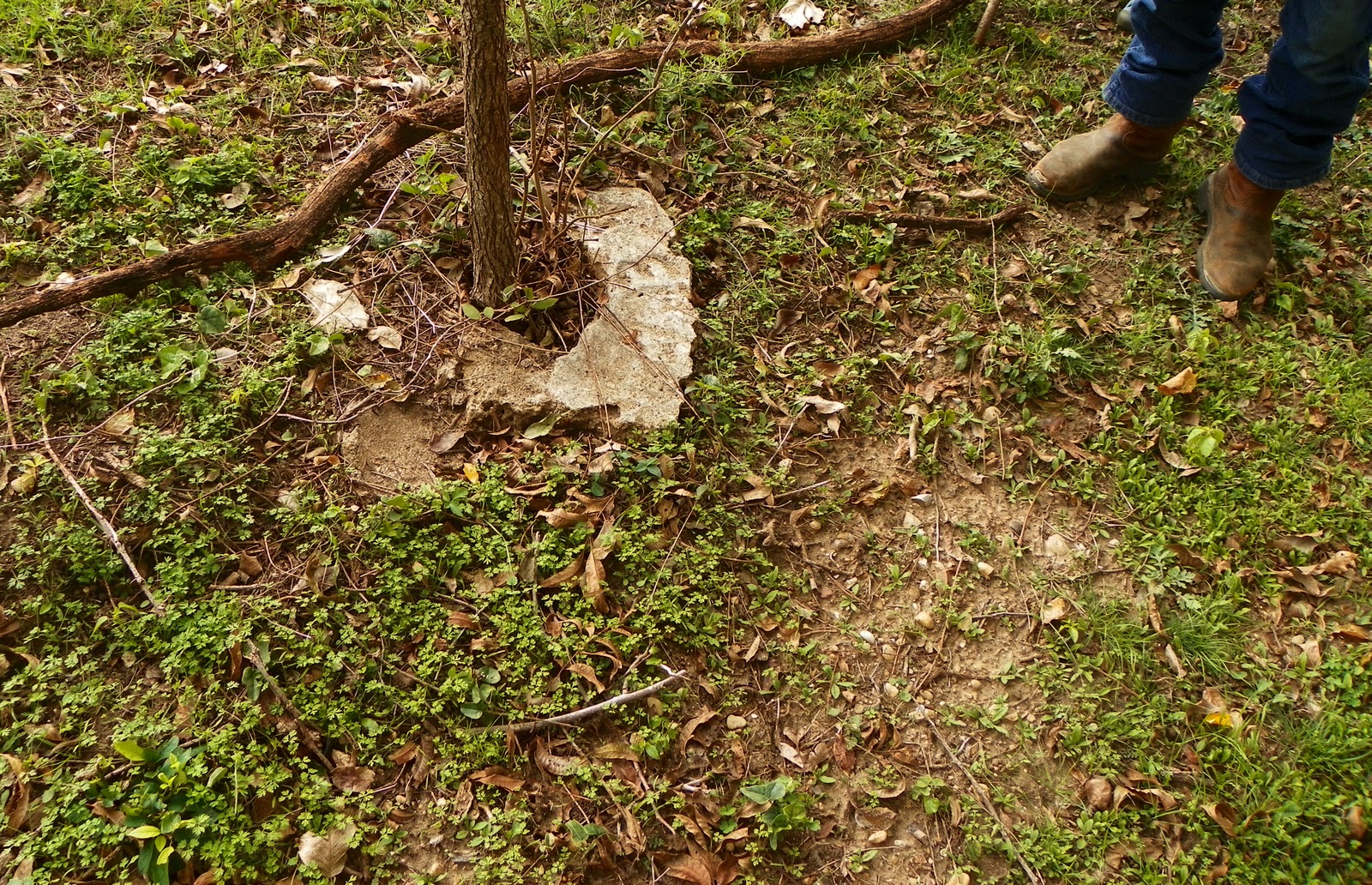
LOCATION OF THE BEEMAN JOHN NEELY BRYAN CABIN AND PEMBERTON CABINS
I know a number of people who are interested in knowing the exact spot where the Beeman/Bryan cabin once stood.
 |
| Archeology survey map published in 2009 |
The aerial map to the left represents the best known location of the Beeman/Bryan Cabin, outlined with a broken line in the shape of a square. The circles represent hand shovel testing done in an archeological survey. The black dots represent areas where artifacts were found.
 |
| Site of Beeman Cabin |
Corresponding to the map above, I am standing at the northeast edge of the cabin site looking southwest. The rise in the background, center left, is the "Southern Topographic High" noted on the map. It's also the location of the lone mesquite tree with the contemporary Indian head. Spring complex is center right and down the hill, noted by the trees changing color.
 |
| Edward Case Pemberton Cabin Site |
Mr Pemberton noted this site in the foreground of the photo as the location of EC Pemberton's home. It sits about 100 yards further up the hill from the Beeman cabin site and on private property still owned by the Pembertons.

THE HIKE TO THE MOUTH OF WHITE ROCK CREEK
 |
| Typical open forest along Bryan's Slough |
We parted ways with the Pembertons later in the morning saying our goodbyes to our gracious hosts at Bryan's Slough. Bill and I wanted to see if we could reach the Trinity and the mouth of White Rock Creek. A nice trail exists beyond the Pemberton's lower pasture that gently follows the fence line marking an old property line. Moving west by south the trail takes you through an example of forest succession. I imagine much of this area was open land within the past 80 years. The trees are of the maturing pioneer type species that will eventually give way to larger mast bearing species.
The photo above is typical of what you see and quite easy to move through on foot. For those familiar with the Buckeye Trail just upstream, you might notice that the lowest sections of White Rock Creek lack any presence of invasive Chinese Privet. There is not a single bush. Not one. The forest in this section is really in nice shape. Very little trash compared with the White Rock Creek most people know in North Dallas. I think White Rock Lake and Parkdale Lake absorb much of the floating trash carried by the creek leaving the lower sections quite clean.
 |
| White Rock Creek roughly 1/3 mile from confluence of Trinity River, looking downstream |
Like many creeks approaching the confluence with a larger river, White Rock Creek makes one last gasp at length with a wild set of meanders, twists and horseshoe bends. Some really unique peninsula features have formed as a result. Above is one of the more gradual bends the creek takes near the mouth. Fording the creek here seems impossible unless you are willing to get wet. There are dead fall trees across the creek in places where one could shimmy across.
 |
| White Rock Creek Logjam |
The only logjam we saw was 100 yards or so upstream of the White Rock Creek mouth with the Trinity River. The logjam is quite large, 20-25 feet high, consisting of mature tree trunks and root balls. This effectively blocks travel via boat up the creek from the river. If one wanted to reach this area via canoe or boat you would need to portage on the east bank of White Rock Creek. The west bank appears to be thick muddy deposits from what I could tell.
 |
| Mouth of White Rock Creek at Trinity River |
Above is the mouth of White Rock Creek as it enters the Trinity River, looking upstream and towards the northwest. The mouth here is about 40 feet wide and lacks a shoal which can be common in a mouth such as this.
 |
| Cormorants fishing near mouth of White Rock Creek |
We were wondering how many people have ever traveled to this spot by foot. In the last year it would not be likely anyone has visited .Two, three, five, ten years? Seems that the lack of access to the east bank of the creek due to crossing private property and just general challenge of reaching it via foot would deter many.
 |
| Downtown Dallas viewed from the Oncor ROW where Bryan's Slough crosses |
I would imagine that visiting the mouth from the Buckeye Trails would pose their own challenges. The terrain is flat and the forest generally lacks an understory through William Blair Park(Rochester Park). The issue is the last few hundred feet approaching the river. The bank appears steep and unstable which would be hard to get down.
Coming down the Oncor ROW, there is a rock crossing of lower White Rock Creek, seen in the video clip from 2010 above. As of this posting, the weeds along the ROW are 10 feet high and passage is difficult. Easier just to dead reckon navigate through the woods rather than use the ROW.
A better way to visit this spot would be via canoe. On the east side of White Rock Creek a hundred yards or so from the mouth with the Trinity sits an interesting campsite.
 |
| Trinity River Canoe Camp with two beds strung using 550 paracord |
Someone, I assume a canoeist, went to quite a bit of trouble to build this impressive lean-to structure and bunks. The bed frames are built from custom cut timbers and logs, then sort of dovetail fit together. Parachute cord was used to fill in the space and serves as a box spring of sorts. One bed was covered with leaves which I imagine serves as a mattress. Couple of low back chairs made from logs too. Whoever built it did a first rate job with the carpentry.
 |
| Canoe camp near mouth of White Rock Creek at Trinity River |
When I see a special place like this I never mention it. Usually it's close enough to a road or trail that someone could show up and ruin it. However, this is a great campsite. If you are bold enough to make it here by foot or canoe you deserve to know where it's located.
THE FUTURE
The draw to places like this is the undeveloped setting in which they exist. Only due to the conservation battles fought(and won) by the Pembertons does the historic spring and the surrounding woods still exist. The city would have bulldozed the whole historic site if they had their way. In the late 1990s, the city piggy backed the White Rock Lake dredging pipeline right through their property en route to Wilmer-Hutchins. If you remember when White Rock Lake was dredged and the massive black pipes at Winfrey Point then you know the size and scope of what went past the spring site.
Mr Pemberton has a deep concern with how the city mows the property. The city owned tractors cut the prairie grass far too short which scalps it. Down to bare soil. This increases erosion and can send runoff into the spring.
I can tell from listening to not just the Pembertons but also their neighbors that the city is trying to cook up some kind of scheme in a land grab. Other properties in this area have been denied simple building permits lately for small outbuildings and sheds. Other properties have also seen swarms of code compliance officers descend on their land writing tickets till their hands cramp.
Personally, I would like to see a simple singletrack dirt trail run down the Dallas sanitary sewer right of way from Rochester Park to the Audubon Center. A very faint trail already exists. Formally connecting Rochester Park to the Audubon Center would allow a complete off street trail network from the Buckeye Trail to Gateway Park at I-20.
Another big thanks to the Pembertons who served as gracious hosts and tour guides. They are a unique treasure that is hard to find in Dallas.
Fantastic piece, Ben! As you know, I am at the opposite end of the Forest, the northeast end where the Beeman settlements once stood...near Jim Miller & Scyene. My house is two blocks away & being on a hill, when I moved here in 1983, each time I dug anywhere to plant something, I found arrowheads. I have spent a decade talking about my area.... now the world is not only making note; they wish they'd listened long ago. Congrats on a great adventure. I am very envous of your time with the Pembertons. I have not seen them in 20 years.
ReplyDeleteI enjoyed reading this. I live in the Joppa Community and met Mr Ben when I was fishing my hole. I like how he gets back to the roots of our communities and ties together people from different races. We river people are all the same. Like he said we all share the river as part of the fabric in our lives. Maybe sometime I can meet the Pembertons. My family has lived on the other side of the river from them almost as long as they have on their side and I never knew they were over there. Jim.
ReplyDeleteWhat a great story. I'm so happy Ben posted about this. Last summer he helped us with finding feral pigs in the Trinity Forest for a Nat Geo documentary. He mentioned the historic spring but our film crew was short on time and never got the chance to visit. Now I wish we went. Dallas has a true untapped resource with the land along the Trinity. Not just with the river but also the people.
ReplyDeleteYou see, this is the kind of story I like. This whole blog has really opened my eyes to a part of Dallas I never knew existed. There should be a historical marker here. If Highland Park Village Shopping Center has one.....there should be one here too. Really neat that the 1908 flood is marked with a nail in that tree. In the Design District they recently put in a steel I-Beam to mark the flood. So cool that the tree down there still has the nail.
ReplyDeleteNice story! That is some wild country looking stuff down that way from the looks of things.
ReplyDeleteYour blog is amazing!! I've been in Dallas for 16 years from growing up on the Canadian border in Western NY near Buffalo & the Trinity Forest puts me back in touch with the great outdoors. This is truly Dallas's best kept secret. That makes it special but I wonder that since most Dallas residents know absolutely nothing of the Trinity Forest that it is in serious jeopardy of being destroyed. Dallas recently unveiled its "gas drilling plan" which is likely the biggest threat to this true urban treasure. Then of course, there is the proposed Trinity Toll Road. Keep up the awesome blog. It is awesome!
ReplyDeleteThanks for taking the time to discuss this.
ReplyDeletewhat an interesting blog you have here bro!
ReplyDeleteThanks for sharing this information. I really like your blog post very much.
ReplyDelete