Monday, December 12, 2011

Miller's Ferry, 3000 Years of Human History At Your Feet

No spot concentrates more history into the size of a tennis court than Miller's Ferry in Dallas on the Trinity River. Exploration. Immigration. Habitation. Emancipation. Commercialization. Transportation. Industrialization. 

Ducks at Miller's Ferry, December 2011


Sitting in the shadow of I-45 and Old Central Expressway with the Wastewater Treatment Plant just upstream it has become a cobweb of a place that you only get a glimpse of at 70mph. Maybe time has been a friend to this old spot leaving it as a time capsule. The crossing is now a favorite overwintering site for thousands of ducks and birds of prey like this Red Tailed Hawk(inset right) that was uses the Old Central Bridge to ride thermals.

At a quick glance the only structure left noting the site is a 120+ year old concrete encased steel pillar that sits in the middle of the river channel. It's literally the newest addition to Miller's Ferry. Everything else you see there is much older. It serves as a monolith of sorts like the one in 2001: A Space Odyssey.

The river holds its secrets like a sealed crypt. Like the movie, I had no idea what the large pillar was doing smack in the middle of the river. I had seen it numerous times as I crossed the Lamar/Old Central bridge. This past summer with the drought and low water levels I was able to get out in the mid-channel and touch it. Originally I thought it was a 55 gallon drum filled with river debris. On closer inspection I saw the metal rivets and concrete. Telltale signs of a pier or pillar. Interesting story, that old pillar holds.

Miller's Ferry sits in a horseshoe shaped bend of the Trinity River between present day I-45 and old Central Expressway(see map right). I have outlined the original Miller's Ferry Road in green. In the 1850s it was known as the road to Hutchins. In the 1870s it was known as the Corsicana Road. It started on what is now present day Ervay, to Holmes Street, down Lamar and across Miller's Crossing on the Trinity. Later forms of transportation emulated the route. The first railroad in the 1870s the H, T & C, the first north-south highway in Dallas, the first US Highway in Dallas, the first freeway in Dallas, the first Interstate Highway in Dallas. All follow the original route of Miller's Ferry.  It has gone by many names, Miller's Ferry Road, State Highway 5, State Highway 14, Dallas-Canadian-Canadian-Denver Highway, Henry Exall Highway, US 77, I-45.
Current Trinity railroad bridge as viewed from Joppa, George Bush Presidential Library and SMU seen in distance
It was not by chance that the H, T and C railroad passed this way, William Miller had much to do with it. The act of incorporation for the Galveston and Red River Railroad which was its original name authorized it to reach the Red River from the south by any route necessary to Coffee's station(near current day Denison). Some tentative plans would have passed it many miles east of Dallas. Advocates of the Dallas route finally won. William Miller at the time held $50,000 in the railroad stock which probably swayed the vote. He also donated $5,000 worth of his own land for right of way to entice the rail line to be built through Dallas. 

Union Pacific train over Trinity River between Joppa and Bon Ton


Many other towns to the east lobbied for the route including Kaufman, Tyler and Texarkana. Dallas would look much different today if the H, T & C railroad did not pass through Dallas. Central Expressway in North Dallas gets its name from the railroad and follows the old railroad right of way for much of the length.

William B. Miller
William B. Miller
 Miller's Ferry namesake was William B Miller. One of the original pioneers to settle this part of Dallas. He was born in Madison County Kentucky in 1807. He was the second of seven children born to John and Mary (Brown) Miller, native of Kentucky. In 1834 he began a dry goods business in New Market, Alabama. It failed in 1836, he moved to Tennessee to farm for ten years. In 1847 he moved to Dallas County, purchasing 562 acres and building a home on the Van Cleave Survey. 

His brief biography which is hard to follow, from the Dallas Pioneer Association--"His mother died in Alabama in 1835, and in 1837 Mr. Miller, married Minerva Barnes, also a native of Madison county, Kentucky, and daughter or Jesse and Patsy Olden Barnes, also natives of Kentucky. In 1844 Mr. Barnes moved to Jackson County, Missouri where he subsequently died. This Mrs. Miller died in 1856, after having had five children: Alonzo, who died about 1855; Martha, wife of W. C. Leonard, of Kaufman county; Mary, wife of Mr. Guess; Elizabeth, now Mrs. John Edmonson; and Susan, now Mrs. Dr. Ewing of Dallas. Mr. Miller was again married, in Dallas in 1860, to Mrs. Emma Miller, widow of Madison M. Miller, and daughter of Silas H. and Amy Spencer Dewey, natives of New York. The parents were married at Cooperstown, New York, and later emigrated to Ohio, where the father engaged in farming. The grandmother Dewey, previously Miss Hyde, was a grand¬daughter of Lord Chancellor Hyde. The maternal grandfather, a Wescott, was of Indian origin, and grandfather, Eliphalet Dewey participated in the Revolutionary War. Silias H. Dewey came to Walker County, Texas in 1855."(source Dallas Pioneer Association)

Ferry Crossings On The Trinity
Many other early pioneers to Dallas had ferry crossings that carried their name. Moving south to north:

Dawdy Ferry (Currently spelled Dowdy Ferry Road)
Miller's Ferry (Old Central Expressway/I-45)
Cockrell's Ferry (Commerce Street) 
Cedar Springs Crossing (near current day Infomart, where Turtle Creek meets the old river channel)
Record Crossing (1500 Record Crossing)
Minter's Crossing (Crossing made for Cochran Chapel)
California Crossing (California Crossing Road)

The abutments for these ferries on either side of the river were large cedar logs securely fastened together with rocks well packed down. John Neely Bryan ran a crude ferry along the hard bottom when he first settled Dallas. The Cockrell Ferry replaced the Bryan Ferry.

Many began as simple hollowed out cottonwood trunks with planks across them. Barely able to float a wagon.

In 1846 the following ferry rates were adopted for use in Dallas County:
Man on foot 5 cents
Man and horse 10 cents
Loose horses and cattle 5 cents each
Sheep and hogs 3 cents each
One-horse wagon 25 cents
Four horse wagon 50 cents
Six horse wagon 75 cents
Miller's Ferry started like many others in the area. A natural hard bottom in the river, with the added benefit of a horseshoe shaped bend in the river which slowed the current down. Earliest records mention that the ferry was in operation in 1852, run by a man named Dunham.
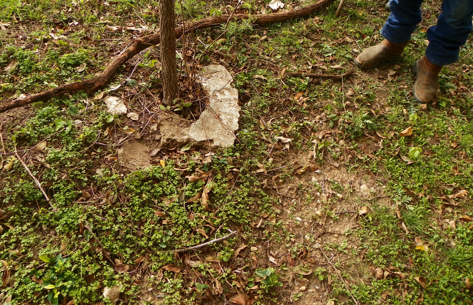
Miller's Ferry Site

The steel encased pillar above was placed in 1890. It had a twin pillar that was noted in surveys as recently as 2001. It has since disappeared, probably washing away. The pillar/pier was placed in the river channel to support half the length of the dismantled Cockrell toll bridge previously located on Commerce. In 1890 Sarah Cockrell's Bridge on Commerce was replaced with a newer bridge. The bridge you see below was authorized for construction in 1860. The Civil War, funding and material shortages prevent it's completion until 1872.


The bridge above was taken apart in two halves. One span went upstream to Grauwyler, the other downstream to Miller's Ferry. It's important to note that the Commerce Street bridge seen in the photo is not the bridge made famous in the 1908 flood photos. The bridge in the photo above is the post-Civil War double span iron bowstring arch toll bridge that was dismantled and sent downstream. A lot of confusion circulates about them. I asked local historian MC Toyer about the bridges, he sent along a timeline of Commerce Street bridges:


Timeline of Trinity Crossings At Present Commerce St(courtesy MC Toyer):
1843-1852  John Neely Bryan and Adam Haught operate a crude ferry 
1852-1853 Alex Cockrell acquires Bryan's unsold land and ferry then John Beeman's 320 acres on west side of Trinity
1854- Alex Cockrell's covered wooden toll bridge and plank causeway completed (Bridge # 1)
1858 - Alex Cockrell killed in April and bridge damaged in a flood later that year.  Alex's widow Sarah resumes ferry until 1872
1860 - Sarah Cockrell receives franchise for a new bridge but construction is delayed by the Civil War
1872 - Sarah Cockrell / Dallas Bridge Company completes the double span iron bowstring arch toll bridge (Bridge # 2) - sold to county about 1885 and becomes a free bridge
1890 Dallas County completes new iron truss bridge (Bridge # 3) - one span of 1872 bridge goes to Miller Ferry; the other to Grauwyler Road
1916 - Concrete and steel viaduct (Bridge # 4) starting at Houston Street and crossing above railroad tracks completed - demolished in 1935 with construction of Triple Underpass
1930 - Concrete and steel viaduct (Bridge # 5) built over Trinity diversion floodway
----


The Prehistoric Site At Miller's Ferry

Couple of years ago, I read a many decades old story from the Dallas Morning News about the enormous amount of Indian artifacts found by the Overton family on their land in the 19th century. Arrowheads, spears, tools of every shape and kind.


Their farm was located near present day Overton Road and Southern Oaks Road. A crime ridden apartment complex now sits on the site. A creek bisected the property and is noted as the Sargent Road Swale on the map above.


I thought, wow. I wonder if any of that is still there. My hopes were dashed when I saw how much of the terrain had been disturbed by gravel operations, landfill, channelization and backfill. I gave up on it. After all, I have been told many times that Native Americans never really lived in Dallas. Those that did wandered in by accident and left as soon as they got here. Turns out that was all wrong.

Caddoan bone bead at Miller's Ferry
The Trinity River through Dallas is one gigantic archeological site.  There are archeological sites both prehistoric and historic that lie inside the Trinity River Corridor. A handful of the sites are old landfills from the early days of Dallas. The rest are archeological sites, some are thousands of years old.

Little is known about the previous inhabitants that once lived in North Texas. The mystery is not an ancient problem of some unknown Anasazi like people. The mystery is one of present inhabitants. Most of the groundwork done on Trinity River archeology was completed by amateur hobbyists or SMU students in the 1930s and 40s. From the 1950s till present, little has been done other than federally required cultural impact surveys for construction projects. I can understand why a professional archeologist would much rather do a doctoral thesis on an Egyptian pharaoh's tomb rather than that of a Caddoan.That's the rub. Sifting through Trinity River mud just is not as fun as Indian Jonesin' a pyramid. As a result, 150 generations of Caddo lived here and what is known about them could scarcely fill a ream of paper.

I have found that if the ground has been left undisturbed on the bank of the Trinity or a nearby tributary, the chances of finding Indian relics, remains or both is very high. The hard part is not finding shell middens or evidence of ancient people, the adventure is finding a spot where the river has not been channelized, dredged, dug or dumped on.

Great examples of Indian occupation in Dallas include :
-The graves unearthed during the construction of the Katy railroad where it passes the Stoneleigh Hotel (where the Katy Trail is now located on the knoll overlooking Turtle Creek)
-The old Parkland hospital grounds held indian remains opposite of the Stoneleigh/Katy Trail site
-The spillway at White Rock Lake held at least seven indian burials. Most were destroyed during the most recent spillway project although some of the site is still untouched

Texas habitation of humans can be divided up in the following categories

Paleo Indian pre 8500bp
Early Archaic 8500-6000bp
Middle Archaic 6000-3500bp
Late Archaic 3500-1250bp

Late Prehistoric I- 1250-750bp
Late Prehistoric II 750-250bp

Historic Native American 250-150bp
Historic European 150bp-present

The earliest artifact found in a charcoal fire hearth at Miller's Ferry was dated at 3050bp in the Late Archaic period. Using radio carbon that translates to 1100bc, 3000 years ago. The Late Archaic here in Dallas saw a population influx of people. The geologic record tells us that the weather was wetter, warm and trees were more numerous. The Trinity River bottoms at the time had numerous backwater swamp areas rich with small game, fish and mussels. Below is an archeological survey map from the latest survey at Miller's Ferry. This particular survey was done as a requirement for the Trinity River Corridor construction project.

Judging from the artifacts found the groups actively traded with Indians from other parts of the countryside. The chert/flint used for tools came from as far away as Arkansas, Missouri and Ohio.

They did some test trenching in the area in and around Miller's Ferry. The artifacts they found included all kinds of shells, tools, animal bones and evidence of human habitation. The radio carbon testing on some of the artifacts found them to be from 1100 BC, 435 BC and 550 AD. The animal bones found in and around the campfire sites included those of deer, antelope, prairie dog, bobwhite quail, bison, freshwater drum and alligator gar.

That report was ten years old. Going back in 2011, the site like many others slowly erodes into the river exposing mostly shell middens or shell lenses as seen in the photo below. The debris is from Indians cracking open freshwater shells to expose the meat inside. In many cases these are cooked over a fire, then eaten.

Trinity River Shell Midden


If you can imagine a group of people camping out for a modern day clam bake or oyster shucking session, that is what is exposed here. The weather erodes the spot then the river during flooding carries it away as seen in the photo above.


Charcoal and burned limestone rock in a fire hearth

The calcium in the shell deposits actually help preserve the bones and other artifacts. It creates an super alkaline environment in which bones do not deteriorate as fast as they normally would.


I had no idea what these circular bone/rock looking things were that eroded from the bank. Found a few. One earlier in my post, I cleaned the dirt out of the hole. The item in the photo above is untouched. I emailed around earlier this fall to see what they might be. They are apparently bone beads of some kind like the beads in the necklace below.

Example of a Caddo Necklace(in a museum not in the river)
Most people would have picked up those beads and taken them home. Like an idiot, I left them there. I think it's probably illegal to remove Indian artifacts from public property. Although with the recent rains they probably washed away into the river forever.

This particular site extends across the river and over towards the Texas Buckeye Trailhead on Bexar.

The Conquistador Battle Axe


The De Soto expedition was the first group of Europeans to explore this part of Texas in the 16th century. I keep on running into references to the conquistador battle axe found here. It's even mentioned in Gunnar Brune's book on Texas Springs. Led by Luis de Moscoso de Alvarado, the Native Americans the Spanish encountered here were known as Socoatino. They spoke Caddoan and were called Canohatino by the French trappers pushing north along the Red River in the 17th century. It is believed this group spoke Caddoan that they were eventually absorbed into the greater Confederacy of Caddo speaking groups (Yojuane, Kichai, Tawakoni, Taovayas, Iscani and Wichita). This Caddo group is what lived in North Texas through the late 18th century.

From the late 18th Century onward, North Texas was invaded by the Apache and Comanche. By 1660 both tribes had horses and expanded their range into North Texas. The Comanche were a Shoshonean group originally residing along the Upper Yellowstone and Platte Rivers. Beginning in the early 18th century they began a southern migration into the Great Plains. Here they drove a wedge between the Apache in the west and the Wichita to the east. By the early 1800's the Comanche Nation stretched as far south as Austin, west to Raton Pass and east to Texarkana. The most imprtant sub tribes included that of the Yamparika(root eaters)-Arkansas River, Kotsoteka(buffalo eaters)--Central Oklahoma, Nokoni(Wanderers)--Red River, Quahadi(Antelope People)--High Plains and the Penateka(Honey Eaters)--North Texas.  Most of the Indian attacks on early Dallas pioneers were from the Comanche.


Henry Critz Hines, Slave of William Miller, Founder of Joppa, Freedman Owner/Operator of Miller's Ferry
  
He saw in a vision I an angel of God coming I and when he looked I he was afraid and said: `What is it, Lord?" And he replied unto him: `Your prayers I are answered I now, send men to Joppa." Acts 10:3


I have seen that biblical passage over and over in regards to the Freedman's town of Joppa. Maybe it's more relevant in discussing Miller's Ferry than the Joppa Community itself.

Henry Critz Hines had an interesting background. At the outbreak of the Civil War he was living as a slave in Missouri or Alabama. There are two different accounts on that. William Miller originally immigrated from Missouri by way of Alabama and knew people in both states. Southerners feared losing valuable property to the North during the war and as a result would often move valuables to backwater parts of the Confederacy for safekeeeping. Henry Critz Hines was one such example of property being sent away to Texas. By all accounts he was sent by a friend or family member of Miller to live on the property. He lived on the Millermore Plantation and was highly thought of as a field hand and worker. 
Joppa Residents Parked on Trinity River as viewed from Soul's Harvest Church, Joppa


 Although present, slavery did not loom as large in the economy of the Dallas area as it did farther into East Texas. In 1846 there were 45 slaves in Dallas County, a number which grew to 207 by 1850. In the 1860 census, Dallas had a total population of 8655 people of whom 1074 were slaves. A five fold rise in slaves over a decade with 228 citizens listed as slaveholders.

Most of the anglo residents were Southerners by birth and supported the pro-slavery side of the abolition question. In a February 23, 1861 vote on the issue Dallas County voted 741 to 237 in favor of secession. Over 1300 county residents joined the Confederate Army and Dallas donated over $5000 in gold to the cause. A small arms and ammunition plant was built in Lancaster. Due to the relatively remote setting of Dallas, many Southerners came to the Dallas area to escape the ravages of the war. By the end of the Civil War, Dallas had 13,500 residents. All merchandise was sent overland by wagon train. The Confederacy ran up a high debt with the Miller's for ferry usage fees. One that went unpaid at the end of the war.

The turning point for Henry Critz Hines and a new life began with emancipation in 1865.  In Texas, General Gordon Granger proclaimed all slaves freed on June 19, 1865. His proclamation, General Order Number Three was read from the balcony of the Ashton Villa in Galveston, Texas.

“General Order No. 3”: The people of Texas are informed that, in accordance with a proclamation from the Executive of the United States, all slaves are free. This involves an absolute equality of personal rights and rights of property between former masters and slaves, and the connection heretofore existing between them becomes that between employer and hired labor.

If you read the order giving slaves in Texas freedom, it reads like a roadmap for the future relationship between Hines and Miller.  Hines chose to stay in Texas rather than head back to the state from which he was shipped. That set in motion a really unique set of events that shaped Dallas.

At the conclusion of the war, Dallas still lacked a railroad or a navigable river for commerce. With very few formal bridges of any kind over the Trinity, ferry crossings were important to the lifeblood of Dallas. Everything had to be hauled overland by oxen pulled wagons or horse teams. An early goal of the Dallas business community was to gain water transport along the Trinity River.  The problems associated with this effort included fluctuations of the river and the many snags that infested the channel. The first effort in this respect came in 1866, when the legislature chartered the Trinity Slack Water Navigation Company to provide improvements required for navigation from Galveston to Dallas. The company never started work on the project. That same year Miller formally chartered his own overland ferry enterprise on the Trinity River, the Honey Springs Navigation Company and the Honey Springs Ferry Company.

In October 1866, William Miller formed the Honey Springs Ferry Company. Below is a copy of the company's article of incorporation which was created during the first Texas Legislature under Reconstruction.

Article of Incorporation for Honey Springs Ferry Company October 26, 1866 (courtesy MC Toyer)


After the Civil War, Miller's Ferry was a vital crossing point. Tying together Dallas, Hutchins, Corsicana and Galveston. Lying east of the Austin Road, Miller's Ferry was an important shipping road to reach the coast, East Texas lumber and coal seams near Corsicana. It was a cash cow of an operation and was the lifeline of the Dallas economy until the railroads reached Dallas in the 1870s. 

An important crossing such as this needed the best men to run it. With high unemployment after the war and relative stagnation of the economy, William Miller could have chosen one of a thousand capable men to oversee his ferry operation. The man Miller handpicked was Henry Critz Hines. Really it was more of a business agreement among men who viewed each other as equals. As a result, Hines became one of the first African American entepreneurs after the Civil War. Not just in Dallas or Texas or even in the South. In the whole of the United States. In addition, you will find very few freed slaves who so soon after the war were able to make a living from a customer base that was largely anglo.

Henry Critz Hines also founded Joppa, one of the best preserved, if not the best preserved Freedmen's communities left in the United States. Joppa was founded in 1872 by Hines and freed slaves from the Miller Plantation. Here they carved trees out of the forest for cabins at first, replaced by shotgun houses, some of which are still standing today. Many of the original Joppa residents were freedmen who immigrated from East Texas plantations. The attraction of Joppa was the safety of living near a large town like Dallas while maintaining the agrarian lifestyle they knew from earlier times. Other freedmen communities in Dallas such as Deep Ellum and State-Thomas had residents more comfortable with city life.

The descendants of the Miller slaves hold family reunions every year here in Dallas. Over 1,000 strong, they celebrate their rich history at a local park that was once part of Millermore. They're even on Facebook Miller Family Reunion

Below is a wood etching from 1879 showing what a Texas river ferry looked like. 

Ferry Crossing a River in Texas - from Homer S. Thrall's 1879 Pictorial History of Texas


In times of moderate flow during wet periods, Miller's Ferry looked like the illustration above. A floating platform large enough for one wagon team was used to carry the customers across. In times of low flow, the platform was positioned in the mud of the riverbed channel and served as a a bridge. Metal cables anchored to the bank allowed the ferry to be pulled manually from one side to the other.

The cables...are...still there!


Hand cables from Henry Critz Hines ferry operation at Miller's Crossing

One of the incredible parts of the current Miller's Ferry site are the old cables from when Henry Critz Hines ran the ferry by hand. The steel cables are literally more fragile than a piece of string. They crumble in your hand. It took quite a bit of research to find out if these are indeed the cables used in the ferry. People have dumped trash and junk into the river for decades and I initially thought it could have been some cable thrown over the bank. On closer inspection, the cable goes straight into the river bank with undisturbed old deposits on top of it.


The braided cable is very fragile. It flakes apart just touching it. I'm amazed something like that is still there.


Also in the same vicinity are very fragile square nails that have almost reverted back to a crude form of iron. The horseshoes in the first photo in this post(inset left) are also very deteriorated. To the point that they are as fragile as a saltine cracker.


Sterling Silver Fork(plated)

Sitting near the horseshoes, half buried was the silver fork above. It's an English made dinner fork dating from the late 19th century. I'm not sure how it got to the ferry crossing. Something that heavy does not float downstream with the march of time. It's about as brittle as the horseshoes.

As I mentioned earlier, the ferry operation was closed in about 1890 when a section of Sarah Cockrell's bridge near the Old Red Courthouse was sent to Miller's Ferry.

As you can see from the photo, the bridge was in two sections. One went to Miller's Ferry, the other to Grauwlyer Road. One of these spans stood at Miller's Ferry until the early 1900s. The bridge was eventually removed to make way for the planned riverboat traffic, that never materialized.

In 1911 a new Miller's Ferry Road Bridge was completed and opened just downstream, where the Highway 310 bridge/Old Central Expressway bridge now stands today. Below are some photos of that 1911 bridge on the day it opened.


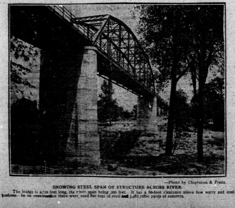
With the completion of the new bridge, Miller's Ferry Road quickly morphed into a much celebrated road for overland travel by car. At the time, traveling cross country by car was new and there was a lack of interstate routes. Cobbled together routes quickly sprang up, linking city-to-city, state-to-state, ocean-to-ocean. Miller's Ferry became a part of the Henry Exall Highway, which was one such road.


Above is a magazine article from 1918 about the routing of the Henry Exall Highway and the soon to be created Dallas-Canadian-Canadian-Denver Highway. The "Canadians" being the Canadian River in New Mexico and crossing it again in Texas. Although this overland route did eventually reach the Canadian/US Border.

After the 1911 bridge was opened, 100 years ago, the Old Miller's Ferry was forgotten. Hard to even find a reference to it in any news articles. Relegated to the dust bin of history. The great thing is that while transportation projects and construction have occured within a couple hundred yards of the site, it still sits undisturbed. I know that there have been recommendations for Miller's Ferry to be included in the National Register of Historic Places. I think that should happen. It's a special place. Unlike many historic landmarks that highlight one ideology, race or religion, Miller's Ferry has a history that touches on every facet of Dallas history. One that we can all be proud of.


Tuesday, November 15, 2011

Where The Red Fern Looking Stuff Grows, Breakfast Hike At The Pemberton Farm


“I'd like to take a walk far back in the flinty hills and search for a souvenir, an old double-bitted ax stuck deep in the side of a white oak tree. I know the handle has long since rotted away with time. Perhaps the rusty frame of a coal-oil lantern still hangs there on the blade.”
-Wilson Rawls, Where the Red Fern Grows


If you could jump in a time machine and travel back to yesteryear Texas where would you go? What would you want to see? Who would you want to meet? If you like Texas history, serious deep woods, old artifacts and friendly conversation there is a place that still exists. Untouched by time and the city that has grown up around it.


Bill and Zada Pemberton, King and Queen of the Great Trinity Forest, Bryan's Slough
Back when Texas was in its infancy and Queen Victoria ruled the British Empire, the Pembertons called this part of Dallas home. They still do today. Possibly the only deeper roots you can find other than the Pemberton family tree in Dallas are the roots of the trees that grow down the terrace from their home. If you stopped the dialogue right there it would make for an interesting story. It goes far beyond that.

Bill Pemberton grew up in what is now called the Great Trinity Forest. Just west of the Elam road and Pemberton Hill road intersection. He shares a deep connection with the surrounding woods with his wife Zada, who grew up in Arkansas. They are a rare breed. Some of the nicest people I have ever met. I wonder if there are any other families living in Dallas where the street name still carries the name of the family that lives on it.

Joining me for the hike this day was Bill Holston. Prior to our visit neither of us knew the Pembertons other than an email exchange and a couple phone call conversations I had with Mrs Pemberton. Bill and I showed up at the Pemberton farm early on a Saturday morning. Ready to hike, we were invited inside where we were surprised with a full breakfast of waffles, pure cane Louisiana syrup, molasses, real butter, bacon, coffee and juice. Remember, we were perfect strangers up until five minutes ago.

After grace, a number of things were discussed over breakfast. Some of the background of their home and farming. Mr Pemberton is big on farming. He and his tractor plowed under Paul Quinn College's football field into a vegetable patch. Helping to turn Paul Quinn into the home of the Fightin' Okra. He has a real interest in educating people on where food comes from. How a field is prepared and how things are grown. In an odd full circle moment, Bill Holston said he attended a dinner where the guests were served food from the very field Mr Pemberton plowed. How about that. Note: I'm starting to think Bill Holston knows everyone in Dallas through two or three degrees of separation. That guy gets around.

At the conclusion of breakfast, Zada had a collection of photos and videos on her computer taken on their property and in the Great Trinity Forest. She is a great photographer. When their lower meadow fills with wildflowers in the spring, they are both in the middle of it. When the Trinity River flooded last year, did they stay away? Nope. They went down to the Audubon Center and wandered around looking at the flooded trails. Really interesting photos. It dawned on me at that moment that the Pembertons were deeply connected to the land. More than anyone else. It's part of the fabric of who they are. Before leaving their home for the hike down to the spring, Mrs Pemberton had prepared a family recipe spice nut cake/bread for us, sliced and packed in wax paper, to eat on our hike. Using nuts collected from the nearby trees.


Archeological Management Survey of Sam Houston Spring

So deep is the history of this land that there have been archeological surveys done on this section of land no less than three times by my guess 1940, 1978 and 2009(inset left). The reports are over 100 pages in length a piece and still leave information out. The property has been the site of human occupation for thousands of years. As evidence, numerous flint tools, pottery shards, charcoal fire pits and even an Indian burial have been found within feet of the spring over the last 70 years.


HISTORICAL BACKGROUND

John Beeman in the 1840s was the first pioneer to patent and own this land. His oldest daughter Margaret Beeman inherited this property along with her husband John Neely Bryan, founder of Dallas. Here they built a home near the spring and raised a family. Margaret Beeman eventually sold the land to Edward Case Pemberton in the 1880s. Edward Case Pemberton operated a dairy farm at this location and also ran a small store just down the road. He was murdered at his store in 1914. The land was inherited by his seven sons. Today the spring portion of the property is owned by the City of Dallas. Mr Bill Pemberton is a direct descendant of the second land owner.

WHEN TEXAS WAS A REPUBLIC--THE PRESIDENT VISITS


During his last term as President of the Texas Republic, Sam Houston's main concerns were Indian relations, war on the horizon with Mexico and Texas annexation into the United States. Sam Houston, who had lived with the Cherokee people for years as a young man, had a fondness for the tribes and wanted them treated fairly as their lands were taken over by civilization despite their depredations against the settlers in Texas.

President Houston's Treaty Expedition Map
For months Houston sent messages to his Indian friends proclaiming he would hold a Grand Council of the Tribes at Fort Bird(presently in the Mid Cities area) during the full moon of August 1843. Similar to what we might consider a general assembly meeting of the United Nations.  Houston sent Indian Commissioner Joseph C. Eldridge out months in advance of the date to bring the Comanches and others to the treaty council.
It was in August 1843 when Sam Houston and an expedition of about 30 men departed Crockett in East Texas, and began their trek to the Three Forks of the Trinity to negotiate with the chiefs of the Indian tribes.  Their route was well documented traveling roughly on the same route into Dallas that US Highway 175 takes today. This route was an ancient Pre-Columbian trail used by Indians for many centuries as an important trade route between the Piney Woods of East Texas, the Plains and Indians living north of the Red River. Scyene and Preston Roads share similar distinctions in Dallas as ancient Indian trails that later became major roads.


One of the men in his group was an Englishman by the name of Edward Parkinson. He kept a detailed account of the trip in his diary. It's believed he came along just for the adventure of seeing real live Indians on the plains. At the time the Beeman family was still living in a blockhouse near present day Dolphin Road and Military Parkway. The account below mentions that they did not see the Beeman family until the next morning. This is because the Beeman family had not moved. There was a mix up in the titleholders of property back then. The land they originally settled was actually already claimed by someone else. The moved to the spring site shortly thereafter.


On the 8th day out from Crockett the diary reports:

Sam Houston circa 1840s
"We encamped that night at White Rock Springs, so called from the calcareous nature of the rocks abundant here about one mile from the White Rock Fork of the Trinity. In the morning some settlers from the infant colony opened about the Forks of the Trinity River visited us, accompanied by some travelers examining the country, they brought us no news of the expected Indians and were on foot, stating that some little time previous the wild Indians had stolen all the horses but one or two belonging to the settlement.

We then saddled up and proceeded to the fork at White Rock Creek which we found very difficult from the rain which had fallen making the bank on the other side one slide of about thirty feet, from top to bottom. We were obliged to dismount and drive the animals over, some of them describing curious mathematical figures, from their inexperience in the science of sliding. However, all got over safe,  and on reaching the prairie on the other side arrived at one of the colonist’s cabins{that of John Beeman} where we were regaled with an acceptable and plentiful supply of buttermilk. My horse(a mustang) having become almost knocked up, I determined upon resting here, and was hospitably entertained until the following day, the company in the meantime moving on to Cedar Springs, where they rested a day or two previous to marching on to Bird’s Fort on the West Fork of the Trinity the appointed Treaty Ground, great anxiety prevailing respecting the Indians but no news of them."--Edward Parkinson 1843

Parkinson was struck with the undulating grasses of the prairie which reminded him of the Surrey country in England. He noted the wooded creek bottoms “clothed with indigo”, the rich wild rye grasses and near White Rock specimens of beautiful purple thistle. Looks just exactly that way today on Lower White Rock Creek.

BEFORE THERE WAS A TEXAS

The first archeological survey in 1940 described the area as an 8 acre site. Recovered from the area were numerous flint tools, broken pottery, arrowheads, darts, charred fire hearths and an Indian burial of some kind. I have no idea on the age other than one description of some of the flint tools being from the Archaic period which really does not narrow it down much 6500BC to 750AD. It is obvious that this site was a focal point of human occupation for thousands of years. I'm not sure anyone in their right mind would ever drink out of the Trinity River, even 5000 years ago. As a result, little camps and such found on the Trinity always gravitate towards water sources other than the river. It has always been a river too thick to drink, too thin to plow.

I would take a wild guess and think that the spring site here would have artifacts about the same age as those found in Joppa Preserve. Joppa has a famous prehistoric bison kill site and an Indian burial. The human bones were carbon dated to about 700AD I believe. Only a 30 minute walk downstream, you would think all this would be of a similar age too.

The Trinity River bottoms must have been a well traveled place a long time ago. While there are really no signs of permanent settlements, little hunting camps litter the banks of the Trinity downstream of the levees and up White Rock Creek.


THE SPRING


Big Spring in the Great Trinity Forest


The spring has undergone a number of name changes over the years. Called White Rock Spring by the Sam Houston treaty party, then noted as Big Spring on Civil War era maps. Later called Bryan's Spring and Sam Houston's Spring. I'm not sure what it might be officially called. It is not labeled on contemporary USGS topographical maps or noted in the Springs of Texas by Gunnar M. Brune. Springs of Texas is the encyclopedic reference to locating many of the natural springs in the state. For whatever reason, this one was missed. It could be that during the writing of the book in the 1930s, that the springs were forgotten, hidden away on the back side of a dairy farm. Since the land has always been closely held among just a handful of families, the location might not have been known.

In previous visits via a route from Rochester Park, I had only checked out the lower portion of the spring. This visit, accompanied by the Pembertons, they showed me where the water flows from. In the short clip below you can see the type of soil layers the water flows from(with impromptu commentary by Bill Holston, who cannot believe how awesome the spring is).


The water flows off of limestone bedrock(photo below) as a base with an aggregate gravel type material just above it. Using my hand I reached up into the water source and grabbed a handful of this weathered gravel material as it sat on the bedrock. Sort of a decomposed pea gravel. I imagine this gravel is from the Pleistocene Era. A time between 250,000 and 12,000 years ago when the ancient Trinity deposited orange looking sands on "terrace deposits" as the Corps of Engineers calls them. These are the same sands that are giving the Corps and the City of Dallas problems with shoring up the levees near Downtown. Some of you might have been Elephant Hunting with me too on the Trinity, where we have seen ancient animal bones sticking out of the river banks not too far from here. I believe 17 mastodon elephants were removed from this area in the past century during gravel mining operations.

Spring source, water running over hard limestone with gravel aggregate on top


The water flows out of the terrace in this area in 2-3 other places within 10 feet. Their combined flow is about 4-5 liters per minute. Even during the extreme and prolonged drought we are experiencing in North Texas, the spring still flows. I have no idea where the water comes from. There are no signs of a spring anywhere else in the pasture until you reach this spot.


Watercress and Walnuts in the spring


The spring is ringed with walnut and pecan trees. This time of year, November, the spring has a number of floating walnuts in it among the watercress. Mrs Pemberton mentioned that watercress really only grows in clean water. It was about that time, that Mr Pemberton drank straight out of the spring. He says he drinks from the spring all the time when he is out working in the pastures. Upon our return from hiking to White Rock Creek and the Trinity River confluence, Bill Holston and I stopped to check out the spring again. We too, decided to drink from the spring. When in Rome. I'll tell you, it is probably the best water I have ever tasted. No aftertaste at all. Almost sweet. I went back for seconds and thirds.


1934 capped well
Twenty feet or so in elevation up the hill and about 100 yards to the northeast is an old capped wellhead marked "1934" around the base. Mr Pemberton said that the well was 45 feet deep. The capped well sits at about 420 feet ASL and the spring sits at 398 feet ASL.


This historic spring only exists due to the conservation efforts of the Pemberton family. Without their hard fought efforts to fight the city, the spring would have been lost. In 1986, the city proposed building a large sewer line directly through the spring. Right through the middle of it. Ruining it. The Pembertons had to go down to City Hall, stand in front of the City Council and argue why the springs should be saved. I cannot imagine just how blunt of an employee or group of employees working for the city could have proposed wrecking such a historic spot.

The Pembertons along with a couple other concerned citizens won their battle. The city moved the sewer line 100 feet further away. Many old trees were still lost. Mr Pemberton on our walk around the spring mentioned an old Elm tree, one that he thinks must have been 70 feet tall, moan and groan as a bulldozer slowly pushed it over. He said over a dozen very large trees were lost to this project. Trees with historic significance, gone for a sewer line that could have been built a couple hundred yards further away and not have impacted anything.

THE WALNUT TREE MARKING THE HISTORIC 1908 FLOOD


High water mark of 1908 flood in Dallas, Texas
Located just up the hill from the historic spring to the northeast is a large walnut tree. On the east facing side of the tree is what appears to be a railroad spike driven into the tree. This was driven into the tree over 100 years ago note the high water mark during the ravaging May 1908 flood.


The Pembertons told me that in the last few decades the Rochester Park Levees upstream have increased the severity of the flooding on their property. With less acreage to spread out, the flood waters simply climb up instead of spreading out across the flood plain. Mrs Pemberton showed me a few recent photos where they had witnessed flooding reach and then surpass the 1908 spike on this tree.

In 1908 there were not any levees of note in Dallas protecting low lying areas. The flood waters spread as far as McKinney Avenue where the Downtown El Fenix now stands. Oddly, a couple people actually drown in their homes close to where the Dallas World Aquarium is now located. That flood was far worse than anything we have experienced in the last 100 years. But not for those who live downstream.


BRYAN'S SLOUGH

Bill Pemberton at Bryan's Slough explaining where his ancestors had to deal with beavers
Named for John Neely Bryan(I bet Bryan named it himself), Bryan's Slough is a loose confederation of water from the spring and a couple of other nearby water sources. Here a small man made ditch ties into a more natural meandering stream bed. The slough eventually ties into White Rock Creek and then into the Trinity River. Mr Pemberton above is explaining the hydrology of the flooding that occurs in the area and the beavers that were a thorn in the backside of his family in the past.

More recently, Mr Pemberton has fought a new battle with the inhabitants of the slough. Car tires. When White Rock Creek floods it floats old discarded tires from upstream into his beautiful collection of woods. The trees act as a fine tooth comb trapping old junk tires as they slowly float by. This section of the woods is now on property owned by the city.

It would be interesting to find the source of the discarded tires upstream. It could be the junkyards near 175 or they could come from the abandoned city owned neighborhood off Tune Avenue. This is a battle that so far Mr Pemberton has fought alone. Since this portion of land is now city park property maybe a corporate group looking to fulfill their community service obligations could lend a hand cleaning this up.

Later in the morning Bill Holston and I headed west towards White Rock Creek. We did not see many tires at all out of the stream beds. The problem with the loose tires must be from a location directly upstream. Either from an illegal dump site or a salvage yard with poor housekeeping.

THE CENTURIES OLD BUR OAK
150-200+ year old Bur Oak at President Sam Houston's Campsite


Bur Oak at White Rock Spring

This massive Bur Oak sits at the southwest corner of the spring complex. Hard to describe the massive size of the tree. The individual limbs are the diameter of most burr oak trees. During the last archeological survey of the area numerous flint pieces and Indian related artifacts were found around the base of the tree suggesting the age of the tree might be much older. The acorns of this tree are the size of chicken eggs. This tree would have been destroyed in 1986 by the Dallas Water Utilities. Their survey lines went right through the tree.

Today the tree looks as healthy as it could be. Mr Pemberton told us he would like for the city arborist to pay a visit and see if the tree needs any work. He pointed to a nearby elm tree with a large scar on it from where the tree lost a limb in heavy winds. He said that the hill turns the wind and can swirl it around in such a manner as to be detrimental to larger limbs.


THE LONE MESQUITE TREE
Bust of Native American at "lone mesquite tree" site where numerous Pre-Columbian artifacts have been found
During the last archeological survey of the property widely spaced shovel testing near this tree yielded 19 lithic prehistoric artifacts. Mrs Pemberton placed the contemporary Native American head and necklace there. While standing around the tree during this visit, we were kind of shuffling our feet around when Mrs Pemberton picked up something that appeared to be a hematite rock shaped like a ball. Out of place in a field like that. I should have taken a picture of it. Mr Pemberton remarked about an old Indian who moved onto the property to the immediate south after the area was settled by European pioneers.


LOCATION OF THE BEEMAN JOHN NEELY BRYAN CABIN AND PEMBERTON CABINS

I know a number of people who are interested in knowing the exact spot where the Beeman/Bryan cabin once stood.


Archeology survey map published in 2009

The aerial map to the left represents the best known location of the Beeman/Bryan Cabin, outlined with a broken line in the shape of a square. The circles represent hand shovel testing done in an archeological survey. The black dots represent areas where artifacts were found.


Site of Beeman Cabin

Corresponding to the map above, I am standing at the northeast edge of the cabin site looking southwest. The rise in the background, center left, is the "Southern Topographic High" noted on the map. It's also the location of the lone mesquite tree with the contemporary Indian head. Spring complex is center right and down the hill, noted by the trees changing color.


Edward Case Pemberton Cabin Site

Mr Pemberton noted this site in the foreground of the photo as the location of EC Pemberton's home. It sits about 100 yards further up the hill from the Beeman cabin site and on private property still owned by the Pembertons.

To the immediate south of the Pemberton cabin site is the foundation of an old windmill and a slab or rock with a collection of old iron bits found on the property. The only one I recognize off hand is a wood splitting wedge. The rest are hard to figure out. I would imagine many of them could predate the Civil War.


THE HIKE TO THE MOUTH OF WHITE ROCK CREEK


Typical open forest along Bryan's Slough

We parted ways with the Pembertons later in the morning saying our goodbyes to our gracious hosts at Bryan's Slough. Bill and I wanted to see if we could reach the Trinity and the mouth of White Rock Creek. A nice trail exists beyond the Pemberton's lower pasture that gently follows the fence line marking an old property line. Moving west by south the trail takes you through an example of forest succession. I imagine much of this area was open land within the past 80 years. The trees are of the maturing pioneer type species that will eventually give way to larger mast bearing species.

The photo above is typical of what you see and quite easy to move through on foot. For those familiar with the Buckeye Trail just upstream, you might notice that the lowest sections of White Rock Creek lack any presence of invasive Chinese Privet. There is not a single bush. Not one. The forest in this section is really in nice shape. Very little trash compared with the White Rock Creek most people know in North Dallas. I think White Rock Lake and Parkdale Lake absorb much of the floating trash carried by the creek leaving the lower sections quite clean.

White Rock Creek roughly 1/3 mile from confluence of Trinity River, looking downstream
32°43'38.07"N 96°44'6.34"W
Like many creeks approaching the confluence with a larger river, White Rock Creek makes one last gasp at length with a wild set of meanders, twists and horseshoe bends. Some really unique peninsula features have formed as a result. Above is one of the more gradual bends the creek takes near the mouth. Fording the creek here seems impossible unless you are willing to get wet. There are dead fall trees across the creek in places where one could shimmy across.


White Rock Creek Logjam

The only logjam we saw was 100 yards or so upstream of the White Rock Creek mouth with the Trinity River. The logjam is quite large, 20-25 feet high, consisting of mature tree trunks and root balls. This effectively blocks travel via boat up the creek from the river. If one wanted to reach this area via canoe or boat you would need to portage on the east bank of White Rock Creek. The west bank appears to be thick muddy deposits from what I could tell.


Mouth of White Rock Creek at Trinity River

Above is the mouth of White Rock Creek as it enters the Trinity River, looking upstream and towards the northwest. The mouth here is about 40 feet wide and lacks a shoal which can be common in a mouth such as this.

Cormorants fishing near mouth of White Rock Creek
In the photo above a flock of cormorants aka water turkeys are fishing a deep pool in the Trinity just downstream of the confluence with White Rock Creek. If you click on the photo to enlarge it, you can see a few with fish. They look like either gizzard shad or maybe crappie about the size of a human hand.

We were wondering how many people have ever traveled to this spot by foot. In the last year it would not be likely anyone has visited .Two, three, five, ten years? Seems that the lack of access to the east bank of the creek due to crossing private property and just general challenge of reaching it via foot would deter many.
Downtown Dallas viewed from the Oncor ROW where Bryan's Slough crosses

I would imagine that visiting the mouth from the Buckeye Trails would pose their own challenges. The terrain is flat and the forest generally lacks an understory through William Blair Park(Rochester Park). The issue is the last few hundred feet approaching the river. The bank appears steep and unstable which would be hard to get down.


Coming down the Oncor ROW, there is a rock crossing of lower White Rock Creek, seen in the video clip from 2010 above. As of this posting, the weeds along the ROW are 10 feet high and passage is difficult. Easier just to dead reckon navigate through the woods rather than use the ROW.

A better way to visit this spot would be via canoe. On the east side of White Rock Creek a hundred yards or so from the mouth with the Trinity sits an interesting campsite.


Trinity River Canoe Camp with two beds strung using 550 paracord
32°43'27.07"N 96°44'0.79"W
Someone, I assume a canoeist, went to quite a bit of trouble to build this impressive lean-to structure and bunks. The bed frames are built from custom cut timbers and logs, then sort of dovetail fit together. Parachute cord was used to fill in the space and serves as a box spring of sorts. One bed was covered with leaves which I imagine serves as a mattress. Couple of low back chairs made from logs too. Whoever built it did a first rate job with the carpentry.


Canoe camp near mouth of White Rock Creek at Trinity River


When I see a special place like this I never mention it. Usually it's close enough to a road or trail that someone could show up and ruin it. However, this is a great campsite. If you are bold enough to make it here by foot or canoe you deserve to know where it's located.


THE FUTURE

The draw to places like this is the undeveloped setting in which they exist. Only due to the conservation battles fought(and won) by the Pembertons does the historic spring and the surrounding woods still exist. The city would have bulldozed the whole historic site if they had their way. In the late 1990s, the city piggy backed the White Rock Lake dredging pipeline right through their property en route to Wilmer-Hutchins. If you remember when White Rock Lake was dredged and the massive black pipes at Winfrey Point then you know the size and scope of what went past the spring site.

Mr Pemberton has a deep concern with how the city mows the property. The city owned tractors cut the prairie grass far too short which scalps it. Down to bare soil. This increases erosion and can send runoff into the spring.

I can tell from listening to not just the Pembertons but also their neighbors that the city is trying to cook up some kind of scheme in a land grab. Other properties in this area have been denied simple building permits lately for small outbuildings and sheds. Other properties have also seen swarms of code compliance officers descend on their land writing tickets till their hands cramp.

Personally, I would like to see a simple singletrack dirt trail run down the Dallas sanitary sewer right of way from Rochester Park to the Audubon Center. A very faint trail already exists. Formally connecting Rochester Park to the Audubon Center would allow a complete off street trail network from the Buckeye Trail to Gateway Park at I-20.

Another big thanks to the Pembertons who served as gracious hosts and tour guides. They are a unique treasure that is hard to find in Dallas.


Wednesday, November 9, 2011

Trinity River Beavers at Miller's Ferry Crossing


Beaver at Trinity River Wetlands Miller's Ferry near sunset

Tucked away in a desolate remote and forgotten part of Dallas resides a family of beavers. That's how most of my posts seem to start. Not so this time! Did not have to travel into one of the remote parts of the woods to find this. The beavers featured in photo above and youtube clip below actually live between I-45 and South Central Expressway in the heart of Dallas. Angry beavers. The kind that give you the stink eye and slap their tails. The video below has some tail slapping at the beginning, done to either scare me off or draw away my attention from wherever they live.


Video below of a beaver slapping it's tail. When the camera pans out towards the end you will see the South Central Expressway Bridge in the background.


Beaver at Trinity River Wetlands September 2010

I'm not sure what makes even the most vulnerable animals in the Great Trinity Forest so aggressive. Maybe it's the absence of human contact that generates a lack of fear. Animals like feral pigs and beavers that many consider to be nocturnal, can be seen during daylight hours here.


The beaver Castor canadensis is North America's largest rodent, and the world's second largest, after the capybara of South America. Beavers live in colonies of four to eight family members. Considered the best engineers among rodents, beavers construct dams with mud, brush, stones, poles, vegetation, and other materials to create safe lodging and a provide themselves with a good food supply.

Beaver Lodge in wetland cell north of Loop 12 Joppa Community


The beaver whittlin' on the stick above was a resident of the rather large beaver lodge in Wetland Cell G during the fall and winter of 2010-11. The beavers built their lodge right at the mouth of where Honey Spring enters the wetland cell.

Other than humans, beavers are probably the best animals at controlling their natural environment through construction. In the wetland cells they have it made since the water level is controlled via a series of flood gates and doors that provide a constant flow of water to the chain of wetlands.

The beavers are probably blamed for sabotaging the efforts of the Corps of Engineers to plant aquatic vegetation in the wetland cells. Below is an example of one type of cage designed to protect new plants from turtles and beavers. Some of the wire mesh enclosures are designed to catch turtles for replacement elsewhere. I think some of the Joppa residents figured this out and now enjoy turtle soup on a regular basis!

Ibis and juvenile egrets at Trinity River Wetlands

Seeing the beavers from time to time, it seems that they eat mostly soft wood saplings from the treelines and not plants in the cages. What the beavers don't eat, the Corps of Engineers tractors mow down on a semi-annual basis.

Beaver Lodge in Wetland Cells July 2011

By July of 2011 the beaver lodge constructed north of Loop 12 could not even be seen. Using mostly willow branches for construction many of the sticks took root and became small saplings themselves. This lodge might have been abandoned after Honey Springs went dry during the 2011 summer drought.

I have yet to see a nutria in this area. Maybe they are more nocturnal than the beaver. Last winter there were a group or maybe family of river otters in this same general area. I have not seen them in 2011.

More information on the Dallas Floodway Extension Project can be found on the official website here: Dallas Floodway Extension Project . The North Texas Municpial Water District operates a similar wetland on the East Fork of the Trinity River near Seagoville. Known as the John Bunker sands Wetlands. Their website can be found here: John Bunker Sands Wetlands. I imagine the Dallas Wetlands Project will one day be similar in scope to the North Texas Municipal Water District site. As it stands right now, the Dallas site lacks parking and the basic infrastructure needed to attract folks to visit.